Loch Lomond and Trossachs National Park paths mapped
- Published

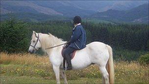
The new map features paths for horse riders, walkers and nature lovers
Some of Scotland's most picturesque pathways have been formally recognised in a new map charting 455 miles of Loch Lomond & The Trossachs National Park.
The Core Paths map features horse, cycle, dog walking, community and nature paths, and includes 47 miles of the West Highland Way
Nearly 60 miles of the national cycling network will also be covered.
The map will also be used to help landowners in the area manage access to their land.
Bridget Jones, visitor experience manager for the National Park, said mapping every single pathway in the park had been a "huge project" for those involved.
She added: "We have some of the most stunning pathways in the UK here in Loch Lomond and The Trossachs including coastal paths from Carrick Castle to Ardentinny, hill walks at Ben A'an, cycle ways from Killin to Lochearnhead, water and gorge walks at Pucks Glen and nature walks such as the Aber path in Gartocharn.
"All of these can now be found in one map and will now be available for anyone wanting to come and enjoy the National Park."