Satellite wildlife map of Wales could be EU 'first'
- Published

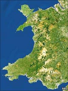
The new satellite map of Wales should show a much higher level of detail than before
Wales could become the first European country to produce a national map of its wildlife habitats using satellite technology, say scientists.
A joint project between Countryside Council for Wales (CCW), Aberystwyth University and Environment Systems is being unveiled in Cardiff.
It is hoped the Habitat Inventory of Wales will be completed by April 2012.
Keith Davies of CCW said it would help in planning and managing change to Wales' natural environment.
Wales' wildlife habitats - from grassland and woodland to coastal heath, upland bogs and moors - were originally surveyed by a team of CCW biologists roaming the length and breadth of Wales.
Their map was built up over many decades and completed in 1997.
Now, by using images from satellites passing over Wales, these maps are being updated at a fraction of the cost and time, reflecting the advancement in technology over the last decade.
The satellite images provide more detail than was collected by field staff during the original survey, said CCW.
The partnership pointed out that the environment creates employment and income worth billions of pounds, provides water, produces our food, energy and timber, and sustains our wildlife.
The scheme will be unveiled to future users at a special event in the National Museum, Cardiff on Tuesday.
Mr Davies, CCW's head of environment policy said: "It is vital that we have the best possible information to plan and manage change to Wales' natural environment, so that we can sustain economic and social wellbeing and conserve the environmental resources that we all depend on.
"The scale and intensity of the original field survey work have not been matched anywhere else in Britain.

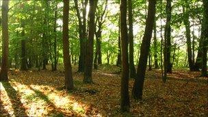
The map will cover Wales' woodland, coastal heath and upland bogs.
"Now that we can update the original maps and track changes, they will provide a sound, scientific basis for CCW's advice to government, local authorities and others on how best to manage and care for Wales' natural resources."
Steve Keyworth, director of Environment Systems, said the project demonstrated the benefits of collaborative working between a government body, a university and private business.
"With Wales taking the lead in using satellite data to assess and monitor the state of the environment, we can also help other regions and nations develop similar capability," he said.
This project will contribute towards delivering the Welsh Assembly Government's new initiative, Living Wales, currently out to consultation.
Living Wales aims to create a more joined-up approach to caring for the environment to improve the health of ecosystems as a whole, which support all life on earth.
- Published15 September 2010