Bangor's Hirael sea defences 'in various states of disrepair'
- Published

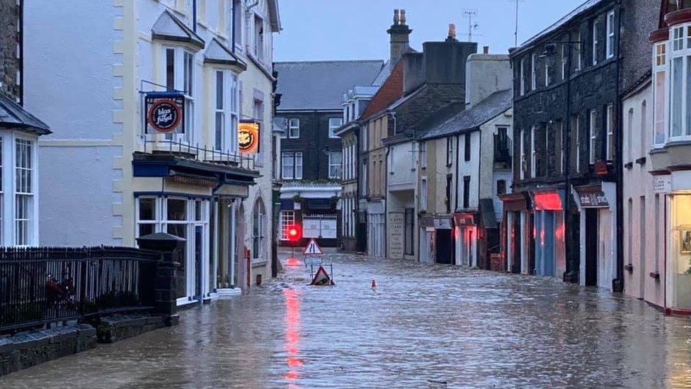
The area has suffered severe flooding in the past
Plans have been drawn up to build 600m (1,970ft) of new defences to protect properties from floods and rising sea levels.
Existing defences are "in various states of disrepair" at Hirael, in Bangor, a report, external submitted to Gwynedd Council has said.
The sea level is projected to rise 1.2m (3.9ft) by the end of this century, the Local Democracy Reporting Service said.
The area has previously been hit by severe flooding in 1923 and 1973.
Parts of Bangor have been identified as being at risk of flooding due to climate change.
The low-lying Hirael area faces a combination of factors, including an expected rise in sea levels and flooding the river Adda, as it empties into the sea.

Experts want to overhaul existing sea defences
The plans at Beach Road showed the wall would be raised 1.3m (4ft 3in) above the existing level of the seafront promenade. Other plans include:
Building a new concrete wall between the existing field and cycle path at Beach Road East car park
A new retaining wall to replace existing gabions, or caged rocks, at the promenade from Beach Road East car park to a Welsh Water pumping station
A compacted 1m (3ft 2in) wide embankment of topsoil and clay to be placed behind the pumping station
Raising a 20m (66ft) section of Glandwr Road by 50cm (19.7in) at its highest point along with a new reinforced concrete wall

Flood defences proposed for the Hirael area will be considered by the council
Designed by Ymgynghoriaeth Gwynedd Consultancy, the supporting documents said: "The existing coastal defences at Hirael are limited with the only formal defences in the area being a sea wall which in various states of disrepair, a revetment and gabion baskets at the coastal frontage, north east of Beach Road.
"Currently, there are no other structures that manage wave overtopping and inundation.
"Temporary flood barriers such as sandbags have been deployed in the past along the length of the sea wall and two slipways to deal with high tides and wave surges but are not a sufficient source of long-term flood protection."
It is expected that Gwynedd Council's planning department will consider the application in the coming months.

1923: Residents had to be evacuated by boat from Orme Road in Bangor
Related topics
- Published24 November 2021

- Published28 September 2021
- Published16 July 2021