Climate change: Floods show impact on Wales, say forecasters
- Published
Record river levels following intense storms show how climate change is affecting Wales
Record river levels and more frequent intense storms show climate change is starting to have an impact across Wales, flood forecasters have said.
More named storms, such as Storm Dennis, have brought severe flooding to parts of the country, Natural Resources Wales (NRW) said.
These storms caused severe devastation that even resulted in deaths.
This means it is vital that rainfall and river levels are monitored to protect communities and save lives.
NRW is run by the Welsh government and helps to look after the environment.
In February 2020, many rainfall records were broken, said Samantha Mitchell, NRW's flood forecasting specialist adviser.

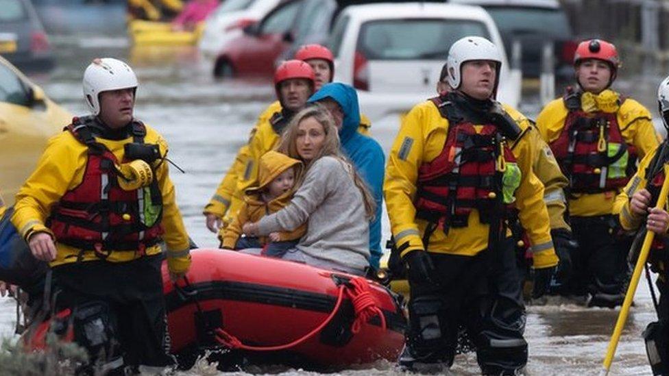
Floods after Storm Dennis caused serious damage in areas such as Taffs Well in Rhondda Cynon Taf
"We had Storm Ciara, which broke records for river levels in north Wales," she said.
"Then the following weekend we had Dennis, which broke records in south east Wales and then at the end of the month we had Storm Jorge, which broke records in the middle of Wales."
She is part of a team that monitors river levels, and looks at whether flooding thresholds will be reached.
But their work to monitor river and coastal activity continues year round, and not only when a storm is forecast. They use a range of technology, including mini remote control boats and drones.
How is it measured?
Paul Griffiths, senior advisor in NRW's hydrometry and telemetry team, spends his time travelling around some of the 350 river level and flow monitoring stations in Wales, including one on the banks of the River Taff in Merthyr Tydfil.

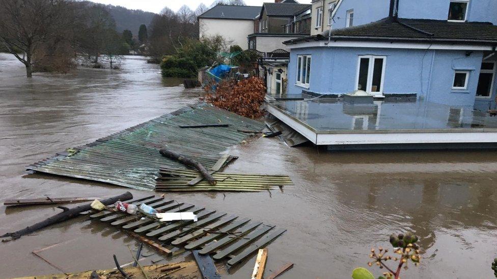
During Storm Dennis, the high river levels flooded many houses in parts of the town and there is still evidence of storm damage within the river.
During the peak on 15 and 16 February 2020 there were 61 flood alerts, 89 flood warnings and two severe flood warnings in force.
Storm Dennis: South Wales under water as floods hit
The station in Merthyr consists of a small brick-built hut and a number of measuring devices that are fixed in the water and on the riverbanks.
The focal point is a river level gauge, which looks like a huge ruler.

Water levels are measured with "large rulers"
Speaking at the station, Paul said: "We've had some fairly big storms in recent years. The last big one was Storm Dennis and the gauge here got to about 2.7m (8ft 10in), not far off the top, which means where we are here we would have been under water."
River level readings are taken from the gauge and are compared to readings from a sensor, a small grey box in the water, to make sure they match up to provide accurate readings. These readings are then sent to NRW's main office via a phone signal.
When the river is too high or fast, the flow has to be monitored manually.

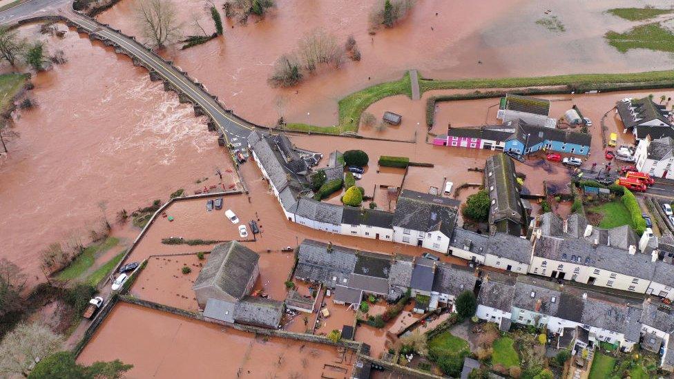
A bridge linking Llechryd, Ceredigion, with Pembrokeshire was completely submerged in February 2020
One way to detect the flow is using a tiny remote control boat called an Acoustic Doppler Current Profiler (ADCP), which sends readings to a laptop via Bluetooth.
Paul said: "What this does is monitor the velocity of particles travelling underneath from the river and at the same time it will track the depth and a cross-sectional area of the bed as well and that gives us the flow. It's a fairly simple calculation.
"This station is really important for climate change studies, it's really important for our flood models and ultimately for protecting people and protecting properties."
A monitoring station on the river bank houses all the data collected, which is then sent to and analysed by the flood forecasting team at NRW.
How does the data turn into a flood forecast?

Flood forecasting specialist Samantha is part of the team who measure floods
At the office in Cardiff, maps of Wales' rivers cover the walls and the computer screens allow the team to visualise the data and detect trends.
Samantha said: "When it starts raining, we take forecast rainfall data from the Met Office and we also take observed river levels, like you would have seen at Merthyr Tydfil.
"They go into our models and the models work out what might be happening… and whether that might be passing any flooding thresholds. We pass that information on to the flood warning duty officers and they will decide whether to issue any flood warnings to the public."
The flood predictions are accessible to everyone on the NRW website, through interactive maps and graphs.
Should I get flood warnings?
How much warning you get depends on where you live.
Characteristics including size and shape can influence a river's behaviour, which in turn affects how far in advance flood warnings can be issued.
Samantha said the fastest responding rivers to rainfall are in south Wales that drain off the old coalfields or the Brecon Beacons, such as in Neath Port Talbot or Rhondda Cynon Taf.
The larger rivers like the Wye, Severn and Towy tend to respond more slowly to rainfall.
"It's definitely becoming a trend for higher river levels and more intense events. So that indicates to us that climate change is definitely starting to have an impact."
- Published15 February 2022
- Published15 February 2021
- Published2 March 2020