Frozen Planet: Aberystwyth scientist Alun Hubbard on filming
- Published

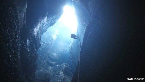
The film crew abseiled into a moulin, which is formed by water drainage
A glaciologist has told of the "incredibly" difficult and dangerous work involved in filming the BBC TV series Frozen Planet.
But Dr Alun Hubbard of Aberystwyth University said the reward is the "stunning" footage.
He helped with location filming on the Greenland ice sheet seen in the last episode to be shown on Wednesday night, including abseiling into deep crevices.
Dr Hubbard has been researching in Greenland for some years.

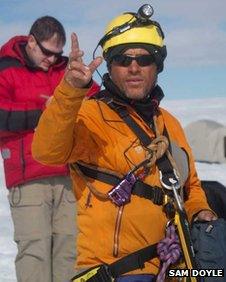
Dr Alun Hubbard has been working in Greenland for some years
Dr Hubbard, from the university's Institute of Geography and Earth Sciences, and his team hosted the film crew at their Melt Lake Camp.
Since 2008, he has been advising and aiding the Frozen Planet producers on the scientific and logistical issues of filming in a "remote and hostile" location, such as providing helicopters to film landscape scenes that have become a big talking point of the series.
He also helped organise the ice research vessel Gambo, which features in the last episode, and which supported operations during filming in July and August 2010 from the sea.
Dr Hubbard said: "Last summer was incredibly hard work and also very stressful at times, directing multiple crews and helicopters with ground, air and marine support along with managing work teams on the ice in difficult and dangerous locations.
"It's so satisfying now to sit back and enjoy the rewards of these efforts. The whole of the Frozen Planet series including our Greenland research looks stunning."

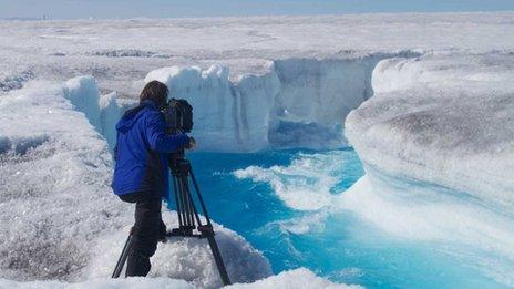
Managing teams in dangerous locations has proved difficult, says Dr Hubbard
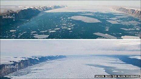
In September, Dr Hubbard revealed photographs which he said showed the extent to which part of a huge glacier in northern Greenland has broken up in two years.
Dr Alun Hubbard of Aberystwyth University said he was "gobsmacked" by the scale of the Petermann Glacier's break-up since he last visited in 2009.
Last year, it shed a piece of ice measuring 77 sq m (200 sq km).
Located in north west Greenland, the Petermann Glacier accounts for 6% of the area of the Greenland ice sheet, said Dr Hubbard.

These photos of the Petermann Glacier were taken two years apart, the latest one in July 2011 (top) and in the summer of 2009
It terminates as a floating tongue of ice, around 43 miles long by 12 miles wide (70km by 20km), the largest of its kind in the northern hemisphere.
At its thickest the glacier is 3,280ft (1,000m) high.
"It's like looking into the Grand Canyon full of ice and coming back two years later to find it's full of water," he said at the time.
With support from the US National Science Foundation and the Natural Environment Research Council in the UK, Dr Hubbard travelled by helicopter to the glacier to gather data from time lapse cameras and GPS sensors set up in July and August 2009, with the help of Greenpeace.
The GPS sensors were set in anticipation of a large break-up of ice that eventually occurred by on 3 August, 2010.
- Published2 December 2011
- Published7 September 2011