Google Street View scales Snowdon using camera backpacks
- Published

Mount Snowdon on Google Street View
Armchair travellers will be able to soak up the scenery of Snowdon the lazy way after Google Street View scaled the mountain.
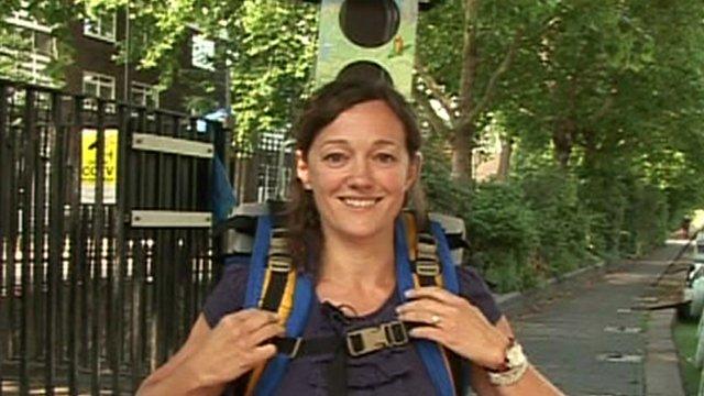
Volunteers carrying backpacks holding Google's cameras walked around and to the summit of Wales' highest peak to capture 360-degree panoramic images.
They can now be viewed online, external, along with those from the highest peaks in England and Scotland.
Google said the pictures could help walkers plan ahead for their treks.

"These areas of outstanding natural beauty in Wales, England and Scotland can be viewed by anyone who is planning a specific visit, or for those who are simply interested in learning more about each peak, from the terrain and landscape, to the vegetation and views," Laurian Clemence of Google UK said.
As well as walking different routes to the summit of Snowdon, the Street View volunteers also trekked around the Snowdonia National park.
They took in popular beauty spots including Cadair Idris, Cwm Idwal, Mawddach Trail and Lôn Gwyrfai.
Liz Jenkins, Snowdonia National Park Authority's geography information services officer, said the images meant "the special qualities of Snowdonia can be viewed by everyone in the world".

Google usually sends out cars and trikes to gather the images used in its Street View maps.
But the company created the modified backpack, called a Trekker, to enable people to walk to remote locations and get the 360-degree images required.
The Trekker has already been used in the Grand Canyon and the world's tallest building, Burj Khalifa, and has mapped some of the UK's canals and rivers.


- Published13 October 2015
- Published15 August 2013