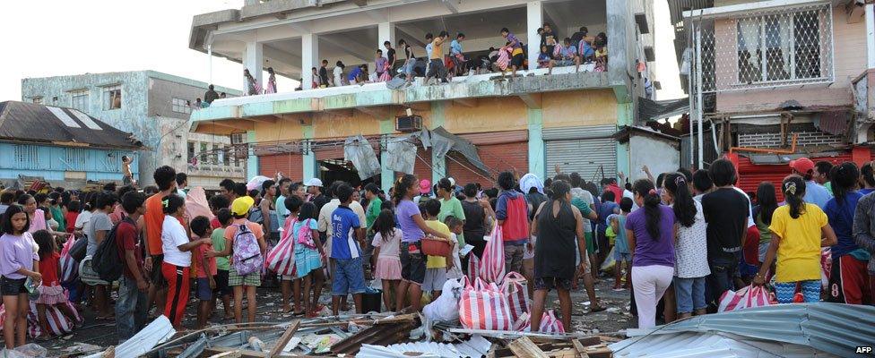
Typhoon Haiyan: Before and after the storm
- Published
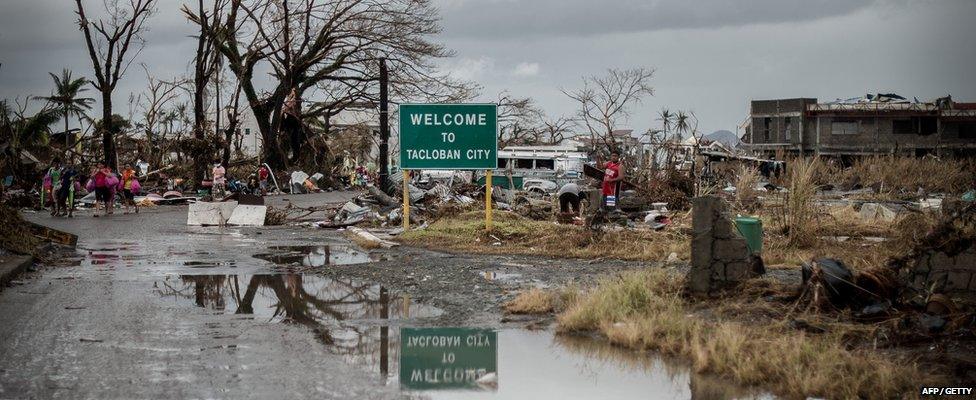
Coastal towns across the central Philippines have been left devastated by Typhoon Haiyan, which brought gusts of wind of up to 275 km/h (170 mph) and waves as high as 15m (45ft).
Satellite and aerial images of before and after the storm show the extent of the damage in the country's low-lying areas, such as Tacloban on Leyte Island and Guiuan, in Eastern Samar province.
Satellite image slideshow
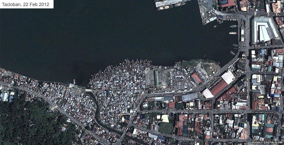
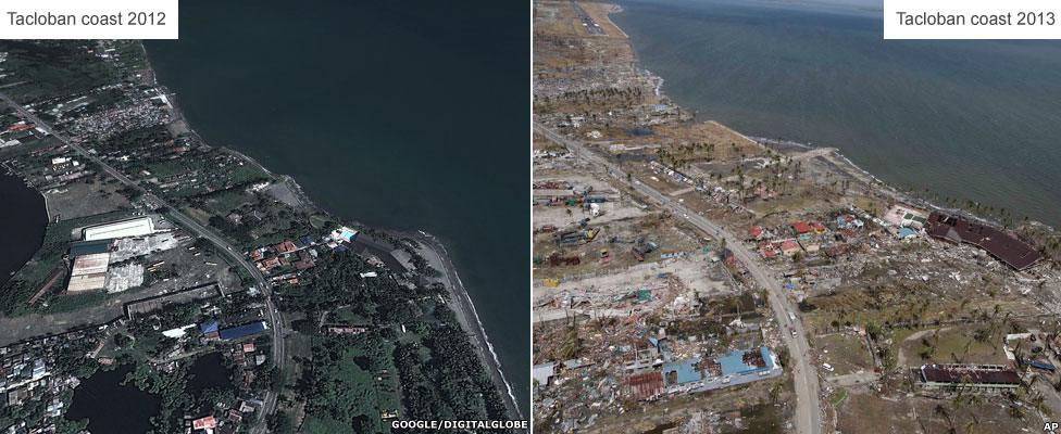
Satellite images from February 2012 show the bustling port of Tacloban and communities near the sea.
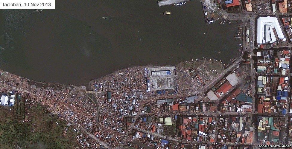
The latest images, taken just after the storm, show homes and buildings destroyed.
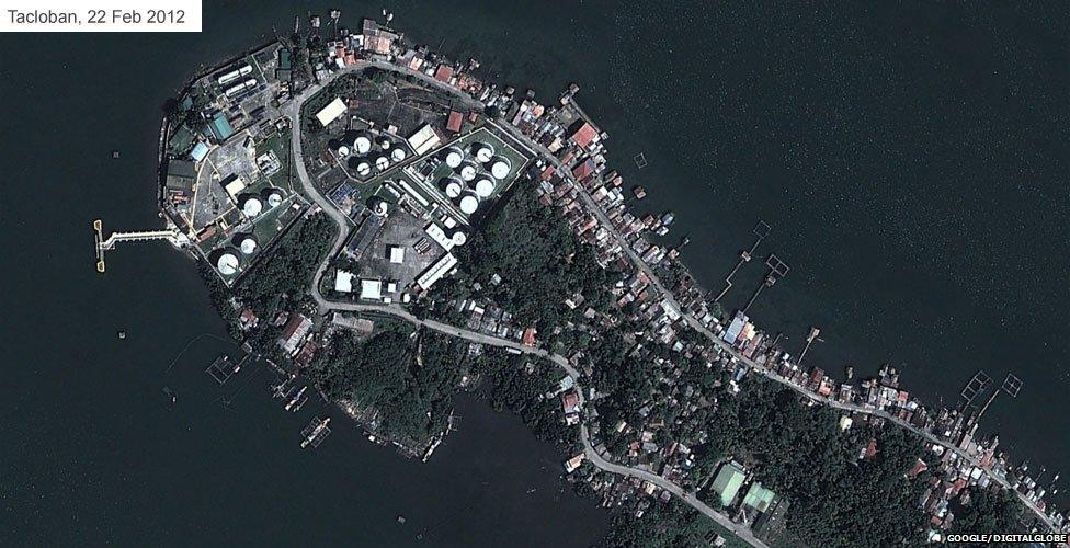
A shot of the headland from 2012 shows pontoons and moorings for boats near people's homes.
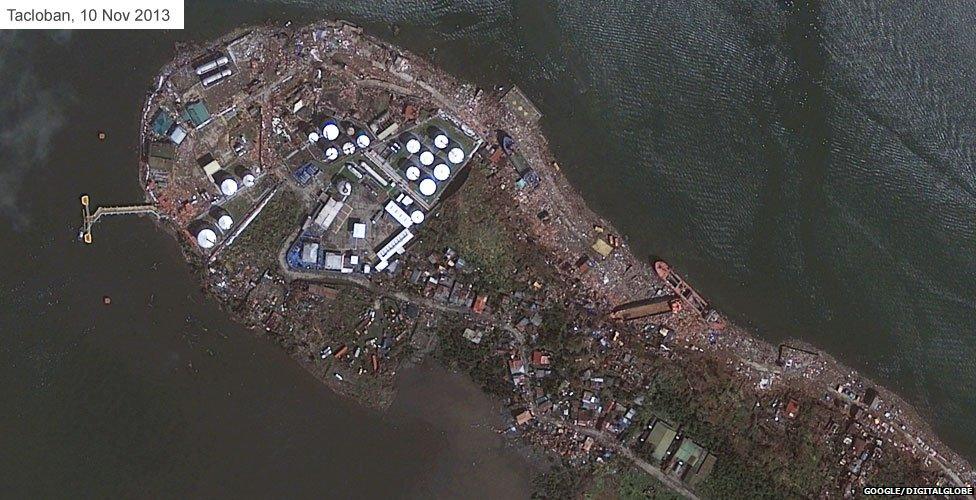
The storm surge that hit Tacloban seems to have washed away the pontoons and shoreside houses.
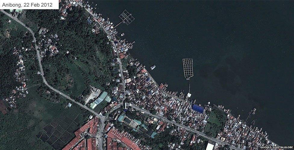
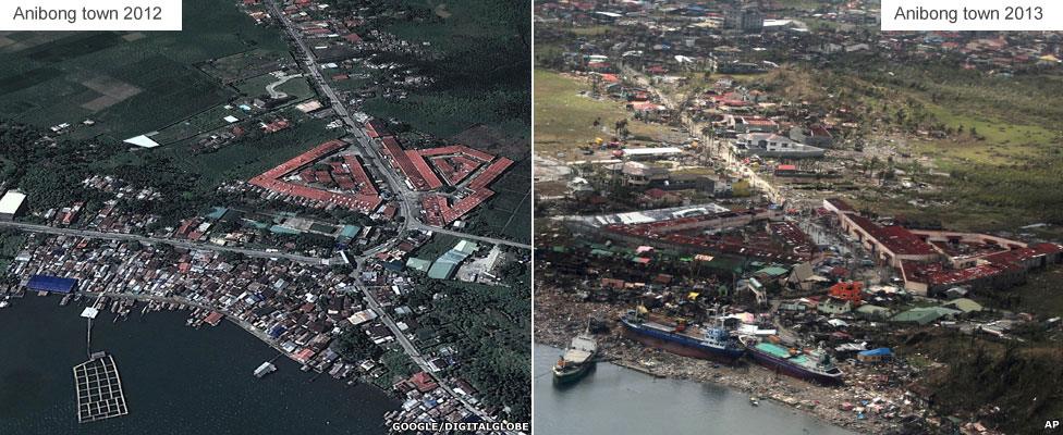
Anibong, just along the coast from Tacloban, has a distinctive red-tiled warehouses (bottom left) next to a school.
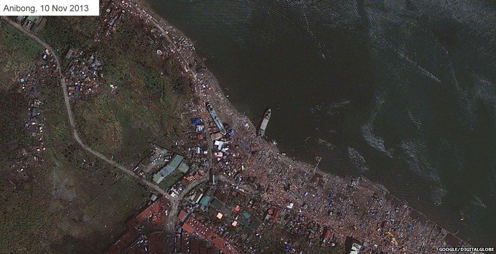
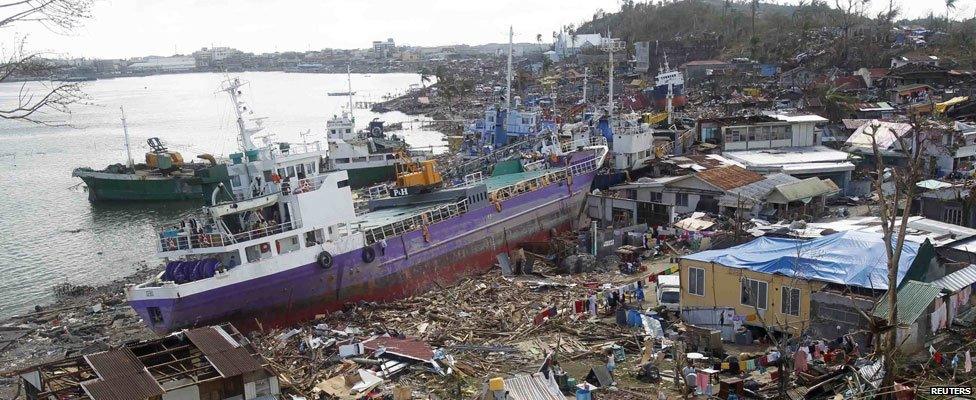
Satellite images show how cargo ships were swept ashore and the coastal buildings were destroyed.

Tacloban and surrounding area in detail
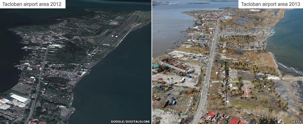
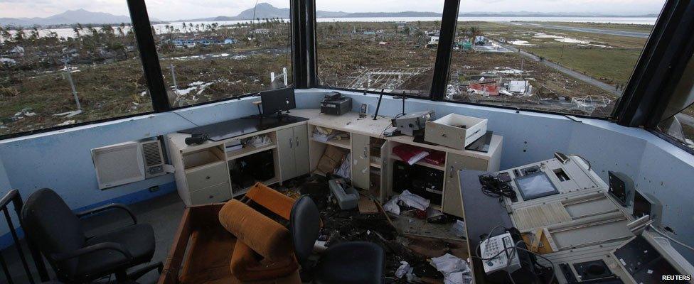
Four days after Typhoon Haiyan hit, survivors in the devastated city of Tacloban are still desperate for help. The city's airport - a key regional transport hub - has been severely damaged, meaning the arrival of planes carrying aid had been delayed.

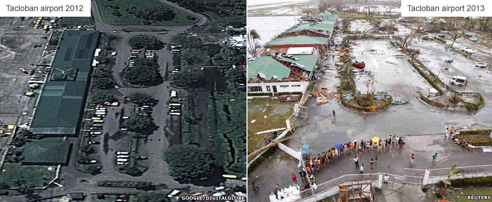
The city's airport buildings were smashed, trees uprooted and vehicles overturned by vicious winds. However, a limited number of planes are now landing, bringing much-needed supplies.

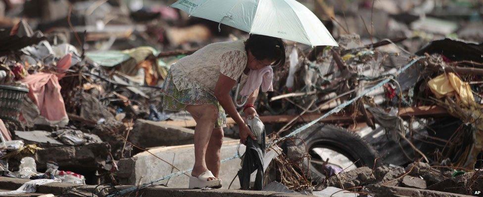
In Tacloban itself, the largest city on Leyte Island, thousands of people are thought to have died. Survivors have been sifting through the wreckage of their homes in a desperate hunt for provisions and belongings.

Anibong town near Tacloban city
Further along the coast from Tacloban, cargo ships ploughed into the coastline at Anibong town. The UN says people are now desperate for help.

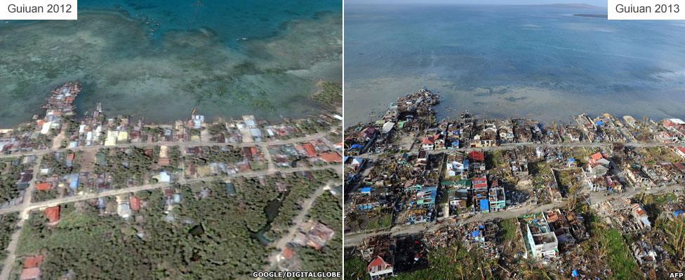
Guiuan town and coastal areas
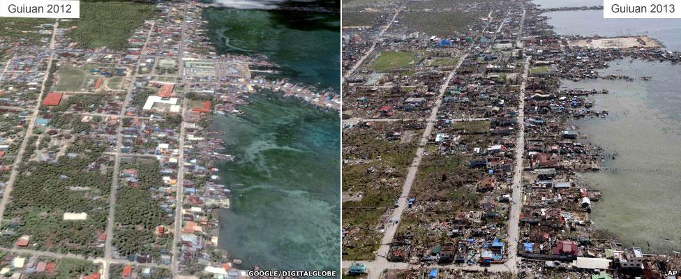
Guiuan was among the first areas hit by the typhoon. Many of the area's buildings have been reduced to piles of debris and locals say much of the town has been destroyed. Some aid has begun to arrive, with residents of Victory Island, off Guiuan, receiving food supplies from a military helicopter.
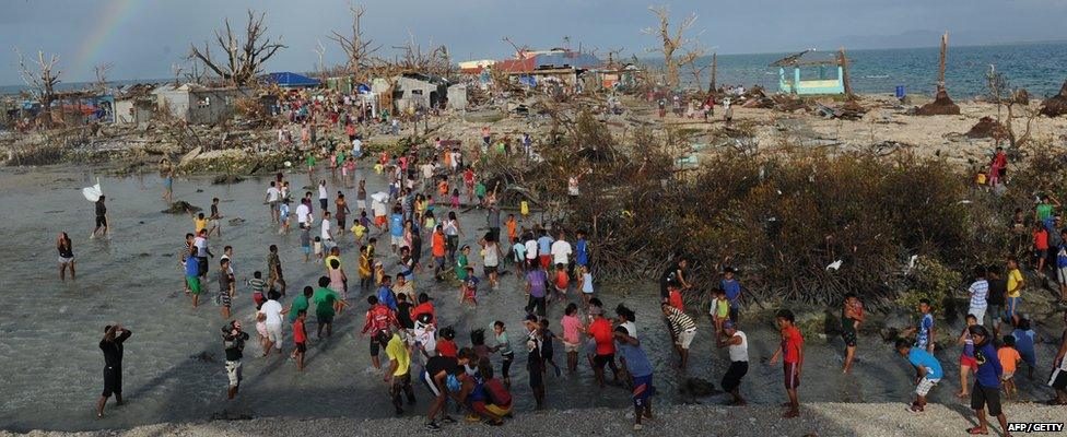

However, large-scale assistance has yet to reach Guiuan, a town of 40,000 people. Residents have been forced to scavenge for the food, water and medicine they need.
