El Nino weather 'could be as bad as 1998', says Nasa
- Published
- comments
How the El Nino weather system has contributed to flooding in the US, Latin America and Arctic
The US space agency Nasa has warned that the effects of the current El Nino weather phenomenon could be as bad as those of 1998, the strongest on record.
That El Nino played havoc with world weather systems and was blamed for several extreme weather events.
The current El Nino has been linked to several floods and unusually warm conditions in the northern hemisphere.
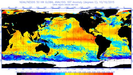
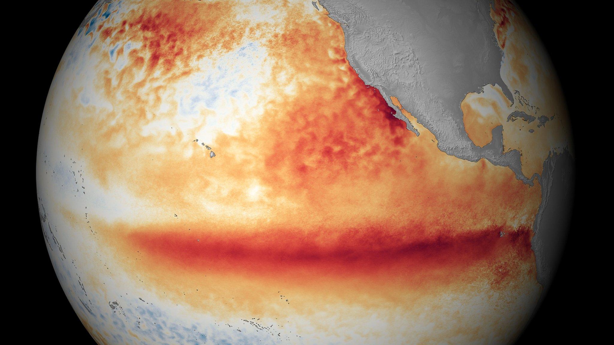
The phenomenon sees warm waters of the central Pacific expand eastwards towards North and South America.
El Nino is a naturally occurring weather episode which happens every two to seven years.
It usually peaks late in the calendar year, although the effects can persist well into the following spring and last up to 12 months.
Nasa says, external the current El Nino "shows no signs of waning", based on the latest satellite image of the Pacific Ocean.
It bears "a striking resemblance" to one from December 1997, the agency says, "the signature of a big and powerful El Nino".
Strongest El Nino since 1950 on the way
Matt McGrath: 'High impacts' from globally stronger El Nino
Worries over humanitarian impact, external
This year's El Nino has been linked to the worst floods seen in 50 years in Paraguay, Argentina, Uruguay and Brazil.
The floods there have forced more than 150,000 people from their homes - more than 100,000 of them in the Paraguayan capital alone.
In the US, 13 people have died in the US state of Missouri as a result of flooded rivers after tornadoes and storms hit the region.
A five-mile (8km) section of the Mississippi River near St Louis was closed to vessels as a result of the "hazardous conditions" that have been caused.
El Nino has also been cited as a factor in the floods that have hit northern parts of the UK, forcing thousands from their homes and leaving thousands more without power.
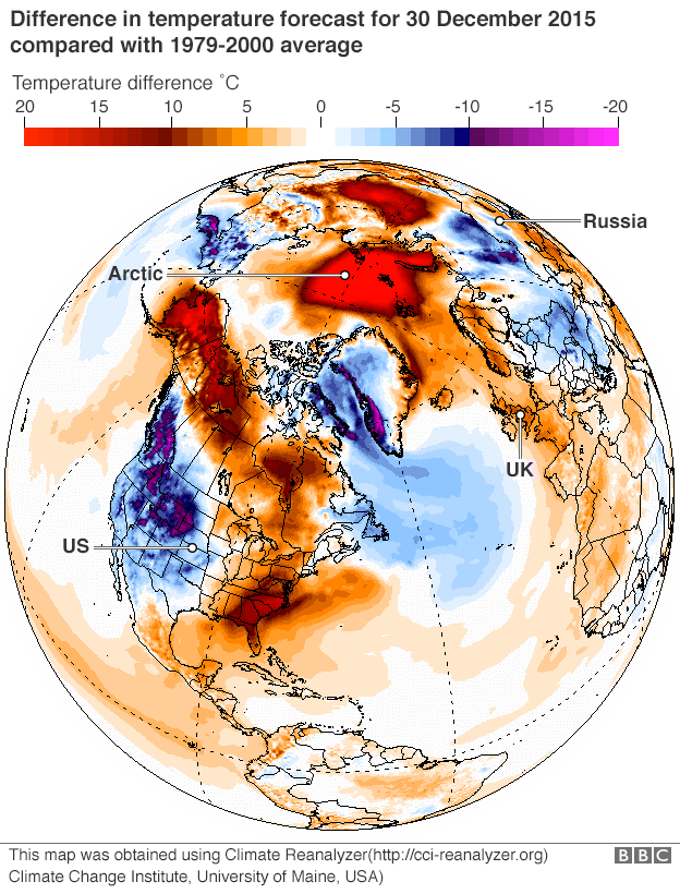
Storm Frank, which is expected to bring fresh rain and flooding to the UK this week, is part of a weather system causing unusually high temperatures in the Arctic.
One weather buoy near the North Pole has measured a temperature above freezing - almost unheard of at this time of year, when the normal figure is about -25C (-13F).

Astonishing spike at North Pole: BBC science editor David Shukman
One of the most bizarre side-effects of the current turbulence in the global weather is that even at the roof of the world, at what is meant to be the coldest time of the year in the northern hemisphere, the North Pole itself is unusually warm.
There are no instruments there at the moment to provide exact readings but US weather buoys, drifting with the ice slightly to the south, have recorded the extraordinary fact of temperatures nudging just above zero. And the Norwegian weather service estimates temperatures there to be around -2C.
Either way, that is astonishingly warm given the average temperature for the time of year, which is around -25C.
The spike in warmth will not last long but may conceivably act as a brake on the usual process of the growth of winter ice in the Arctic. And it certainly serves as a reminder of the power and reach of Storm Frank, which is currently battering the UK, as the swirl of winds around it has pushed warm air northwards.

Meteorologist Matt Taylor explains what El Nino is
Higher temperatures than the seasonal average have been noted in many parts of Europe and the US.
Average temperatures on Christmas Day in France were the second highest on record, just below those of 1997.
The mild weather has forced farmers to harvest crops such as salad, strawberries and asparagus early, with reports of large amounts of produce going to waste.
Desperation in one French ski resort at the lack of snow led to 100 tons of snow being airlifted in by helicopter.
In Italy, experts say the unusually calm and dry weather has exacerbated pollution over the cities of Milan and Rome.
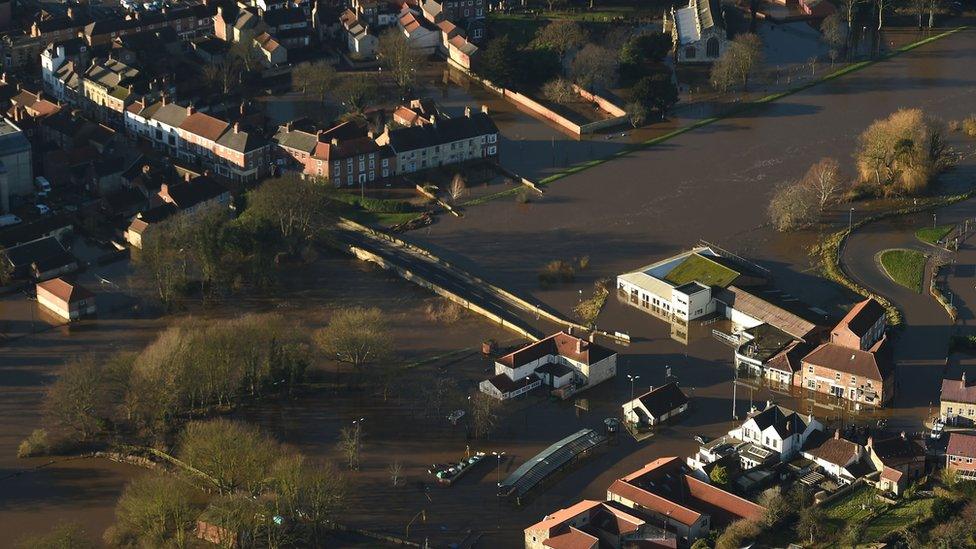
El Nino has been linked to storms that have brought flooding to the UK...
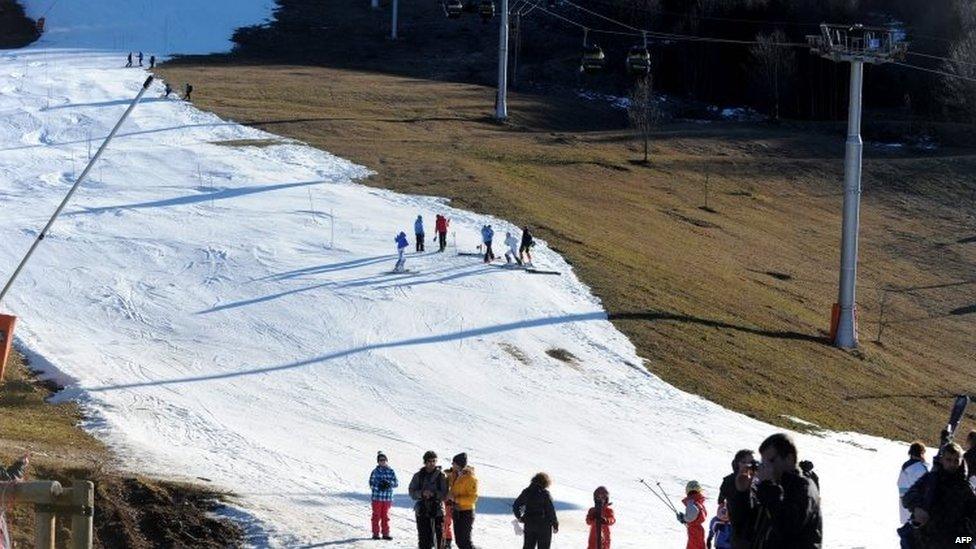
...while snow has been thin on the ground at some French ski resorts
By contrast, in Mexico El Nino is being blamed for freezing temperatures in the north of the country, with snow seen in parts of the Sonoran desert for the first time in 33 years. Three deaths have been blamed on the cold in Sonora state.
'Turning up heat further'
The World Meteorological Organization (WMO) , external has stressed that El Nino is not the only factor driving global climate patterns but said the implications of the weather systems in a warmer world are uncertain.
"This naturally occurring El Nino event and human-induced climate change may interact and modify each other in ways which we have never before experienced, " WMO secretary general Michael Jarraud said last month.
"Even before the onset of El Nino, global average surface temperatures had reached new records. El Nino is turning up the heat even further," he said.
- Attribution
- Published12 May 2015
- Published30 December 2015
- Published31 December 2015

- Published16 November 2015
