Hurricanes: A guide to the world's deadliest storms
- Published

As we enter hurricane season, when there is a greater chance of more powerful storms developing in the Atlantic, here is a guide to how deadly storms form, how they are measured and why they happen where they do.
Hurricanes are the biggest and most violent storms on the planet. Every year, between June and November they hit the Caribbean, the Gulf of Mexico and the eastern coast of the United States, sometimes leaving a trail of destruction in their wake.
In the Pacific Ocean, they are known as cyclones. In the Indian Ocean and southern Pacific, they are known as typhoons. They are all tropical storms, but they are only called hurricanes in the north Atlantic and north-eastern Pacific.

Where do hurricanes start?
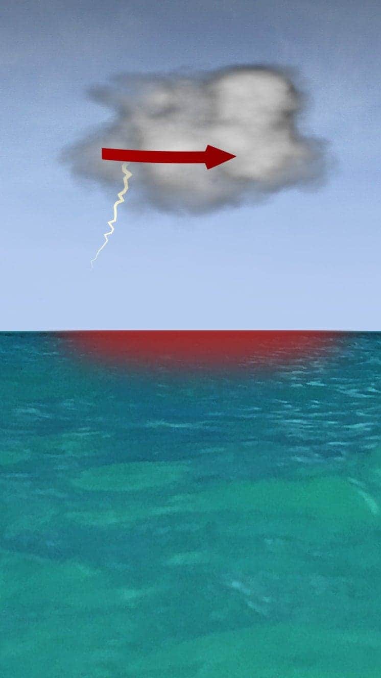
Most hurricanes that form in the Atlantic are the result of an atmospheric phenomenon known as a tropical wave.
The wave starts as a type of atmospheric trough that creates an area of relatively low air pressure - usually in western Africa, in mid-July.
If the conditions are right for it to develop, the low pressure starts to move west, with the help of the trade winds or easterlies.

When it reaches the Atlantic, the tropical wave has the potential to become a hurricane - but for this to happen it needs enough energy in the form of heat and wind.
In fact, it needs a deep layer of warm water, with a surface water temperature above 27C.
It also needs the right winds - horizontally swirling winds to concentrate the storm and a weak vertical wind shear rising from the surface of the sea.
If the wind shear changes too much as it rises, it can disrupt the flow of heat and humidity needed to create the hurricane.
The final ingredient is a concentration of rain clouds and high humidity in the area.

This all needs to happen in the right place - generally between 10 and 30 degrees latitude in the northern hemisphere, where the rotation of the Earth helps the winds converge and rise in the area of low pressure.
When a tropical wave encounters all these elements, they all start to interact over an area between 50km (31 miles) and 100km wide.
"The movement of the tropical wave is a trigger for the storm," says Jorge Zaval Hidalgo, general co-ordinator of Mexico's National Weather Service.
What does a hurricane look like?
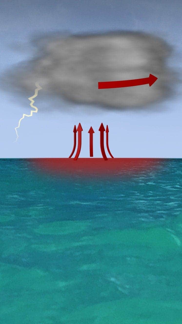
The storm is the catalyst - and the dance of heat, air and water begins.
The area of low pressure cools the humid, warm air rising from the ocean, which fills the clouds.
The condensation of this air releases heat, which lowers the pressure even more, drawing more humidity from the ocean and the storm builds.
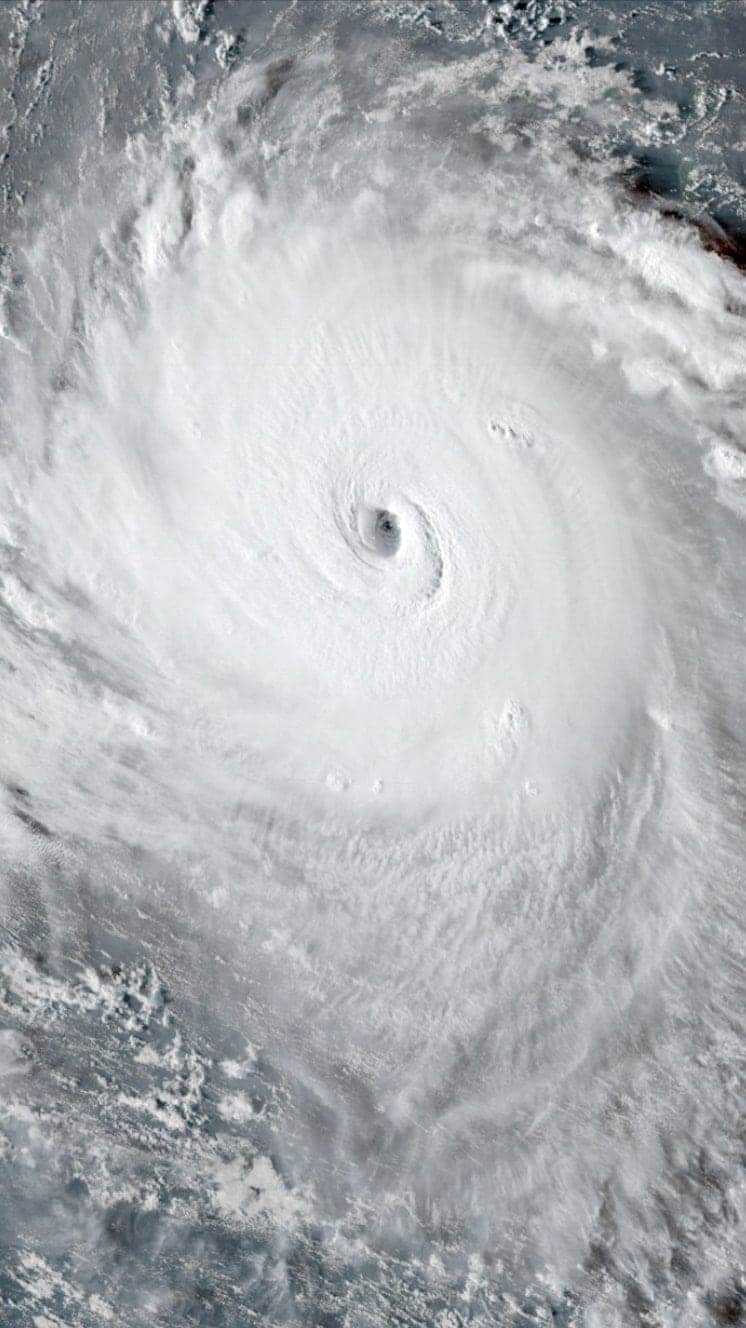
The winds converge and rise within the area of low pressure, spinning counter clockwise, giving the hurricane its trademark shape.

While the storm becomes more powerful, the eye of the hurricane - the central area about 30-60km wide on average - remains relatively calm.
Around it, rises the eye wall of dense clouds and most intense winds.
Beyond that are the spiral bands of cloud, where there is the most rain.
The wind speeds are what determine the moment at which we can call this phenomenon a hurricane.
At its birth, it is a tropical depression. As it gathers strength, it becomes a tropical storm. When speeds reach more than 118km an hour, it is a hurricane.

How do you compare hurricanes?
However, hurricanes can be classified in five categories depending on the sustained wind speeds. In the Atlantic, the Saffir-Simpson wind scale is used to measure their destructive power.
One hurricane's winds can produce about half as much energy as the electrical generating capacity of the entire world, according to the National Oceanic and Atmospheric Administration (NOAA).

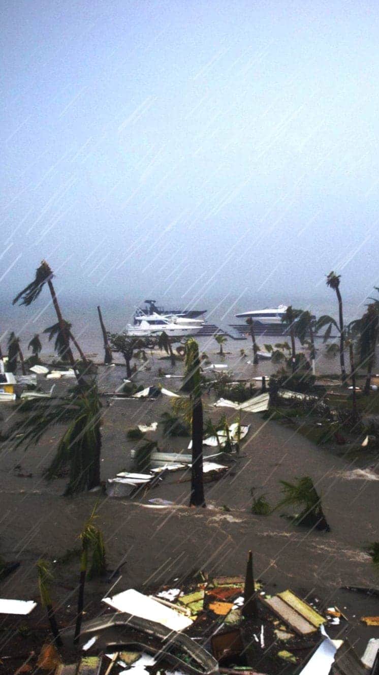
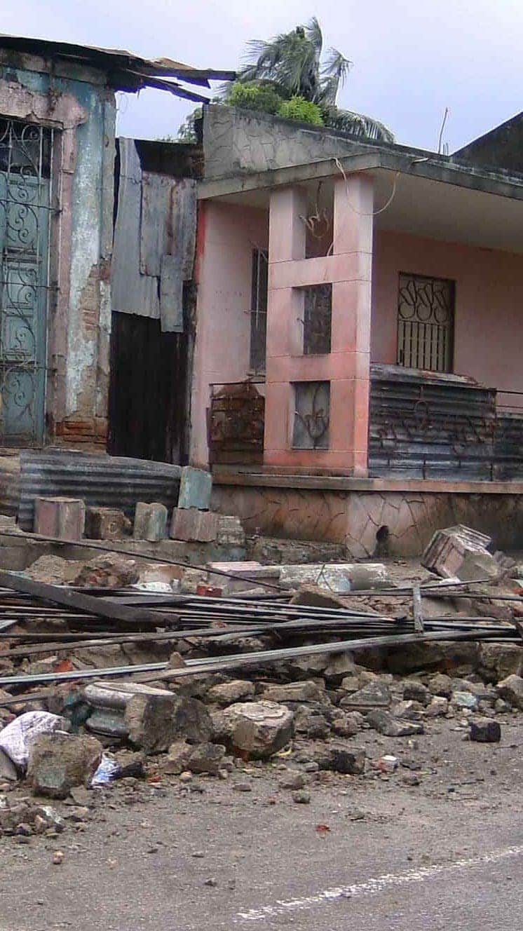
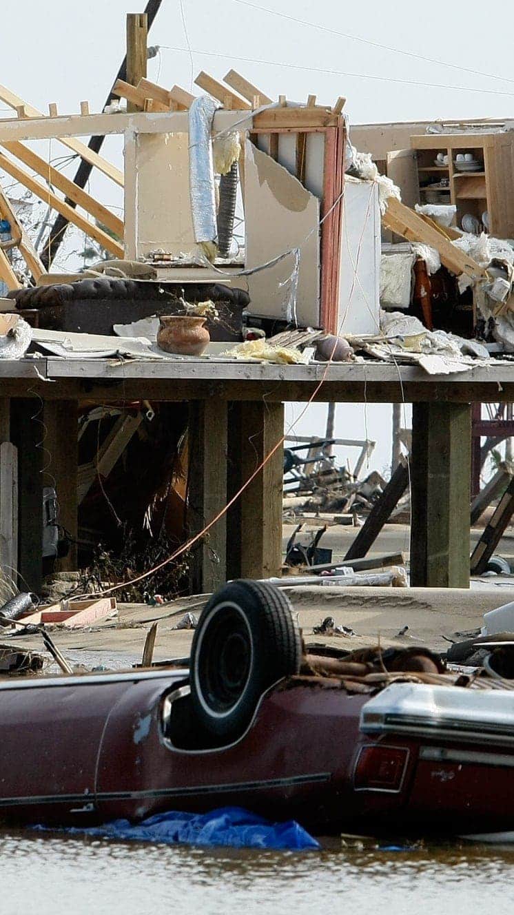
However, it is not the winds that cause the most destruction and loss of life, but the storm surge and flooding caused by the hurricane's rain.
In the United States, for example, the storm surge caused by tropical cyclones in the Atlantic were responsible for nearly half of hurricane-related deaths between 1963 and 2012, according to the American Meteorological Society.
The level of destruction caused by a hurricane is also going to depend on other circumstances, such as the speed at which it hits, the terrain and local infrastructure in the affected area.
"The damage or danger associated with a tropical cyclone does not necessarily correspond to its category. For example, the highest level storm will not necessarily mean more rain," Mr Hidalgo told the BBC.
Here is a recap:
Hurricanes
A guide to the world's deadliest storms
Hurricanes are violent storms that can bring devastation to coastal areas, threatening lives, homes and businesses.

Hurricanes develop from thunderstorms, fuelled by warm, moist air as they cross sub-tropical waters.
Warm air rises into the storm.
Air swirls in to fill the low pressure in the storm, sucking air in and upwards, reinforcing the low pressure.
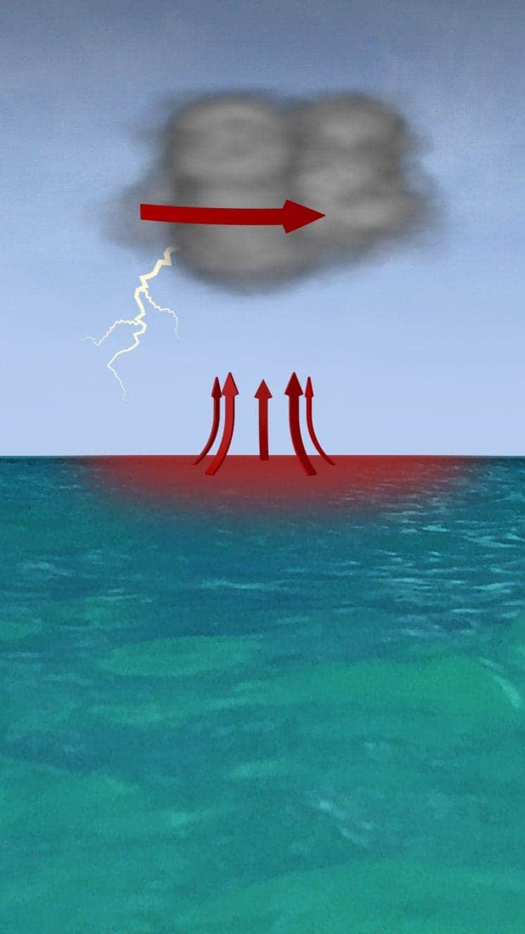
The storm rotates due to the spin of the earth and energy from the warm ocean increases wind speeds as it builds.
When winds reach 119km/h (74mph), it is known as a hurricane - in the Atlantic and Eastern Pacific - or a typhoon in the Western Pacific.

"Everybody has a plan until they get punched in the face. Well, we're about to get punched in the face."
Florida Mayor Bob Buckhorn, ahead of Hurricane Irma (2017)
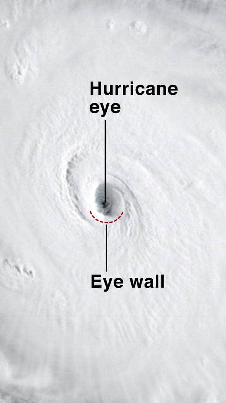
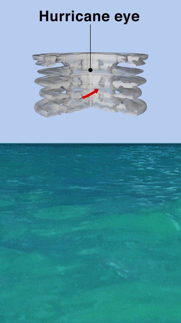
The central eye of calmer weather is surrounded by a wall of rainstorms.
This eyewall has the fastest winds below it and violent currents of air rising through it.
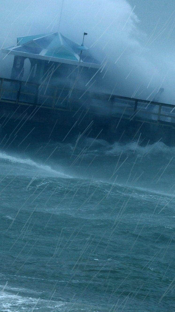
A mound of water piles up below the eye which is unleashed as the storm reaches land.
These storm surges can cause more damage from flooding than the winds.

"Urgent warning about the rapid rise of water on the SW FL coast with the passage of #Irma's eye. MOVE AWAY FROM THE WATER!"
Tweet from the National Hurricane Center
The size of hurricanes is mainly measured by the Saffir-Simpson scale - other scales are used in Asia Pacific and Australia.
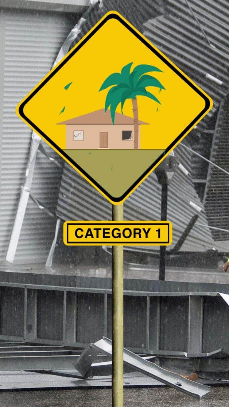
Winds 119-153km/h
Some minor flooding, little structural damage.
Storm surge +1.2m-1.5m
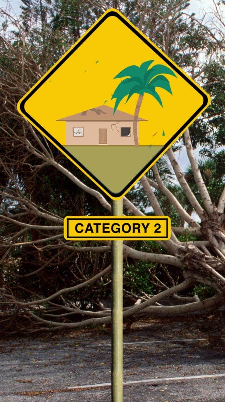
Winds 154-177km/h
Roofs and trees could be damaged.
Storm surge +1.8m-2.4m
Winds 178-208km/h
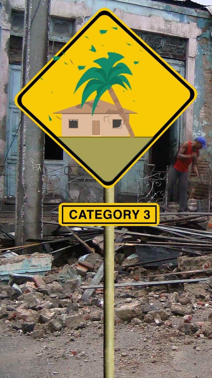
Houses suffer damage, severe flooding
Storm surge +2.7m-3.7m
Hurricane Sandy (2012) caused $71bn damage in the Caribbean and New York
Winds 209-251km/h
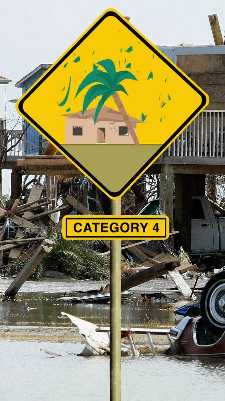
Some roofs destroyed and major structural damage to houses.
Storm surge +4m-5.5m
Hurricane Ike (2008) hit Caribbean islands and Louisiana and was blamed for at least 195 deaths
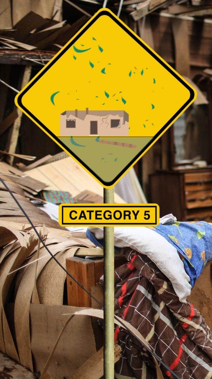
Winds 252km/h+
Serious damage to buildings, severe flooding further inland.
Storm surge +5.5m
Hurricane Irma (2017) caused devastation in Caribbean islands, leaving thousands homeless
"For everyone thinking they can ride this storm out, I have news for you: that will be one of the biggest mistakes you can make in your life."
Mayor of New Orleans Ray Nagin ahead of Hurricane Gustav, 2008
If you can't see the explainer above, follow this link, external
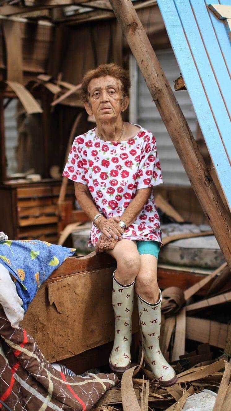
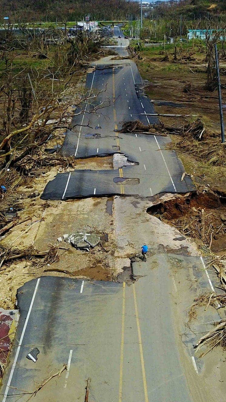
Six graphics that sum up Puerto Rico disaster
Text and graphics by Camilla Costa, Carol Olona and Cecilia Tombesi