Ethiopia's Tigray war: Satellite images capture troop build-up near Eritrea border
- Published
Satellite images have given a rare glimpse into the resurgence of fighting in Ethiopia's northern Tigray region, one of the world's most hidden conflicts, where communications have been cut off and journalists denied permission to visit.
The images taken this month show the build-up of troops and military hardware along Ethiopia's border with Eritrea.
They belong to the Ethiopian federal forces and their Eritrean allies who are both fighting the Tigray People's Liberation Front (TPLF), which controls most of the region.
The images taken this month show the build-up of troops and military hardware along Ethiopia's border with Eritrea, which backs Prime Minister Abiy Ahmed against the Tigray People's Liberation Front (TPLF), the group that controls the region.
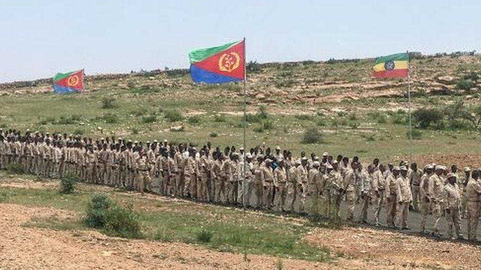
Eritrea recently mobilised its reserve forces for a reported offensive in Tigray.
Fighting reignited in August after a five-month humanitarian ceasefire broke down.
The United Nations' World Food Programme estimates that 13 million people need aid across northern Ethiopia because of the civil war.
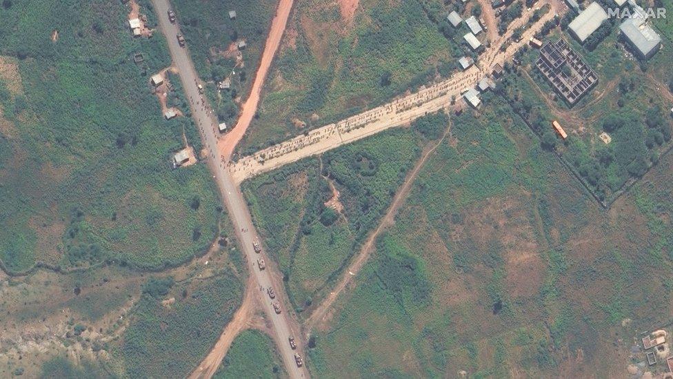
These images were taken on 26 September of the north-western town of Shiraro, which had been in the hands of the Tigrayans until it was taken over by pro-government forces earlier this month.
The image above shows the main road leaving the town heading east.
Tanks are positioned on the main road in the bottom left. Maiani Hospital can be seen in the top right. This opened in 2014 with surgical rooms, an obstetrics department, X-ray facilities and 35 beds.
What appears to be about 150 people, probably fighters, are organised in a formation or queue stretching from the entrance back to the main road.
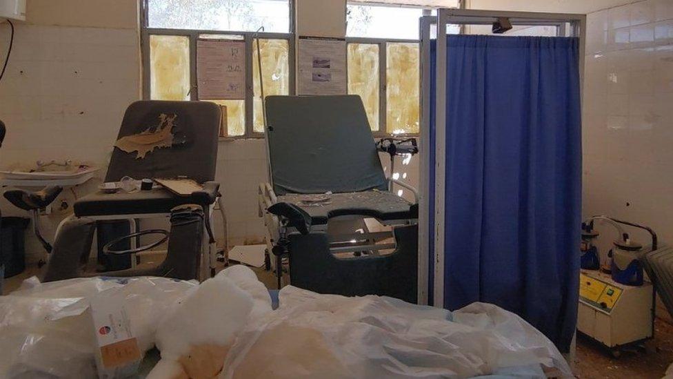
Last year, reports suggested the hospital was badly damaged.
The charity MSF said in March 2021 that its teams had found health facilities across the region - including Maiani hospital - "looted, vandalised and destroyed in a deliberate and widespread attack", external.
Of 106 centres they visited, only 13% were working normally. MSF said, "While some looting may have been opportunistic, health facilities in most areas appear to have been deliberately vandalised to make them non-functional."
The BBC has spoken to a senior aid worker in the town of Shire, which is 95km (60 miles) east of Shiraro. He says about 210,000 people have fled Shiraro and the surrounding areas to Shire since 1 September.
"For one week [in August] before the people left the town, there was continuous shelling, it was 24 hours, continuous," he told the BBC.
We have hidden the aid worker's identity for his safety.
He told the BBC that according to those fleeing, as well as his staff who had been posted to Shiraro, Maiani Hospital was now in the hands of Eritrean and Ethiopian government forces.
On 13 September, before the latest satellite images were taken, the head of the Tigrayan Forces, General Tedesse Werede, told local media that "the joint Eritrean and Ethiopian army in Shiraro have taken control of areas from Shiraro to Ademeiti".
It is not clear who is currently in charge of Shiraro - the aid worker in Shire told the BBC reports of who is control change day by day.
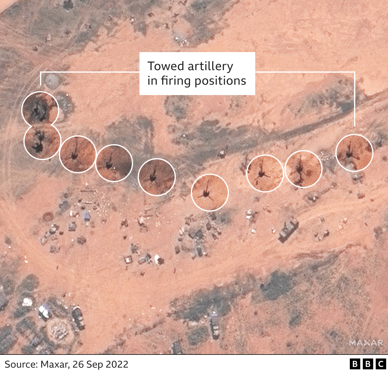
Less than a kilometre south of the hospital lies what Maxar, the company which released the images, identifies as "towed artillery in firing positions".
What the artillery is aimed at is unclear.

There has been no comment from the Eritrean or Ethiopian governments about their reported presence in Shiraro.
But last week, the US special envoy for the Horn of Africa told journalists that the US was concerned about Eritrean troops crossing into Ethiopia and that it "must stop".
"We've been tracking Eritrean troops movements across the border. The presence of Eritrean troops in Ethiopia only serves to complicate matters and to inflame an already tragic situation," Mike Hammer said.
Six kilometres (four miles) away from Shiraro, Maxar captured a long line of about 45 vehicles. They appear to include a number of buses and to be heading towards the town.
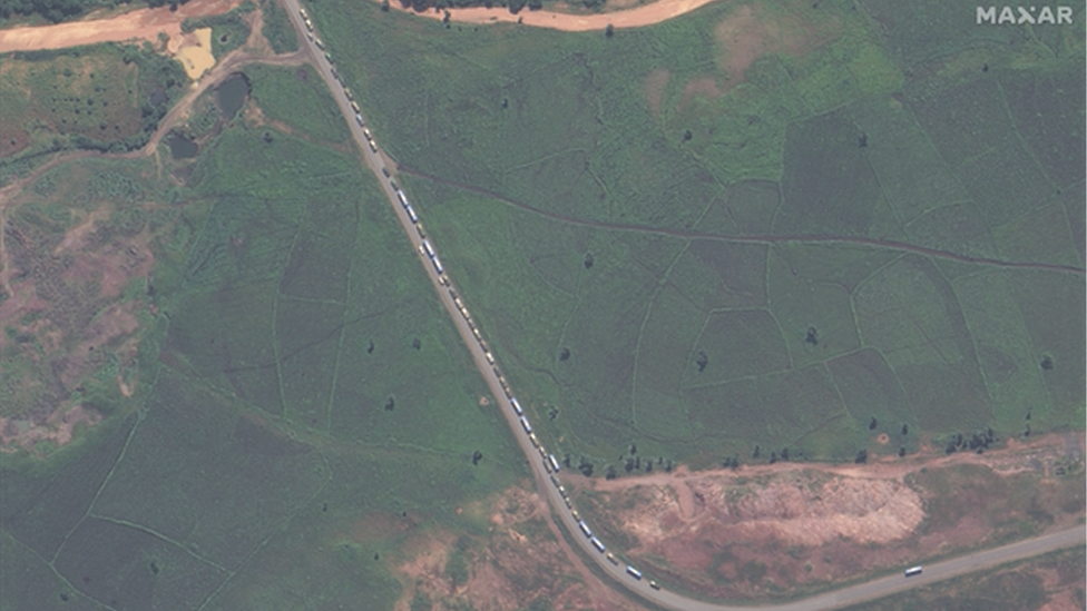
Five kilometres further down the road is another, smaller group of about 20 military vehicles and buses, also travelling towards Shiraro.
This is the Adi Goshu road which leads from Shiraro to western Tigray's biggest town, Humera, and then, ultimately, to Eritrea, which is about 180km (110 miles) away - about a three-hour drive.
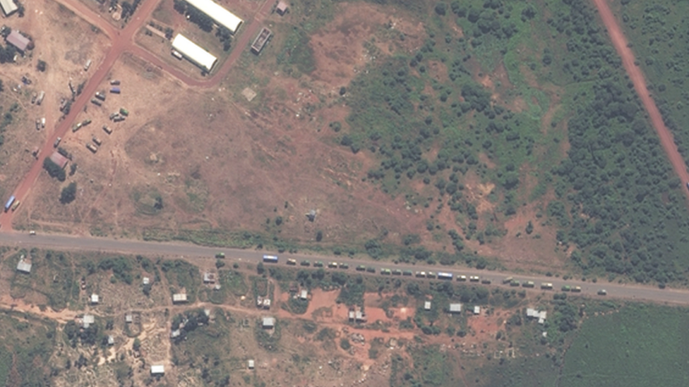
Western Tigray has been under the control of Ethiopian government forces and their allies since the start of the conflict at the end of 2020.
Here, in a position off the road near Shiraro, the satellite image indicates buses and vehicles of the same type seen in the previous image on Adi Goshu Road parked next to and between some buildings.
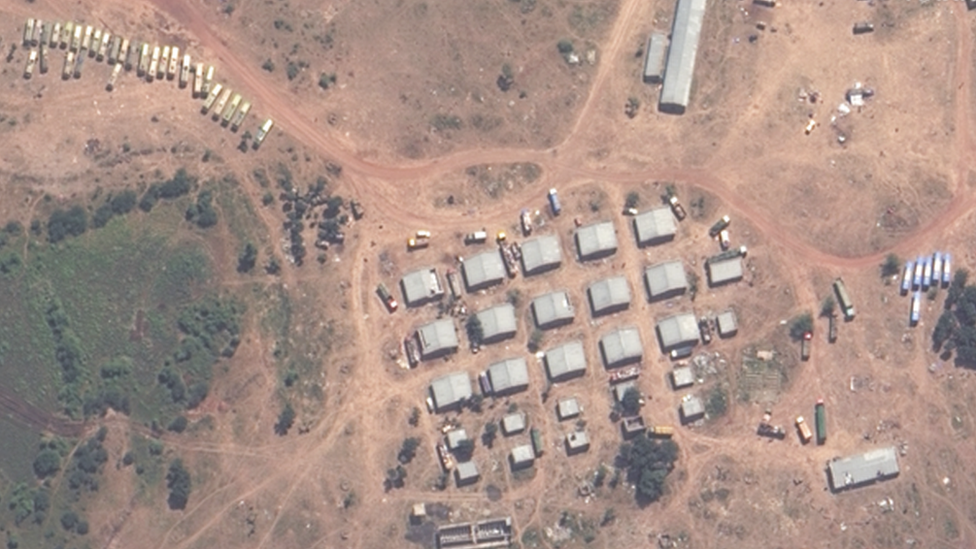
By the morning after these images were taken, satellite photos of the same position no longer show the vehicles - suggesting they had moved location.
This tallies with reports from people who have fled Shire that positions in town are shifting between opposing forces.
According to an internal document from the United Nations Office for the Coordination of Humanitarian Affairs seen by the BBC, at least 10 people had been killed by fighting in and around Shiraro by 14 September.
Like the senior aid worker, it says 210,000 people have fled the area, including 45,000 internally displaced people who had previously fled western Tigray.
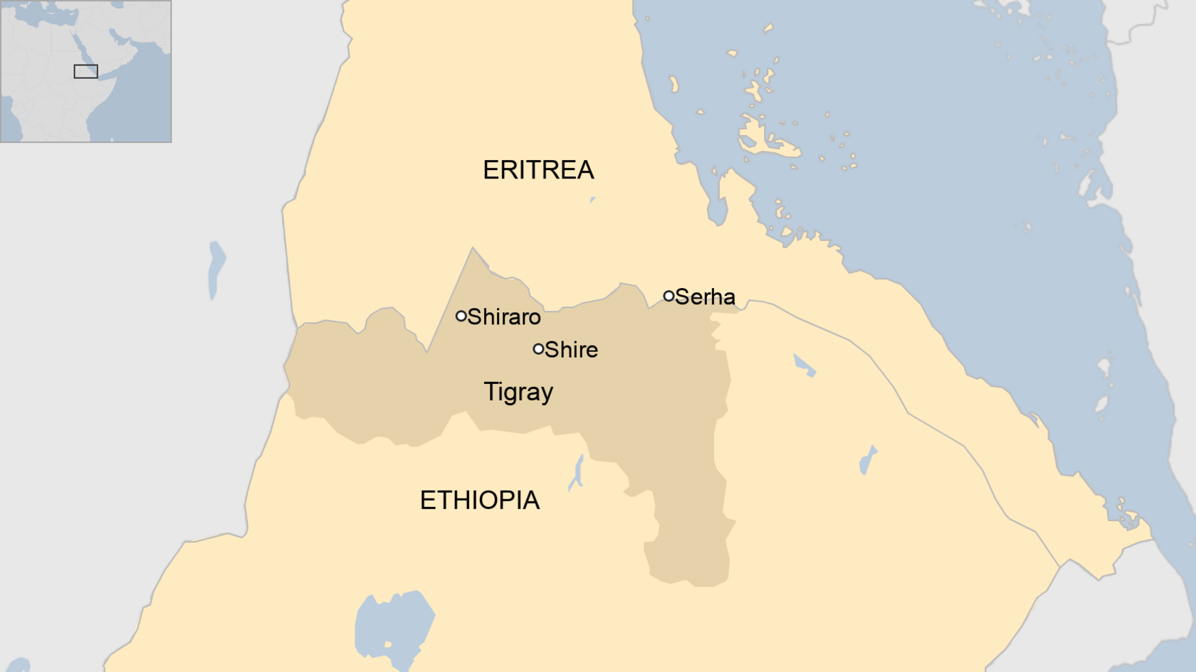
Maxar also released images taken on 19 September around the town of Serha, in Eritrea, which lies just one kilometre from Ethiopia, just across the border from the town of Zalambessa.
The day after these images were taken, the Tigray authorities said in a statement that Eritrea's President Isaias Afwerki had "mobilised Eritrea's entire army, and reservists and militia, launching massive offensives via Zalambessa", among other locations.
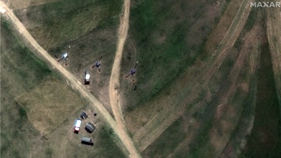
Maxar identified this as an M-46 field gun battery, positioned to the north of the town of Serha.
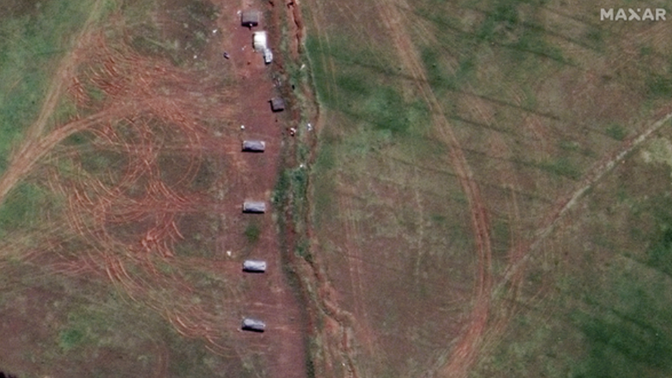
A little further south, next to a cemetery, Maxar identified this as an S21 SP howitzer battery. The tracks left in the ground as they took up their positions are clearly visible in the earth to the left of the image.
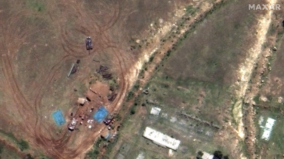
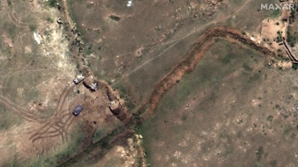
And much closer to the Ethiopian border, Maxar identified this as the main battle tank deployment. These positions are within one kilometre of the border - from here, you could walk to Ethiopia in about 15 minutes.
Images by Maxar Technologies Inc
Related topics
- Published16 September 2022
- Published1 September 2022
- Published11 October 2021

- Published11 June 2021
