In pictures: Disputed inter-Korean western maritime border
- Published

The disputed western maritime border between North and South Korea is one of the region's major flashpoints.

The Northern Limit Line (NLL) border was unilaterally drawn by the United Nations after the 1950-53 Korean War, as a line beyond which South Korean vessels were not to venture.

North Korea disputes the border, however, saying the Military Demarcation Line much further south should be the true border.

There have been periodic skirmishes in the seas between North and South Korea, where fishing rights are hotly contested.

Five islands lie just to the south of the South Korean side of the NLL, including Baengnyeong and Yeonpyeong. The islands are home to tiny communities of fishermen and farmers.

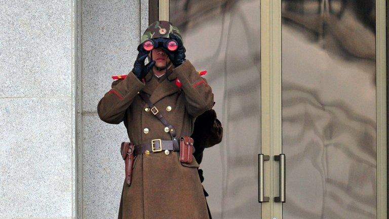
Though they may be defensively ill-sited, the islands provide South Korea with a useful balcony from which to spy on the North Korean coast.

In March 2010, the border issue ignited when a South Korean navy warship sank near Baengnyeong Island, killing 46 sailors. Seoul says Pyongyang torpedoed the ship, but North Korea denies involvement.

Eight months later, North Korean shelling of Yeonpyeong Island left four South Koreans dead - two civilians and two marines.

Following the attack, South Korea fortified its military presence on Yeonpyeong and other border islands.

In March 2014, cross-border firing forced residents of Baengnyeong Island into evacuation shelters. Seoul said it was responding to North Korean shelling - during a military exercise - which had fallen into South Korean territorial waters.
- Published25 November 2010
- Published31 March 2014