India floods: Unusual weather systems clash was trigger
- Published

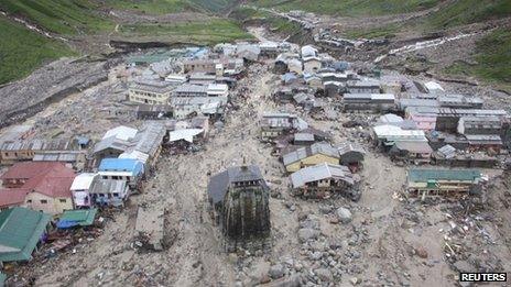
The floods have swept through a number of towns and villages in Uttarakhand
An unusually intensive fusion of two weather systems from opposite directions triggered this week's devastating floods in northern India and western Nepal, authorities have said.
They say the monsoon advancing towards the west of South Asia combined with westerly winds for an unusually long time and with an extraordinary intensity, which resulted in days of torrential rains.
Weather authorities in India and Pakistan have warned there is still a threat that the dangerous combination will cause more devastating floods.
At least 560 people are known to have been killed and thousands are missing in northern India. The death toll is expected to rise further.
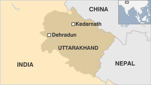
The worst-affected areas are in India's Uttarakhand state, where floods have flattened homes and swept away roads and bridges.
More than 40,000 people, many of them Hindu pilgrims, are still stranded in what the government has described as a "national crisis."
Single phenomenon?
"Such interaction (between the two weather systems) does happen at times during this season but the intensity this time and the duration is something we have not seen for quite some time," BP Yadav, director at the Indian Meteorological Department, told the BBC.
The interaction lasted three days he said, the first such event for many years.
In Pakistan, experts said the westerly weather system arrived unexpectedly and had covered almost all of the country.
Qamar Zaman Chaudry, former director general of Pakistan's Meteorological Department, said this was highly unusual at this time of the year - the first occasion in 26 years.
He said May and June normally represented the dry season in Pakistan, with monsoon rains from July to September.

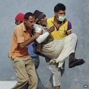
More than 33,000 have been rescued over the past several days
"The westerly weather system should be here only between October and April, but - quite bizarrely - we are seeing it at this time of the year and all over the country: from the Himalayan mountains to the coastal zones."
Mr Chaudry said the cause was unknown, adding: "It is difficult for us to link this single phenomenon to climate change."
But he added: "When we look at the abrupt changes in the climate and weather patterns in our country during the last 10 to 15 years, it becomes easy to link this to the changes taking place around the globe."
Bill Hare, visiting professor at the Potsdam Institute for Climate Impact Research, agreed that it was an intensive interaction between monsoon and westerly winds that resulted into the torrential rainfall.
"But the question is: is this intensity of interaction and resulting rainfall in any way linked to global warming?
"In this specific event, we simply don't know but what we do know with a high degree of confidence is that these kinds of events, as a general statement, will be occurring more often in the future and will be more damaging as the globe warms.
"I think that's a fairly solid analysis from the physical science community," Prof Hare said.
The Inter-Governmental Panel on Climate Change, in its fourth assessment report, says that it "is likely that warming associated with increasing greenhouse gas concentrations will cause an increase of Asian summer monsoon precipitation variability".

"Changes in the monsoon mean duration and strength depend on the details of the greenhouse gases emission scenario."
Debates continue on whether global warming has any role on the changing rainfall patterns around the world, but soot and urban smog pollution have also been blamed for disrupting the south Asian monsoon.
A report by the United Nations Environment Programme and the World Meteorological Organisation in 2011 said: "They disturb tropical rainfall and regional circulation patterns such as the Asian monsoon, affecting the livelihoods of millions of people.
"They can change wind patterns by affecting the regional temperature contrasts that drive the winds, influencing where rain and snow fall."
Experts, however, say not much is known about why westerly winds reach the South Asian region when they are not supposed to.
"That is still an area which is still pretty unclear scientifically," says Prof Hare.
"But anything that brings a lot of moisture into the region and interacts with the convective energy of the monsoon will probably contribute to more extreme rainfall events."
- Published22 June 2013
- Published21 June 2013
- Published20 June 2013
- Published17 June 2013