Why is India drilling deep into an earthquake hotspot?
- Published
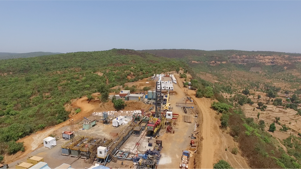
The deepest holes are being drilled on a table-top mountain in Maharashtra
In the windswept skein of mountains in India's Western Ghats, geologists are drilling some of Asia's deepest boreholes in an audacious attempt to unlock the mysteries of earthquakes.
The site is Gothane, a table-top 3,051ft (930m)-high mountain in the western state of Maharashtra, lashed by squally winds and ringed by looming wind farms and damp green forests populated by Asian antelopes, wild boars and deer.
More significantly, the place is barely 10km (6.2 miles) from Koyna, the site of a devastating 6.3 magnitude earthquake in 1967, five years after a big, hydropower dam was built in the region. The December quake killed 177 people, injured more than 2,000 others and caused widespread damage and destruction.
Mountains are ideal places to set up water reservoirs for generating electricity, but water pressure can build up in the pores of the Earth and stress the crust to danger levels. Quakes can also be triggered by mining, fracking (hydraulic fracturing to recover gas and oil from shale rock) or extracting water from under the ground.
Geologists believe there are more than 100 sites around the world where quakes have been triggered by filling of water reservoirs.
At Koyna, geologists say, earthquake activity began after the reservoir was filled with more than a trillion litres of water in 1962. Seismologist Harsh K Gupta says the Koyna region "is the best site anywhere in the world, external where an earthquake can be observed".
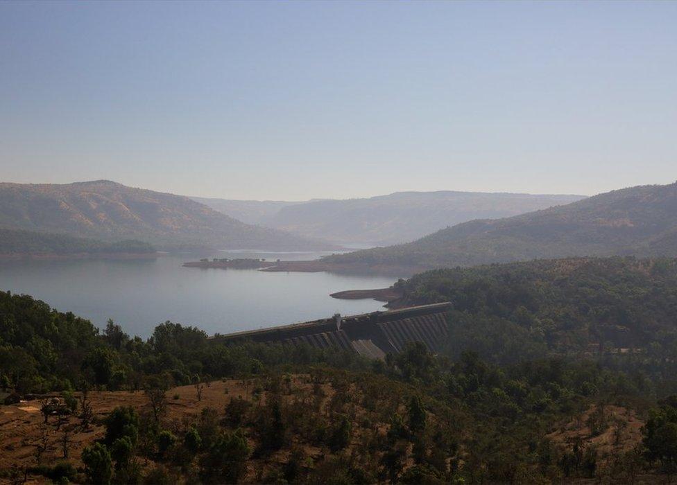
The quake at Koyna happened five years after the completion of a dam in the mountains
No wonder then that Koyna is one of the world's most persistent earthquake "hotspots". Between 1967 and 2017, the region has seen 22 quakes with magnitudes ranging from 5 to 5.9, and some 400 quakes greater than magnitude 4. There have also been several thousand recorded smaller quakes.
The depth at the epicentres have ranged from 2km to 10km. (The last recorded quake was of 3.8 magnitude on 3 June). These quakes have caused no recorded loss of life or property in the past decades.
That's not all. In 1987, another reservoir was built on the Warna river, some 20km from Koyna. Six years later, there was a 5 magnitude quake near the reservoir.
Most seismic instruments to measure quakes sit on the Earth's surface or in shallow boreholes. Scientists believe that by drilling deep into the Earth and placing instruments in the heart of a fault zone, they can monitor quake activity at very close quarters.
Scientists are digging deep into the earth for scientific research
Indian geologists were clearly inspired by an ambitious experiment by US scientists, external to drill directly into the San Andreas quake zone for a unique view of how earthquakes work. The crack in the Earth's surface, which runs through California, is one of the most studied faults on the planet.
So between 2012 and 2014, geologists drilled up to depths of 1.5km at nine places in the Koyna region to gather information on its geology. Last December, they began drilling the pilot borehole. This posed different challenges.
Braving inclement weather, scientists trekked up 4km (2.4 miles) from the nearest muddy, red earth road to the top of the barren, wind-whipped mountain. Trucks trundled up through the blinding mist carrying an imposing 90-tonne, 86ft-high drilling rig, steel drilling pipes, mud and cement tanks and other vital equipment. Tankers carried water every day for the 80-odd scientists and technicians who worked and stayed at the site because, ironically, there was little groundwater in the mountain.
Working 24/7 for six months on end, the drill dug deep into the Earth. When they finished in June, the rig had blasted its way through the hard rock and reached depths of 3km or nearly 10,000ft where temperatures hover around 80C (176F). After the monsoon rains end, the geologists plan to lower custom-made sensors - thermometers, seismometers and stress meters - down the borehole.
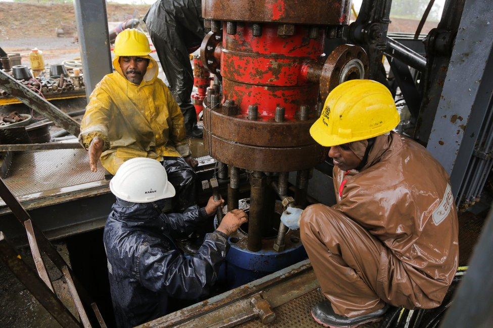
Drilling deep boreholes is a challenging and expensive exercise
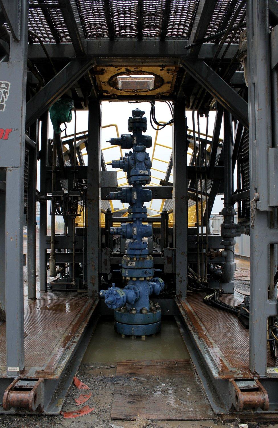
The deep borehole at Koyna has a diameter of an average effluent pipe
"Then we will have an observatory of depth to measure the changes in the physical, mechanical and chemical properties of rocks before, during, and after an earthquake. It is all very exciting," says geophysicist Dr Sukanta Roy, who is leading the project.
That's not the end.
If all goes well, next year geologists will drill deeper, reaching 5km or more than 15,000ft, in what will be India's deepest dig in hard rock. "That will be," says Dr Roy, "our main deep borehole observatory."
Drilling deep boreholes for scientific research is not uncommon.
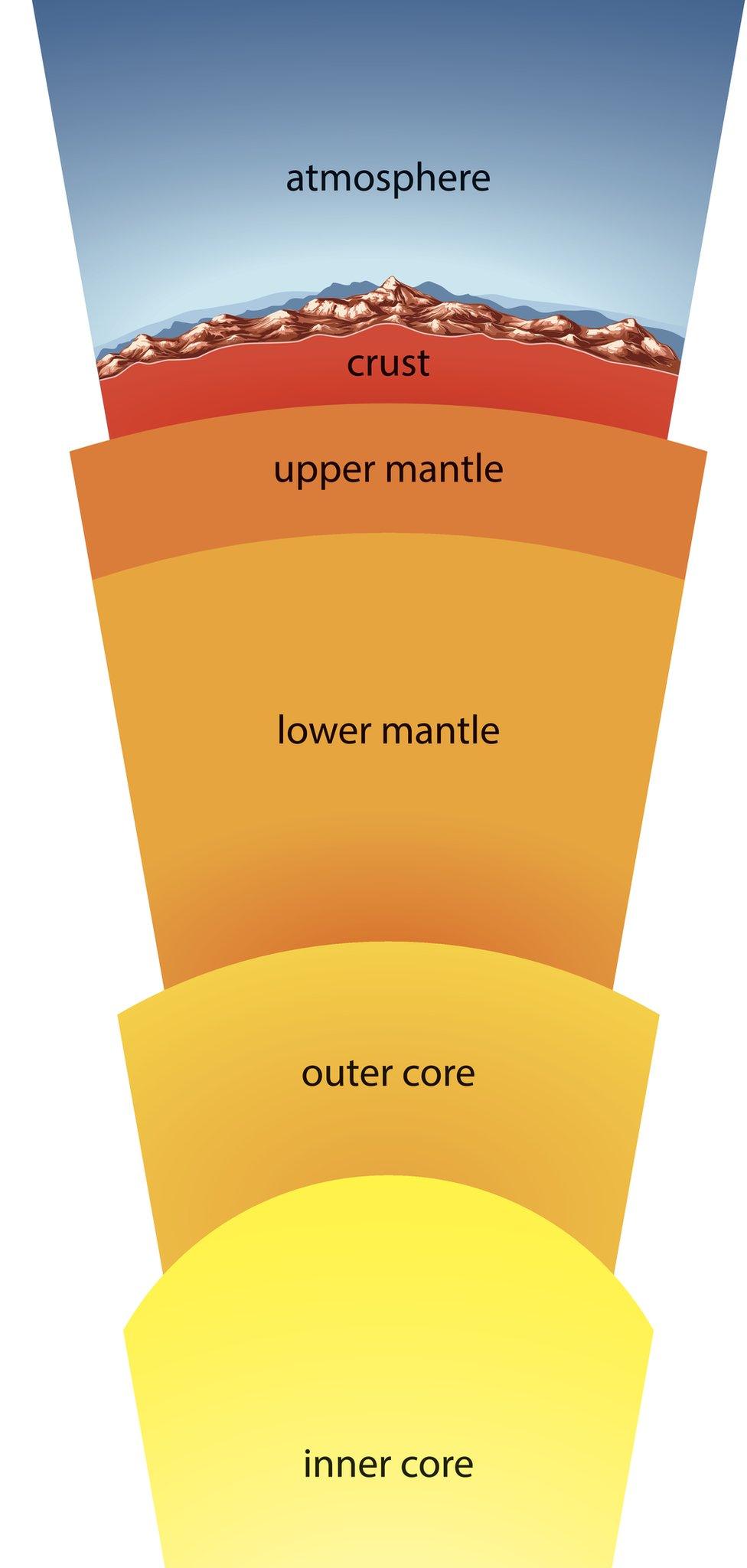
In Iceland, geologists have drilled into the heart of a volcano. Scientists have also embarked on a controversial initiative to drill into a supervolcano beneath the Gulf of Naples. In 1961, American scientists attempted to drill into the mantle, which makes up the bulk of the planet's volume and mass. The deepest scientists have managed to penetrate is 12km at the Kola Superdeep Borehole, external in Russia - a paltry 0.2% of the way to the centre of the Earth.
Critics of the Koyna project like Shyam Rai, a professor of earth sciences, wonder whether the deep borehole is worth its $73m (£56m) price tag. "The maximum intensity of quakes in Koyna is between 6 and 6.5 magnitude. It repeats itself once in several hundred years. The Himalayan region is prone to bigger quakes. Have we chosen the right place to drill?"
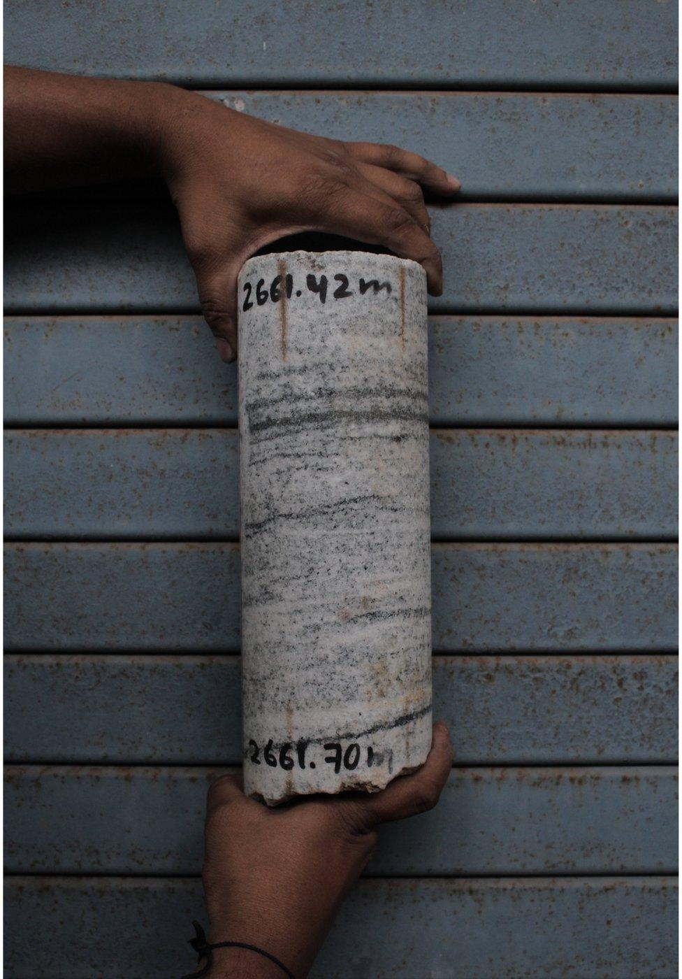
A sample of granite rock dating back to 2,500 million years has been taken out of the dig
Back at his laboratory in Karad, a sleepy, little town ringed by mountains and sugarcane farms, some 70km from the drill site, Dr Roy proudly shows me some rock samples that the dig has thrown up. Scientists from around the world have shown interest in the rocks: some want to look for rare bacteria; others want to examine whether they offer clues about an asteroid strike which wiped out dinosaurs.
There are chunks of milky white and salmon pink and dark green granite which date back to 2,500 million years. Some of the rocks are topped by dark basalt from the lava that spewed out of a volcano in the region much later.
"That was only 65 million years ago," says Dr Roy. "When our instruments go down the hole they will be observing what these rocks are up to."

Major Indian earthquakes
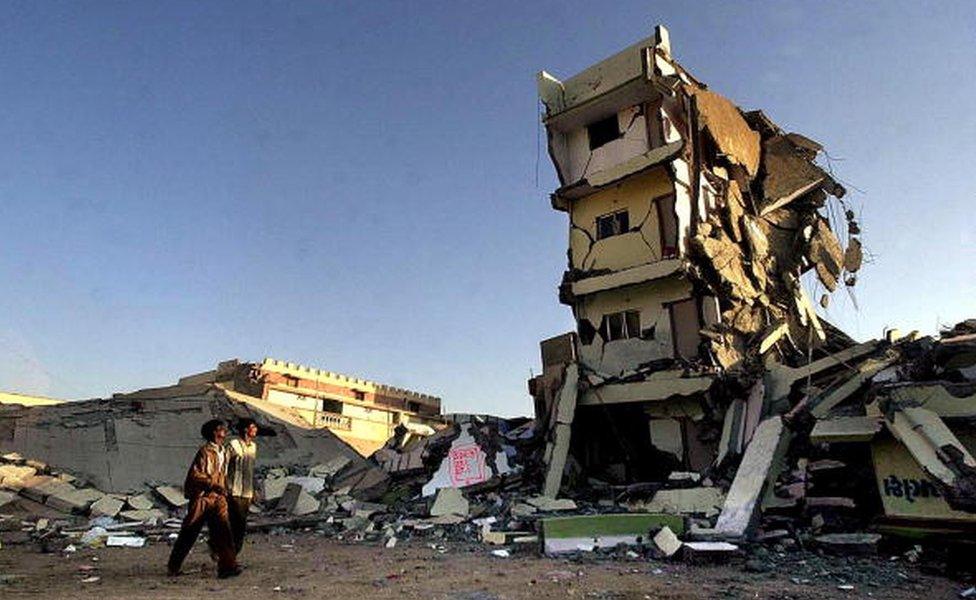
Nearly 20,000 people died in the Gujarat earthquake in 2001
26 January 2001: An earthquake measuring magnitude 7.9 devastated much of Gujarat state in north-western India, killing nearly 20,000 people and making more than a million homeless.
18 September 2011: More than 100 people were killed when a magnitude 6.9 quake struck the mountainous state of Sikkim in northeast India.
29 March 1999: Nearly 100 people died during after an earthquake measuring 6.8 on the Richter scale struck Chamoli in northern India.
30 September 1993: More than 10,000 people were killed when a magnitude 6.4 earthquake struck Maharashtra.
10 December 1967: 177 people died and more than 2,000 others were injured after a 6.3 magnitude earthquake struck Koyna in Maharashtra.
15 January 1934: More than 30,000 people died in a 8.1 magnitude earthquake that hit the eastern state of Bihar.

Photographs by Rakesh R Rao and Anushree Fadnavis