Entire Bailiwick's territorial waters quadruple
- Published

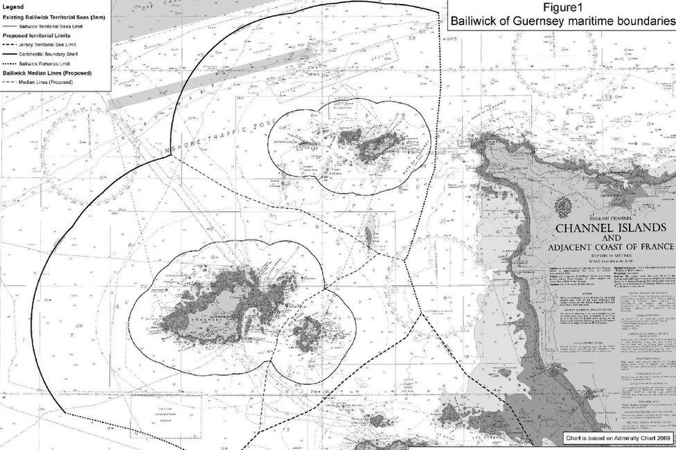
An approximate rendering of the change to the territorial waters
The three islands of the Bailiwick of Guernsey will see the size of their territorial seas quadrupled.
From 23 July, Guernsey, Alderney and Sark will control 12 nautical miles (nm) of sea, the maximum distance permissible by international law.
This means they have greater "control" of the area, including both legislative and law enforcement authority.
In particular, the change will increase the island's ability to "manage and conserve" their fish stocks.
A spokeswoman for the States said the extension would bring necessary "clarity" about the status of the seas in the context of the UK's intention to withdraw from European fishing rules, following its exit from the EU.
The extension is a "unilateral act" made for the Bailiwick by the UK in line with international law.
Deputy Al Brouard, a member of Guernsey's Policy & Resources Committee, said he was "delighted" with the result, arguing that would bring the island greater control "in line with international norms".
One nm equates to 1,852m or 6,076ft, meaning 12nm is approximately 13 miles or 22km.
The territorial limit would be smaller wherever the distance between the islands and another party - France or Jersey - is less than 24 nm.
- Published23 May 2015

- Published22 March 2013
