Gaza before and after: Satellite images show destruction
- Published

New satellite images of Gaza show the extent of the destruction caused by Israel's intense aerial bombardment of the territory - home to 2.2 million people - over the past three weeks.
The pictures, released by Maxar Technologies, compare detailed images captured from space earlier this week with images from before the recent conflict began.
They show three areas in the north of Gaza where aerial attacks have left dozens of tower blocks completely destroyed or badly damaged as well as large areas of tightly packed buildings reduced to piles of grey rubble.
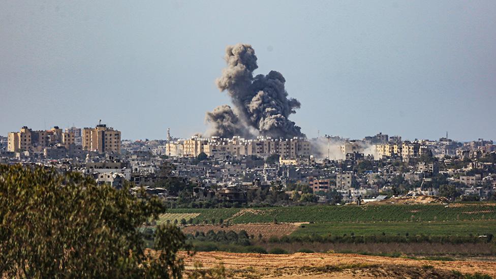
Beit Hanoun, a settlement in the north-eastern corner of Gaza that is just 2km (1.2 miles) away from the border with Israel, is one area shown to have been badly affected. The Israeli military have said the area is a hub for Hamas and it was one of the first areas where Israel warned residents to leave.

The area of Beit Hanoun shown below sits on the main road to the Erez border crossing. Several multi-storey buildings that were visible just over two weeks ago are now barely standing.

The Hamas-run housing ministry has estimated that about 45% of all the housing units in the territory have been either completely destroyed, rendered uninhabitable or damaged. An estimated 1.4 million people are internally displaced.
Thousands of Palestinians have fled their homes in the north of Gaza after being told by the Israeli military to leave for their own safety - but some have returned to the north because strikes are also being carried out in the south.

Smoke rises above Beit Hanoun after an Israeli aerial attack on the area on 21 October
Al Karama, shown below, sits on Gaza's northern coast on the Mediterranean sea. Areas just behind the main coastal road, where several hotels are located, have been hit by Israeli strikes.

In Atatra, which is about 3km (1.8 miles) south of the Israeli border, more than 20 high-rise blocks and several buildings have been badly damaged. A sports facility just south of the tower blocks, seen in the image below, was covered by grey ash from the attacks.


More on Israel-Gaza war
Follow live: Latest updates
Explained: What is happening in Israel and Gaza, and why now?
History behind the story: The Israel-Palestinian conflict
Bowen: Has the invasion begun?
- Published16 January
