Hurricane Sandy map and satellite images
- Published

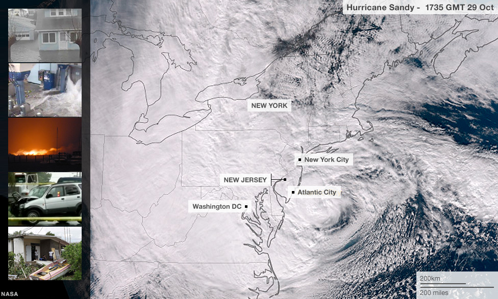
The Nasa satellite image below shows the extent of the Hurricane Sandy's storm clouds. Winds of up to 75mph (120km/h) were recorded. The storm is predicted to make landfall in New Jersey on Monday 29 October, somewhere between Philadelphia and New York City.
New York flooding

Sandy caused a record surge of seawater in New York City, flooding subway and road tunnels and leaving much of Lower Manhattan without power.
Queens fire destroys 50 homes

A fire has destroyed at least 50 homes in a flooded neighbourhood in the New York City borough of Queens.
Sandy batters the Bahamas

Schools, offices, airports and bridges close across the Bahamas as residents stocked up on supplies
Hundreds seek refuge in Jamaica

Hundreds of people took refuge in emergency shelters and schools and airports closed

Hurricane Sandy is huge and its winds could stretch across the eastern third of the US by Monday night, according to the National Hurricane Center. Here's what the storm would look like if its centre were over western Europe:
