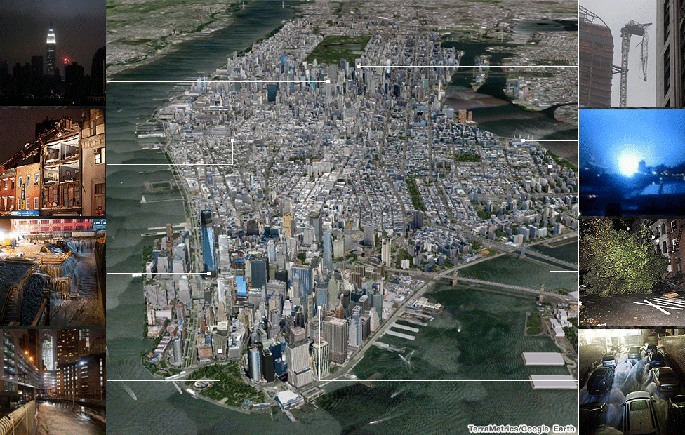
Sandy: New York devastation mapped
- Published
Super-storm Sandy has devastated parts of the US east coast, leading President Barack Obama to declare a "major disaster" in New York state.
New York, the country's most populous city, is among the worst-hit, with floodwaters swamping the subway system, flooding low-lying streets and wiping out power. Explore the map of New York below to see some of the worst of the damage.
Power cuts cause blackouts across city
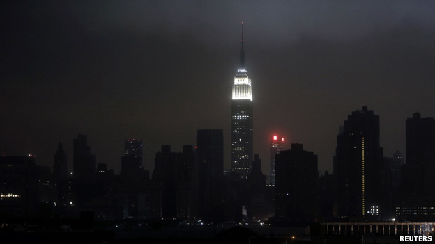
Much of Manhattan was plunged into darkness overnight following power cuts caused by the super-storm. The Empire State Building in Midtown Manhattan was one of the few to remain lit up.
Apartment building wall collapses
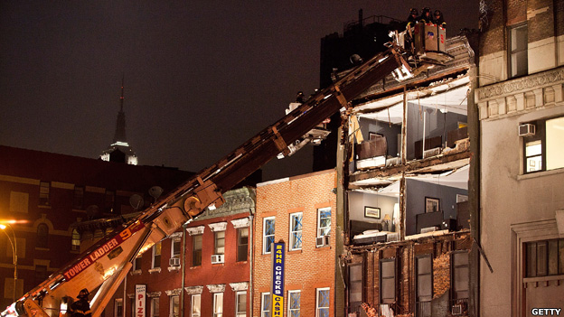
Fire fighters attended an apartment building where the storm ripped off the front wall. Part of the facade of a four-storey building in the West Village collapsed, leaving rooms exposed. No-one was injured.
Ground Zero building site flooded
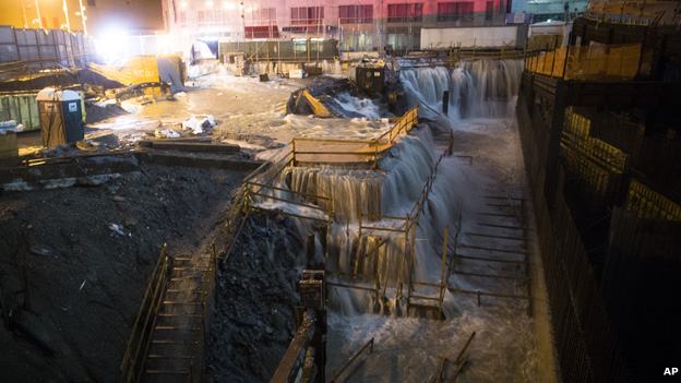
Neighbourhoods along the East and Hudson rivers in Manhattan were underwater. Low-lying streets in Battery Park and the construction site at Ground Zero, where the World Trade Center once stood, were particularly badly hit.
Battery Tunnel swamped
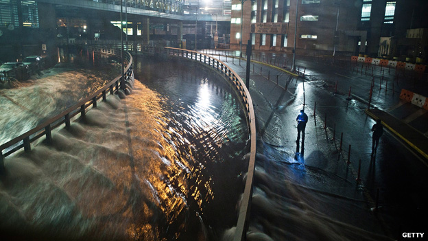
Battery Tunnel, which links Manhattan with Long Island, was inundated. 'Lower Manhattan is being covered by seawater,' Howard Glaser, director for the New York state government, told the BBC.
Crane bent double by storm
As strong winds from Sandy hit New York, a damaged crane was filmed dangling dangerously above the streets of the city, not far from Central Park.
Power sub-station explodes

The city's Consolidated Edison utility provider said an explosion at a sub-station, probably caused by flooding or flying debris, blacked out much of Lower Manhattan. The company said about 500,000 homes in Manhattan were without power.
Tree crashed to ground in storm
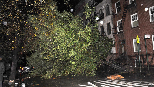
An uprooted tree blocked 7th Street near Avenue D in the East Village as a result of high winds from Sandy. Many of the deaths as a result of the storm were caused by falling trees.
Financial district hit by floods
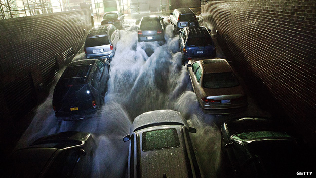
New York's financial district was badly affected, closing stock exchanges and curbing government bond trading. The New York Stock Exchange and the Nasdaq closed on Monday and remained shut on Tuesday. One underground car park was inundated with seawater.
Parts of New York City are designated hurricane evacuation zones - low-lying areas most at risk from flooding.
The most vulnerable areas are marked in blue on the map below. Most of the flooding from super-storm Sandy appears to be in these locations.
Areas of New York City most vulnerable to flooding
Super-storm Sandy hits NYC: the numbers
- 80mph (129km/h)
- Winds caused by storm
- 13.7ft (4.15m)
- Height of record tidal surge to hit Manhattan
- 375,000
- New Yorkers ordered to evacuate the city
- 600,000
- Households without power in and around the city
- $10bn-$20bn (£6.2bn-£12.4bn)
- Estimated cost of the storm
Before and after
See a selection of views below of parts of Manhattan and New York before and after the storm.
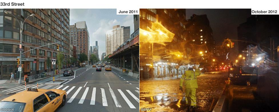
The storm waters reached 33rd St in a largely deserted Manhattan late on Monday night. An unprecedented 13 ft (3.9m) surge of seawater - 3 ft (90 cm) above the previous record - submerged parts of lower Manhattan.
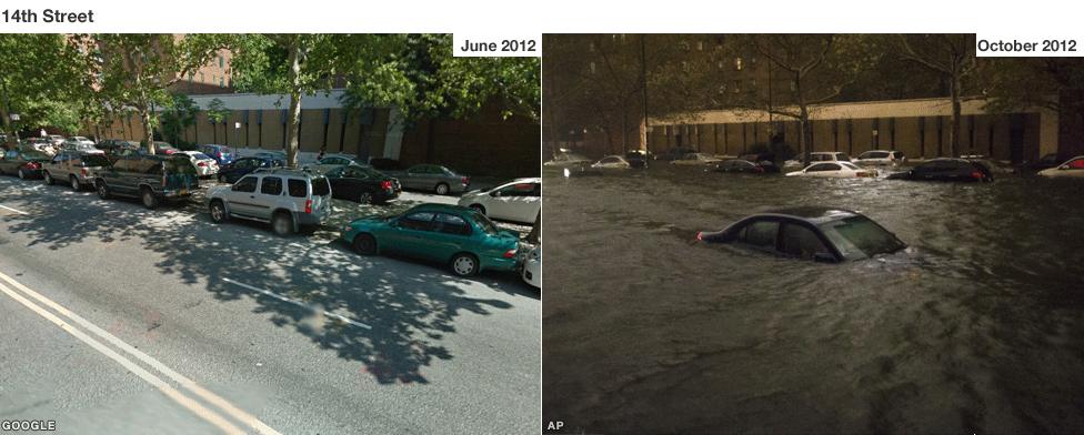
Flood water surged up 14th Street on Manhattan's east side as the storm hit New York. The storm has left the city's public transport crippled and 600,000 people in the New York area without power.
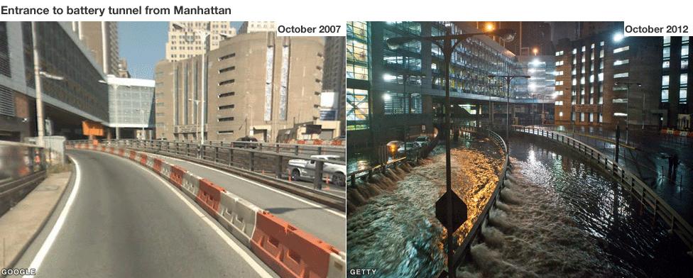
Heavy flooding in Battery Park on the tip of Manhattan led to water gushing into the Brooklyn-Battery Tunnel. In advance of the storm New York Governor Andrew Cuomo closed all New York City bus, subway and commuter rail services.
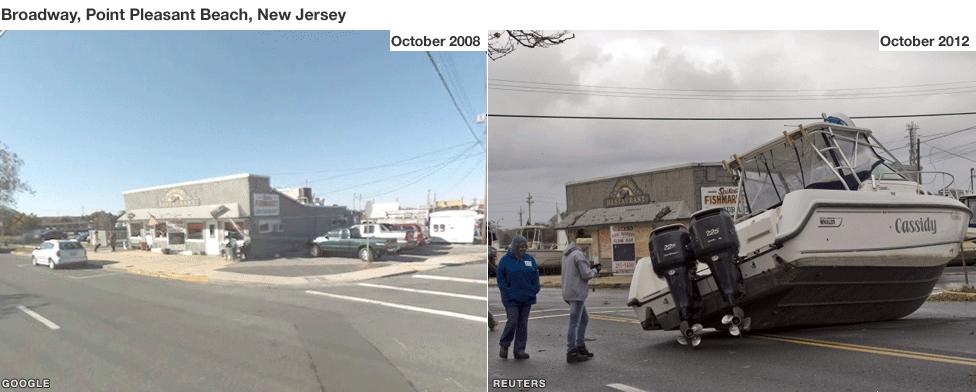
Residents photograph a boat resting on Broadway Avenue as they inspect damage from Hurricane Sandy in Point Pleasant Beach, New Jersey
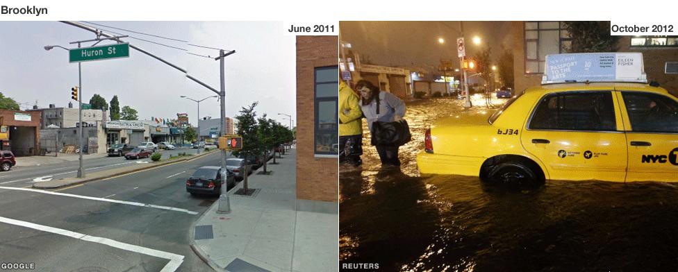
Pedestrians walk past a submerged taxi in Brooklyn which was badly affected by the widespread flooding caused by Storm Sandy.
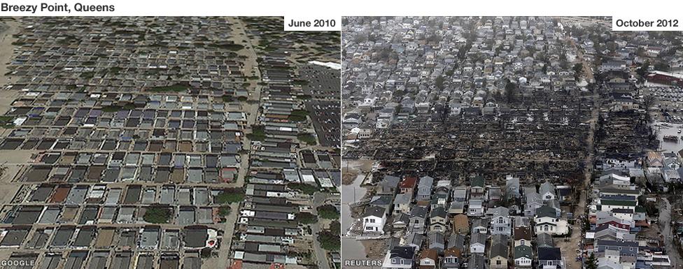
More than 100 homes were burnt to the ground in the borough of Queens. "We expected a flood and we got a fire," said Bill Valentine, a member of the Rockaway Point Fire Department.
