California fires: What happens when fire clouds form above wildfires?
- Published

Fires have been raging across large parts of the western US
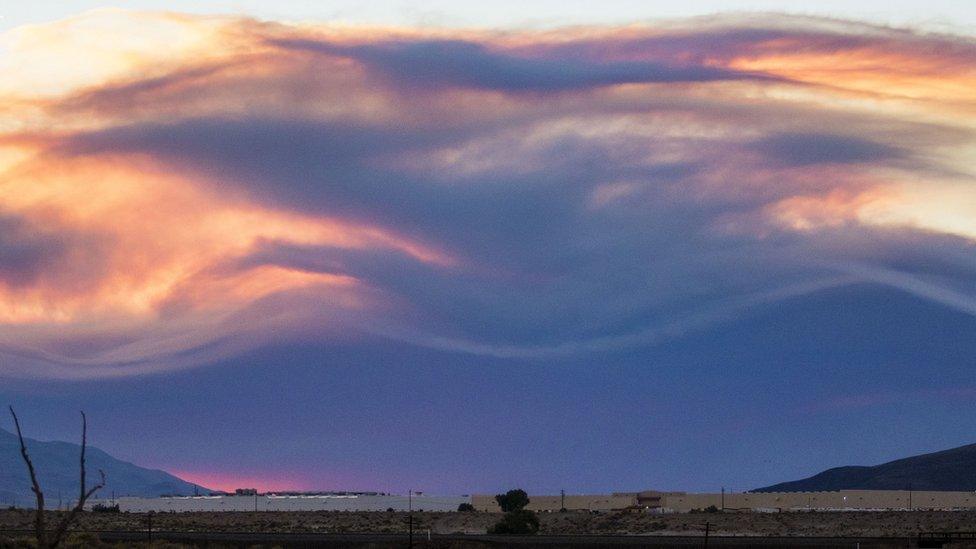
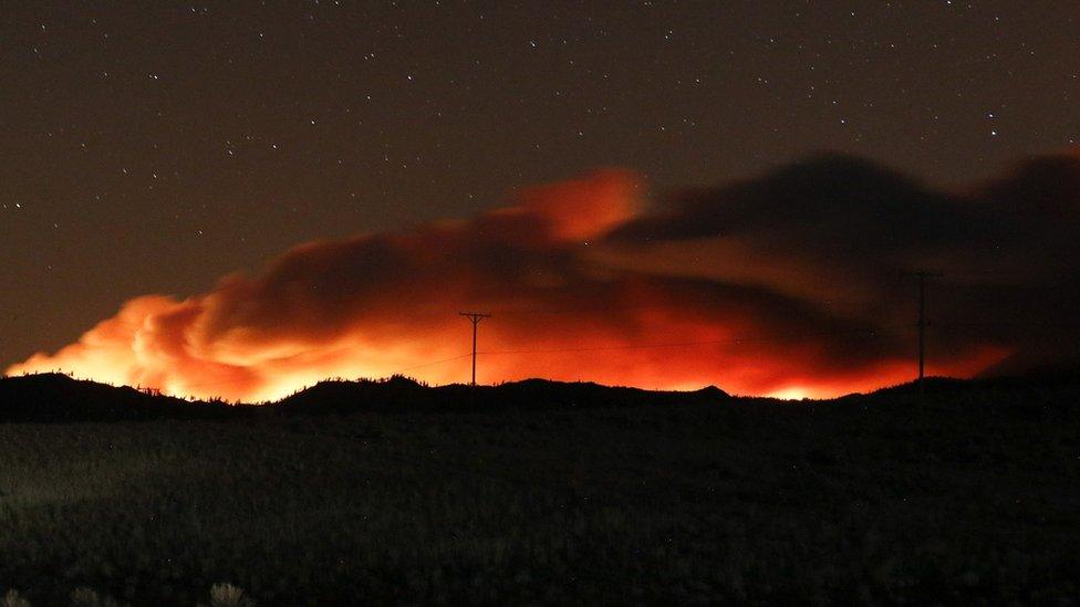
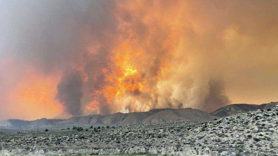
As fires rage across large parts of the western United States, a unique kind of large storm cloud has been forming in the skies above. Firefighters and scientists are reporting huge, smoky clouds towering a mile (1.6km) rising over the blaze in California and surrounding states.
These pyrocumulonimbus clouds - dubbed "fire clouds" - can produce hurricanes and lightning, which can generate even more fires.
These are giant, fast-moving blazes so powerful they create their own weather systems akin to thunderstorms.
And due to their ferocity, they are largely impossible to fight.
Why do fire clouds form?
With certain ground and atmospheric conditions, wildfires can rip through a large area with so much energy that they generate a pyrocumulonimbus, or "fire storm cloud".
Nasa calls pyrocumulonimbus "the fire-breathing dragon of clouds", because they funnel smoke like a chimney into the Earth's atmosphere, while hurling thunderbolts, wind and rain.

Pyrocumulonimbus clouds tend to form when the fire is at its hottest
Ordinarily, wildfires are driven along by the wind but a massive blaze can carry so much power that its smoke is not pushed to the side. Instead, it forms a plume that rises up to 15km (nine miles) into the sky.
Because the plume contains heat and moisture, when it hits the stratosphere it can condense and form clouds.
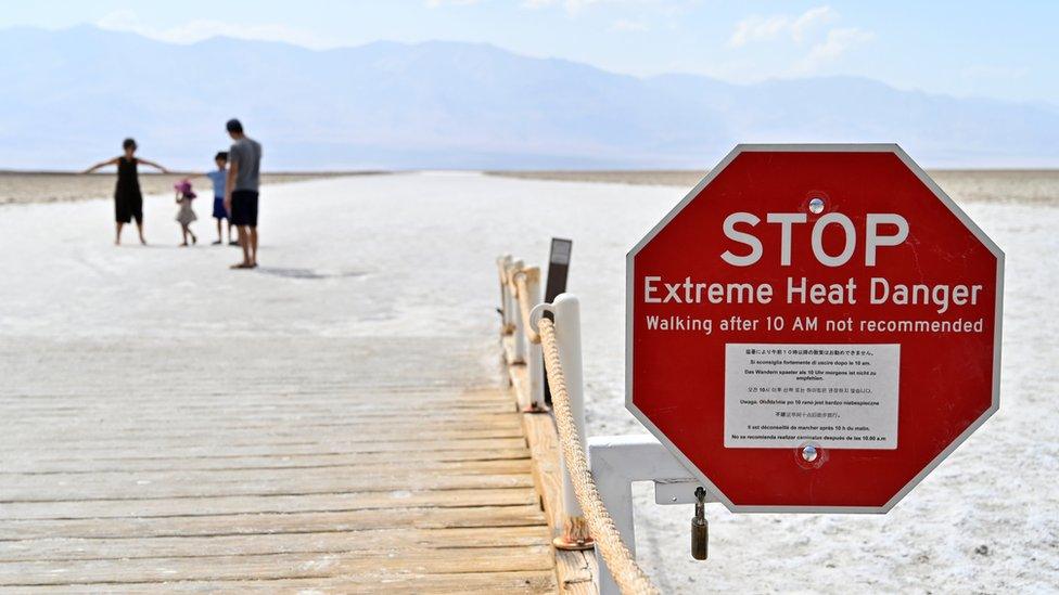
Pyrocumulonimbus clouds tend to form in the afternoon when the fire is at its hottest. On Friday, Death Valley National Park in California recorded a staggering high of 54.4C (130F) - smashing the record as the hottest temperature recorded there since 1913.
What can they do?
When they form above fires, pyrocumulonimbus clouds can make the blaze spread even faster. Sometimes they can also create their own lightning, which can spark more fires. But in some cases, they can also cause rain.
When the weather cools into the evening, the clouds can pose a danger as they fall to the ground.
"Later in the afternoon, that cloud will collapse and create a downdraft of heavy smoke, embers, things like that, and it can actually create additional fire behaviour," Lisa Cox, information officer for the western California fires told the Los Angeles Times, external.
That can fling sparks miles ahead of the main fire, while the smoke reduces visibility, grounding firefighting aircraft, she said.
On Friday afternoon, strikes along the eastern side of the fire, produced by a pyrocumulonimbus cloud, were recorded by the National Weather Service in Reno, Nevada.
Allow X content?
This article contains content provided by X. We ask for your permission before anything is loaded, as they may be using cookies and other technologies. You may want to read X’s cookie policy, external and privacy policy, external before accepting. To view this content choose ‘accept and continue’.
Can you fight such fires?
"It is very difficult to tackle such extreme fires", said Martin Wooster, Professor of Earth Observation at King's College London.
"Air attack (water bombing) is the method which is usually attempted, but fighting such fires effectively often needs a change in the weather that is driving such extreme fire activity," he told the BBC.
In California, the erratic behaviour and extreme heat of such fires, bolstered by the fire clouds, has made it dangerous for fire crews in California to fight them directly.
"It's too dangerous, at least during the day," Ms Cox told the Los Angeles Times. "At night they can try to get around spot fires that form. It just really depends."
Are they becoming more common?
According to Yale360, there are an average of 25 fire clouds in western North America each year.
But Mr Wooster said that while there appears to be more reports of fire clouds, global fire activity overall has decreased since 2000. Although before that, it had been increasing for several decades.
He said what feels like an increase could be a result of people taking more notice and better data from ground-based radar and satellites.
"In some well publicised areas, fire activity seems perhaps to be getting more extreme," he said.
Mr Wooster added that factors driving these changes include the different ways humans are now using and managing land, for example in places like the Amazon.
Extreme heat builds again in North America
However climate change is very likely also having effects in some areas, Mr Wooster said.
In parts of Australia and North America "satellite data suggests that fire activity seems to have become more extreme over recent decades".
"This may be related to climate change and more extreme fires can lead to more of these types of fire cloud," Mr Wooster said.
Scientists have predicted that climate change is likely to increase the chances of such events.
Related topics
- Published12 July 2021

- Published19 August 2020
