Canada wildfires: North America air quality alerts in maps and images
- Published
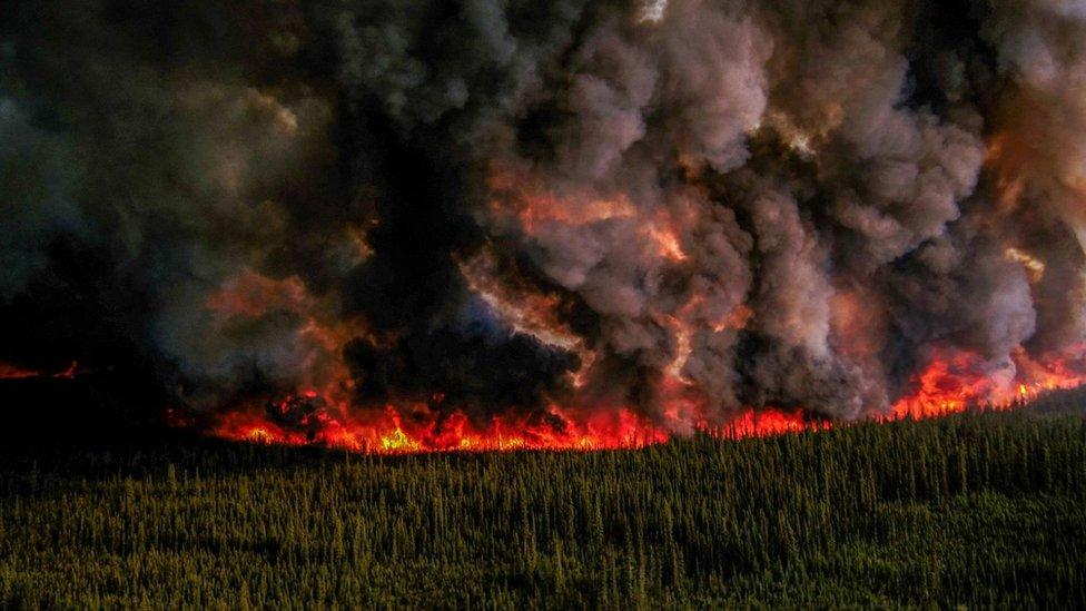
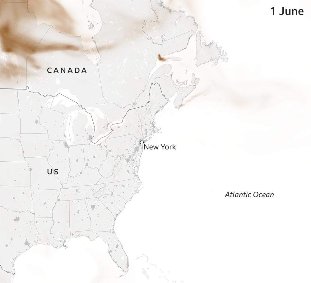
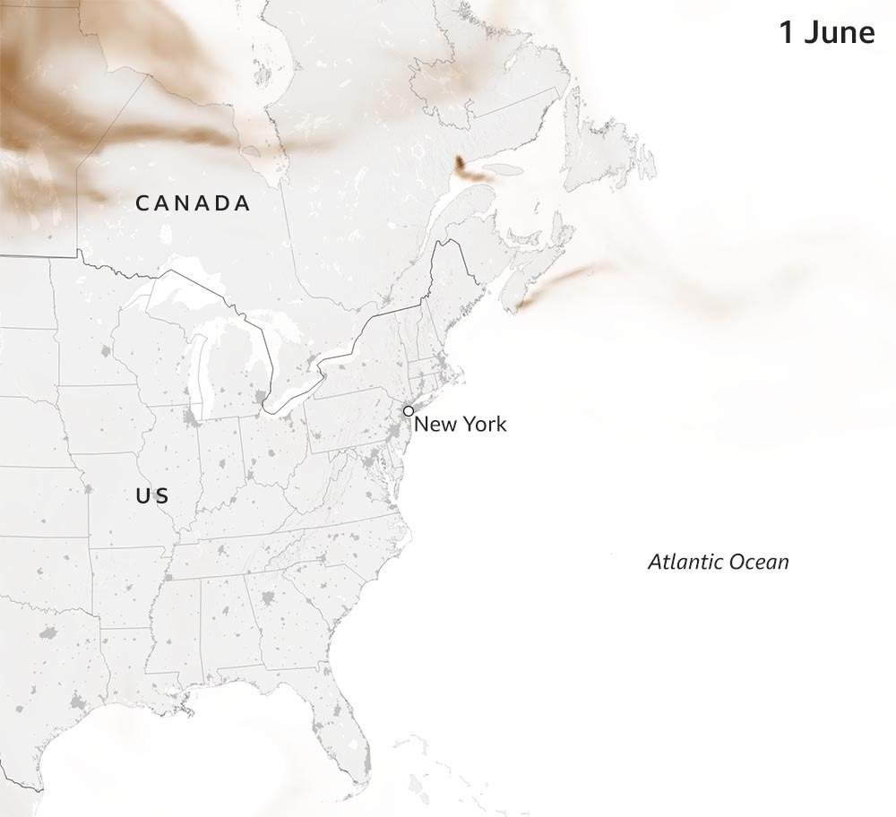
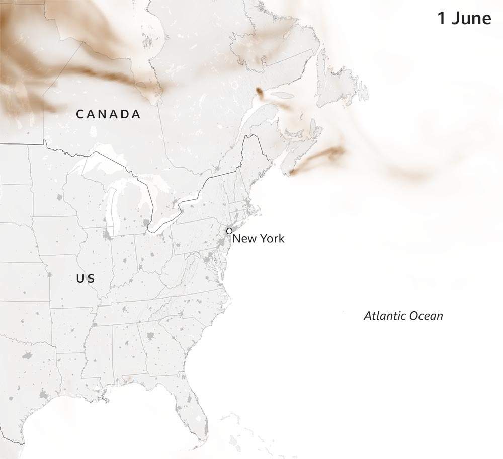
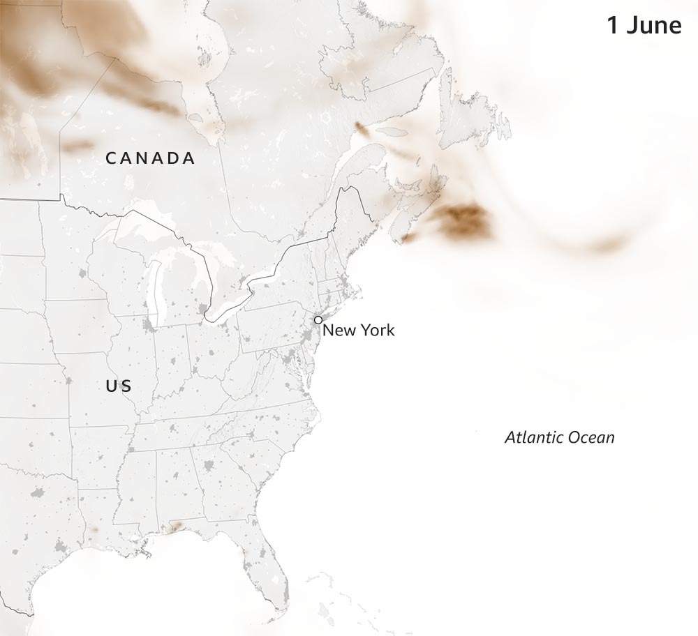
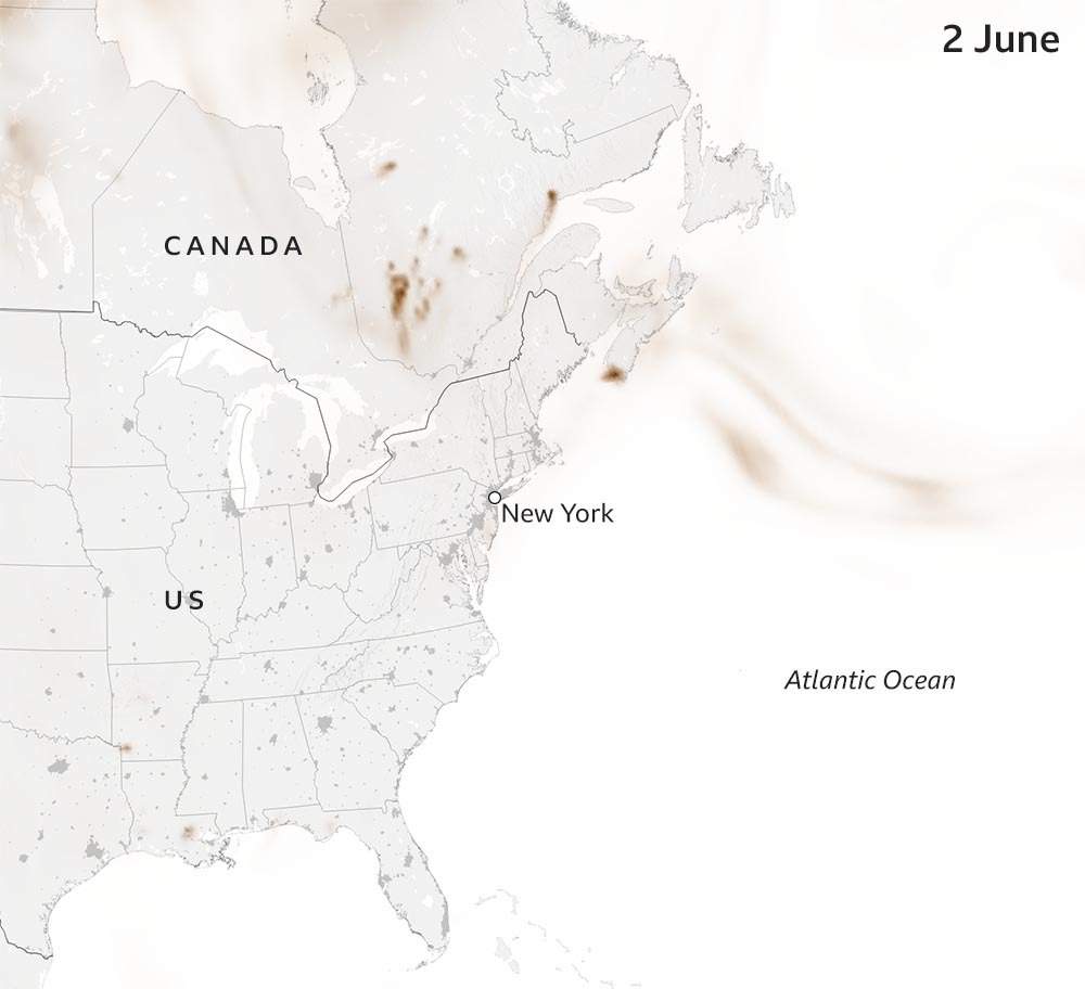
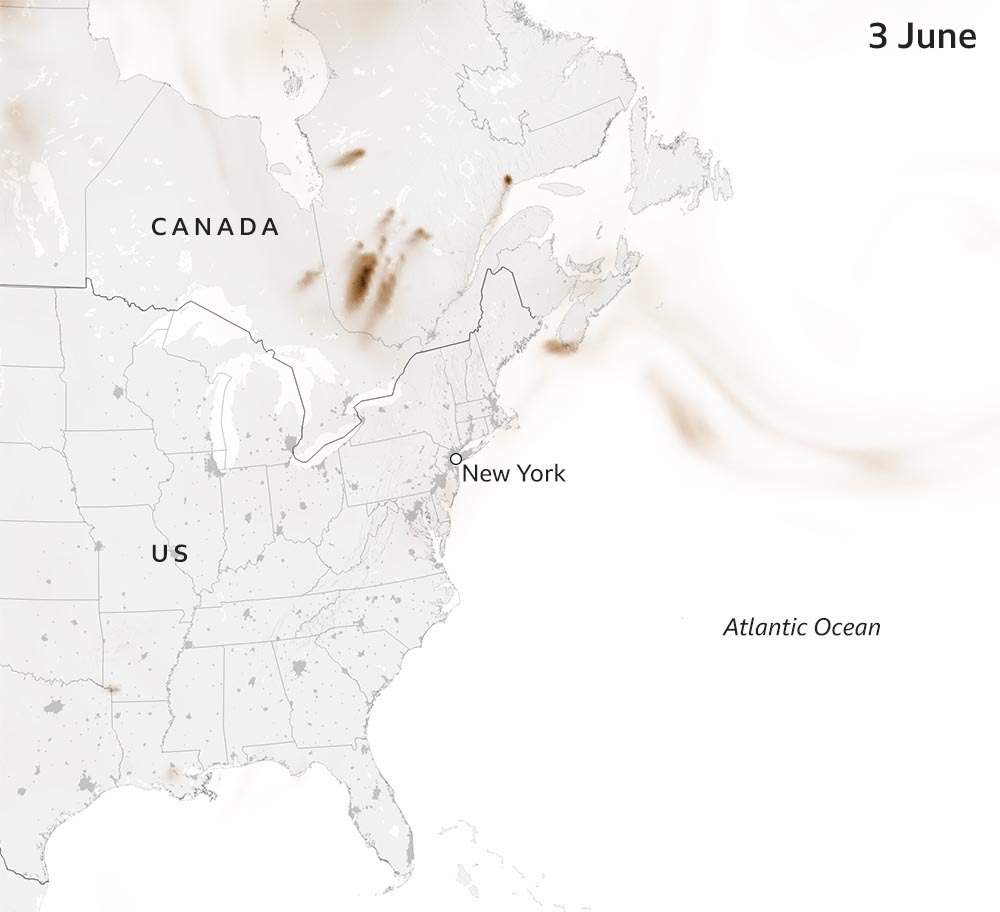
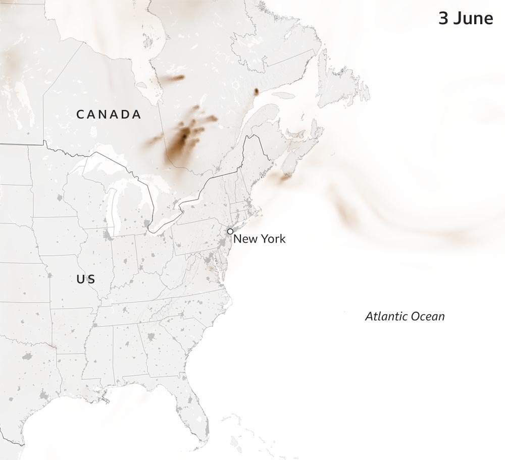
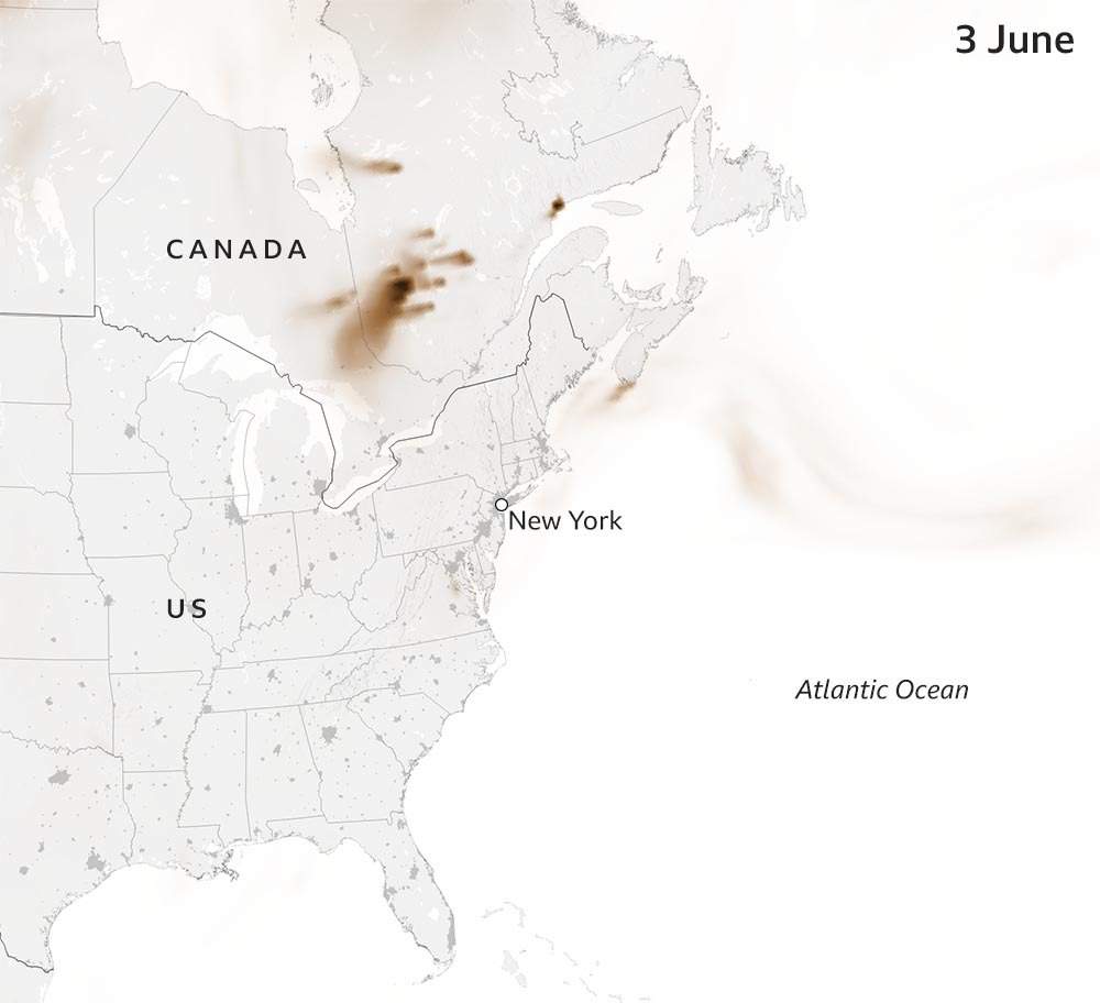
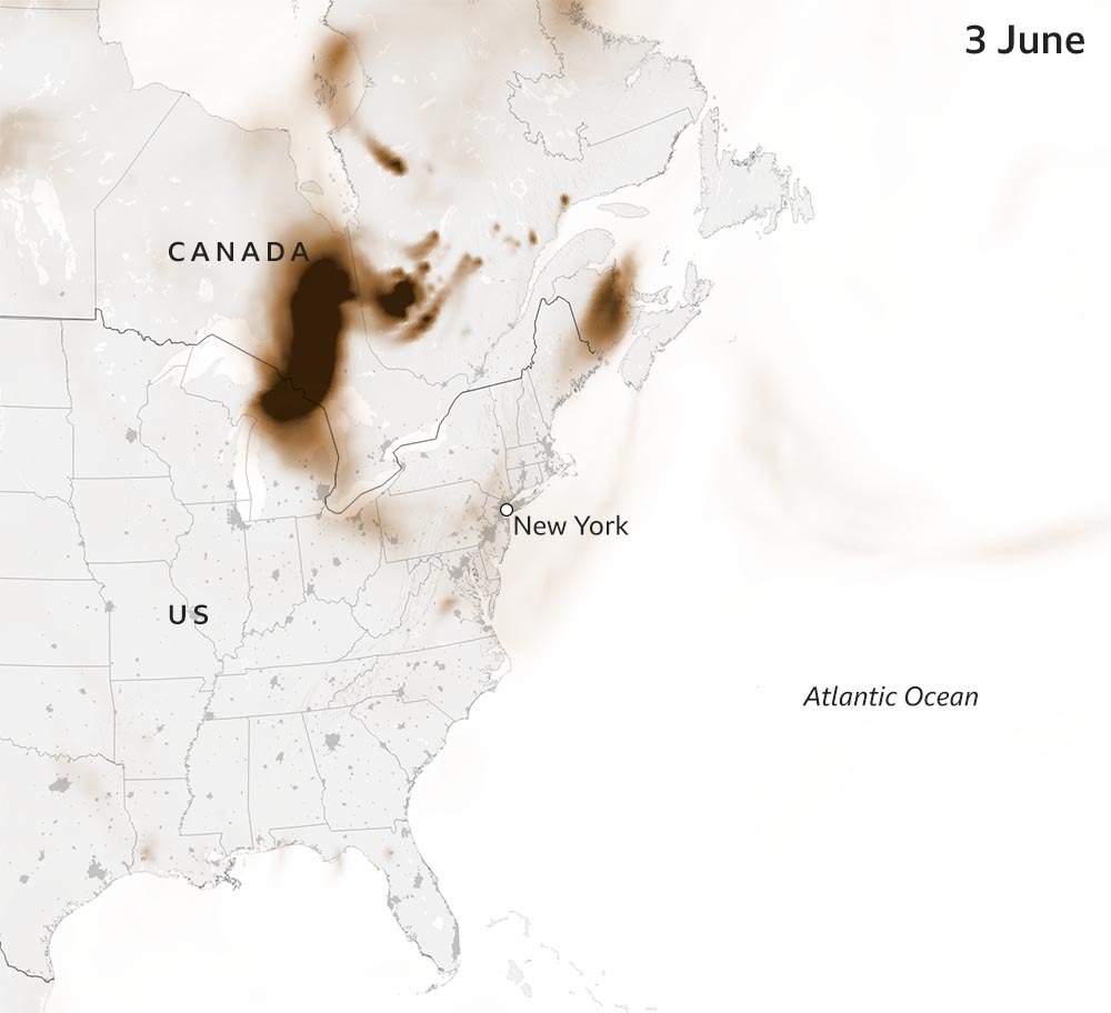
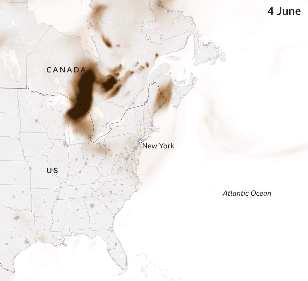
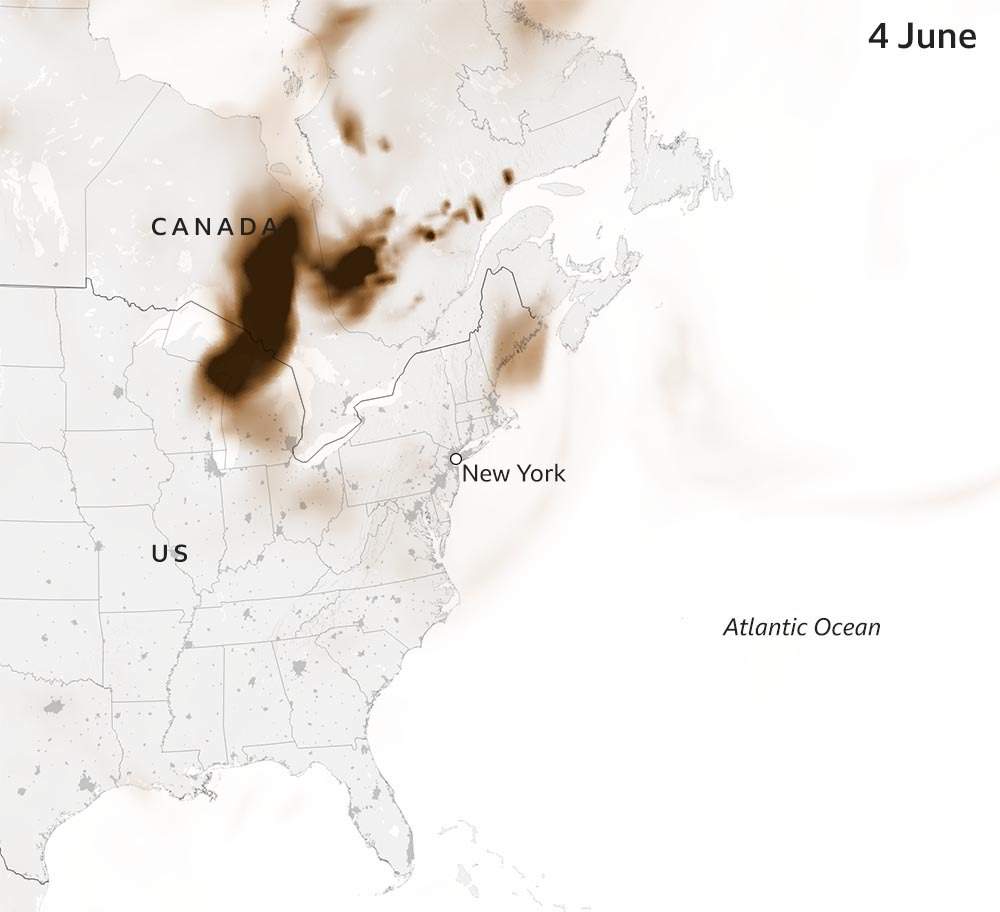
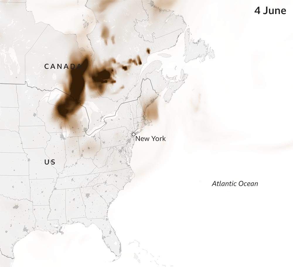
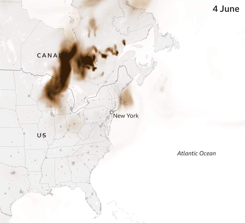
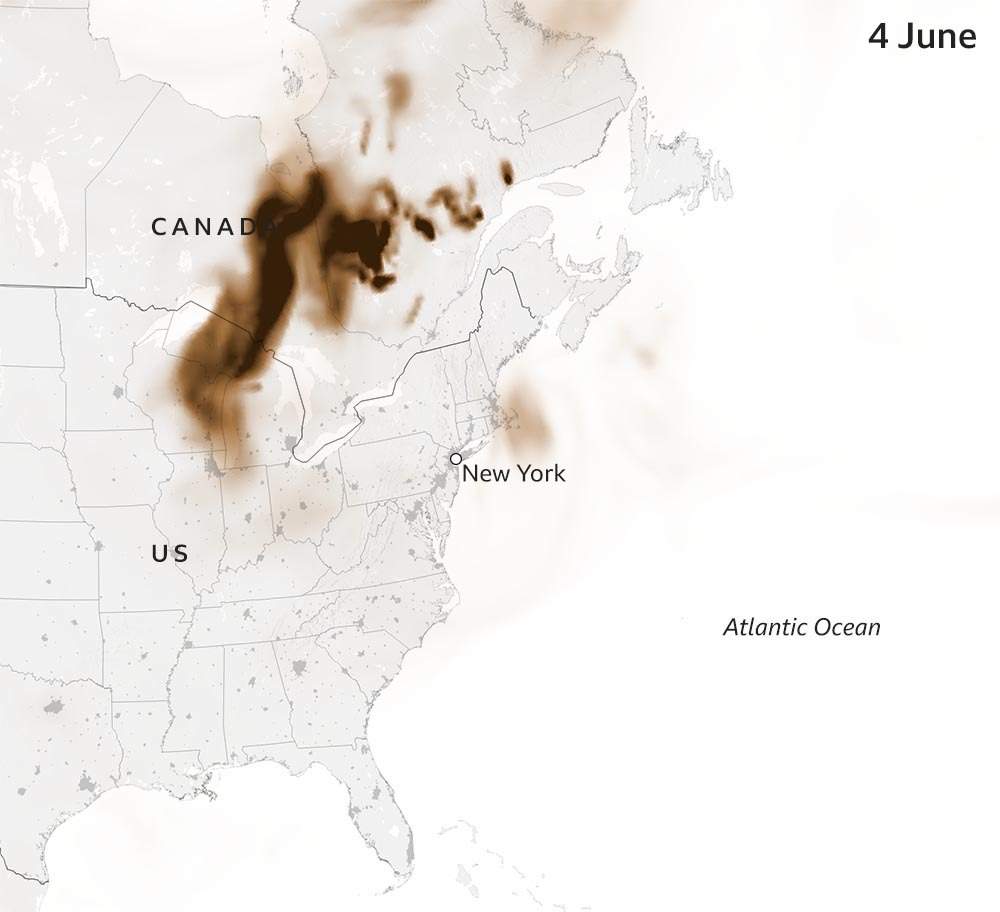
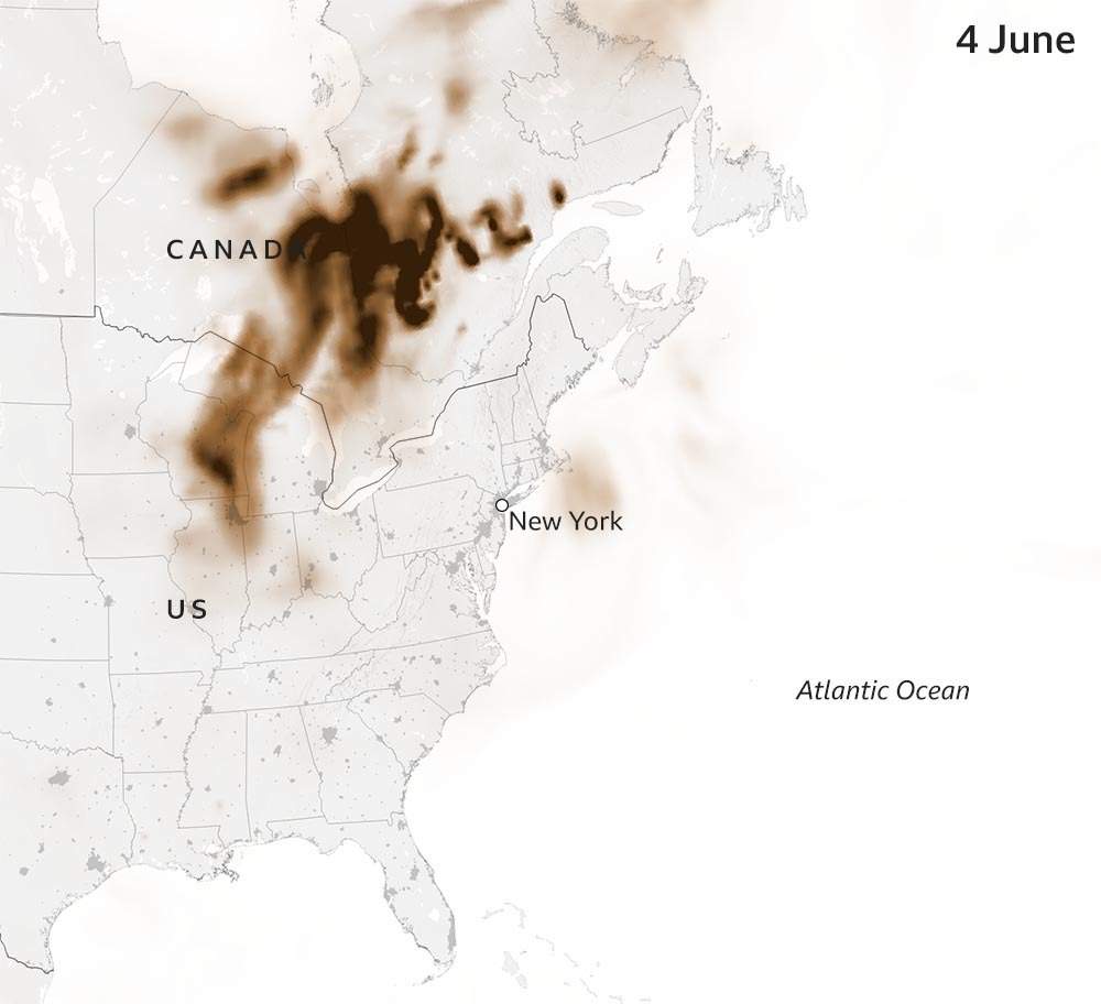
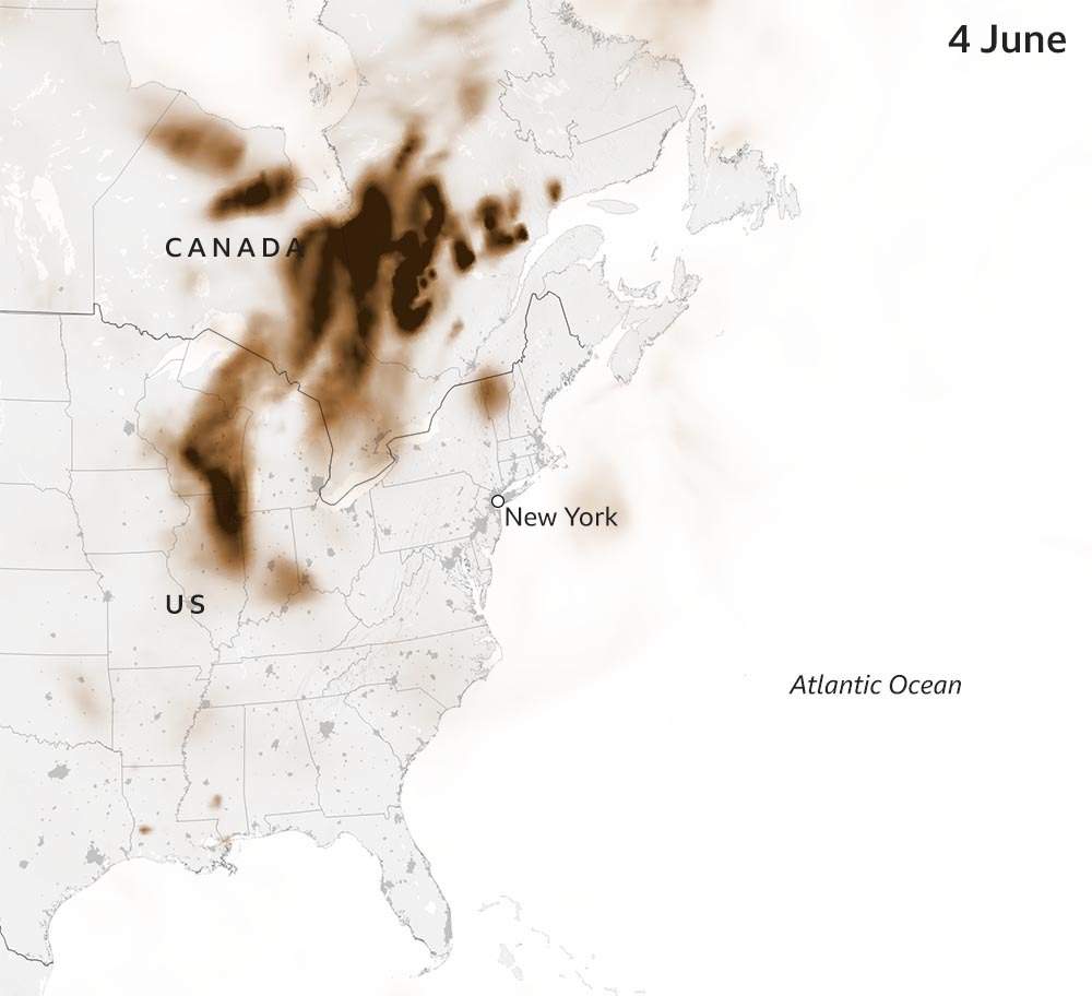
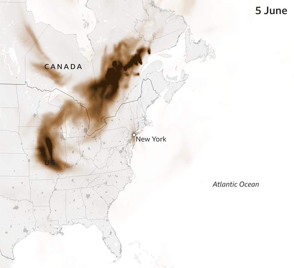
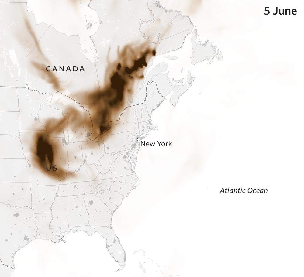
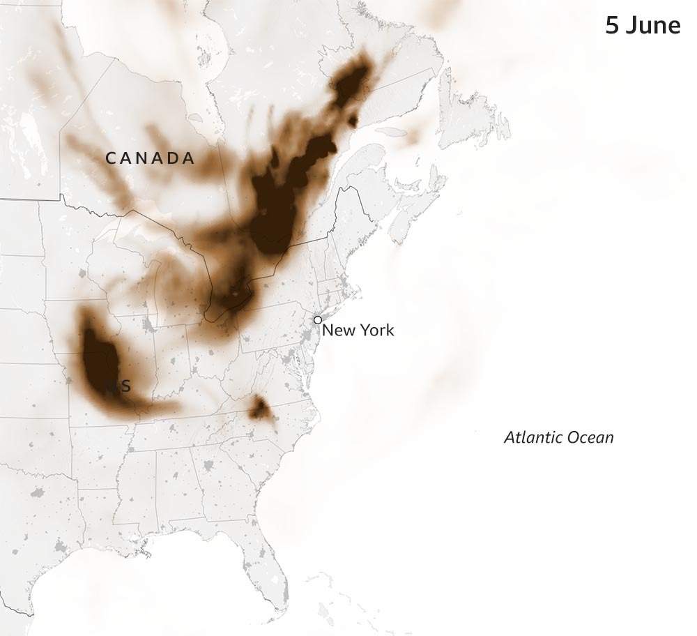
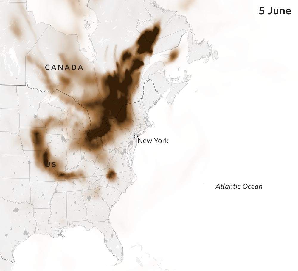
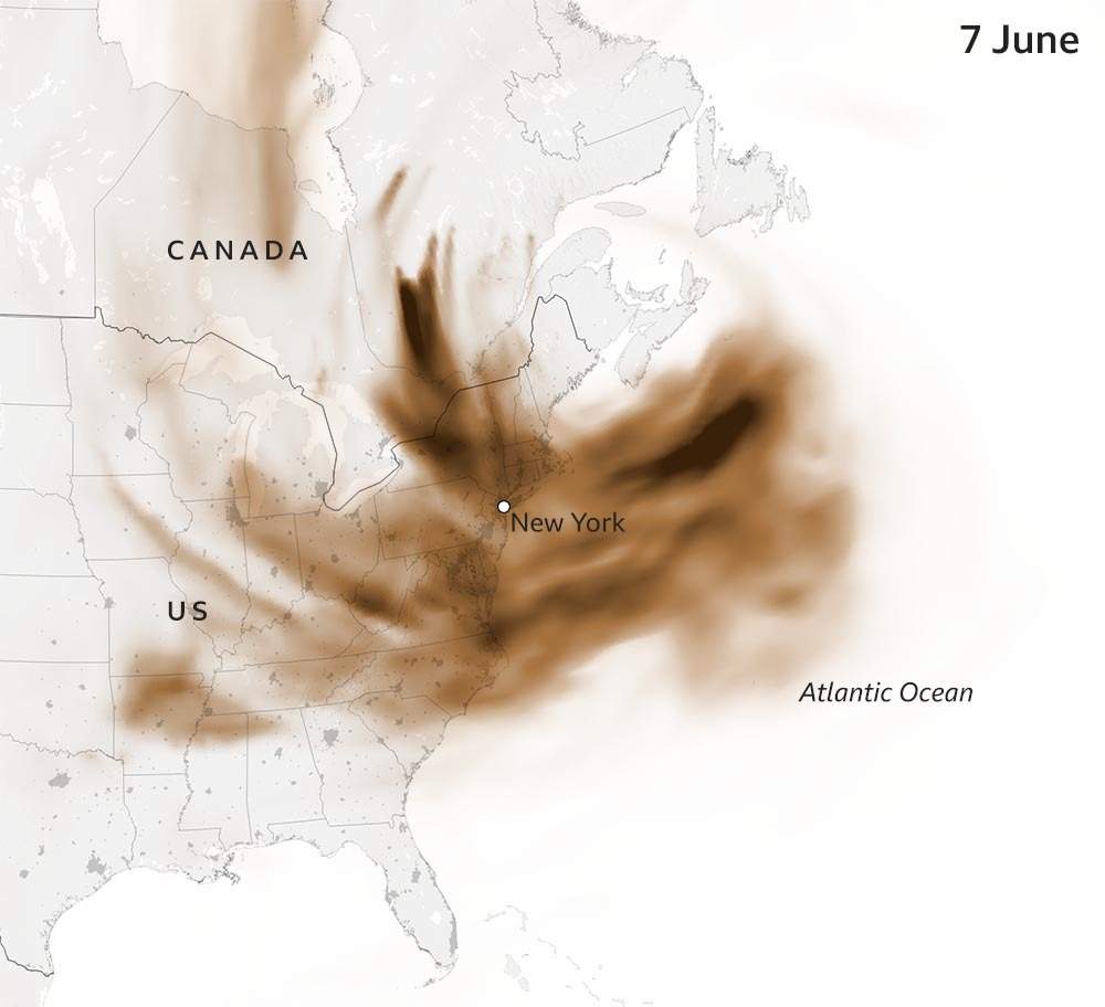
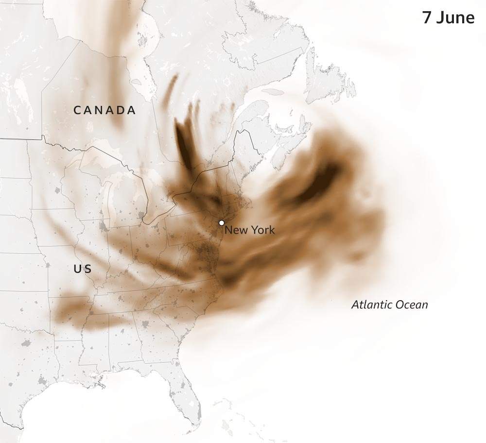
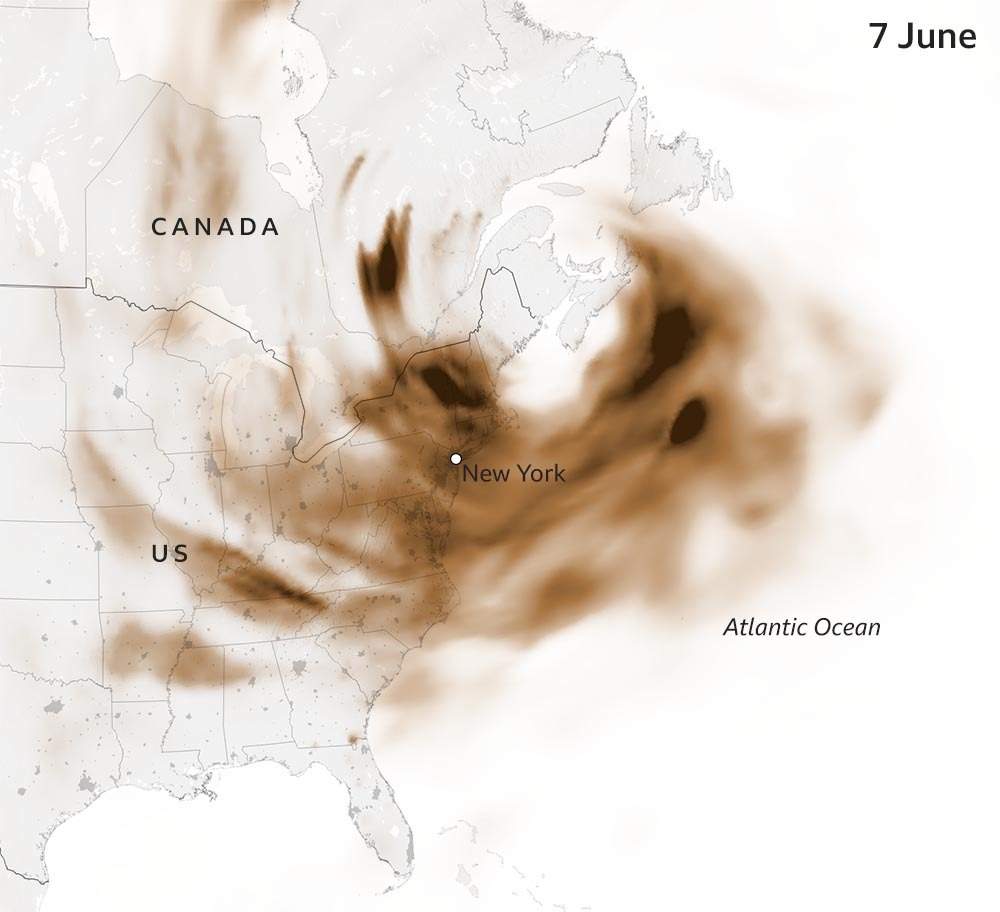
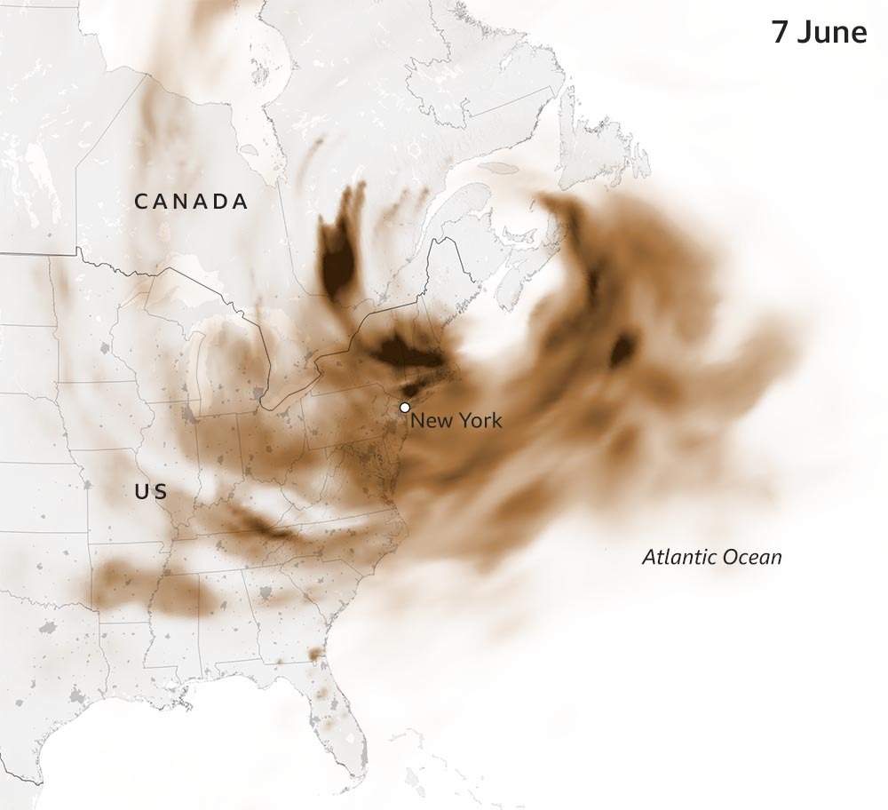
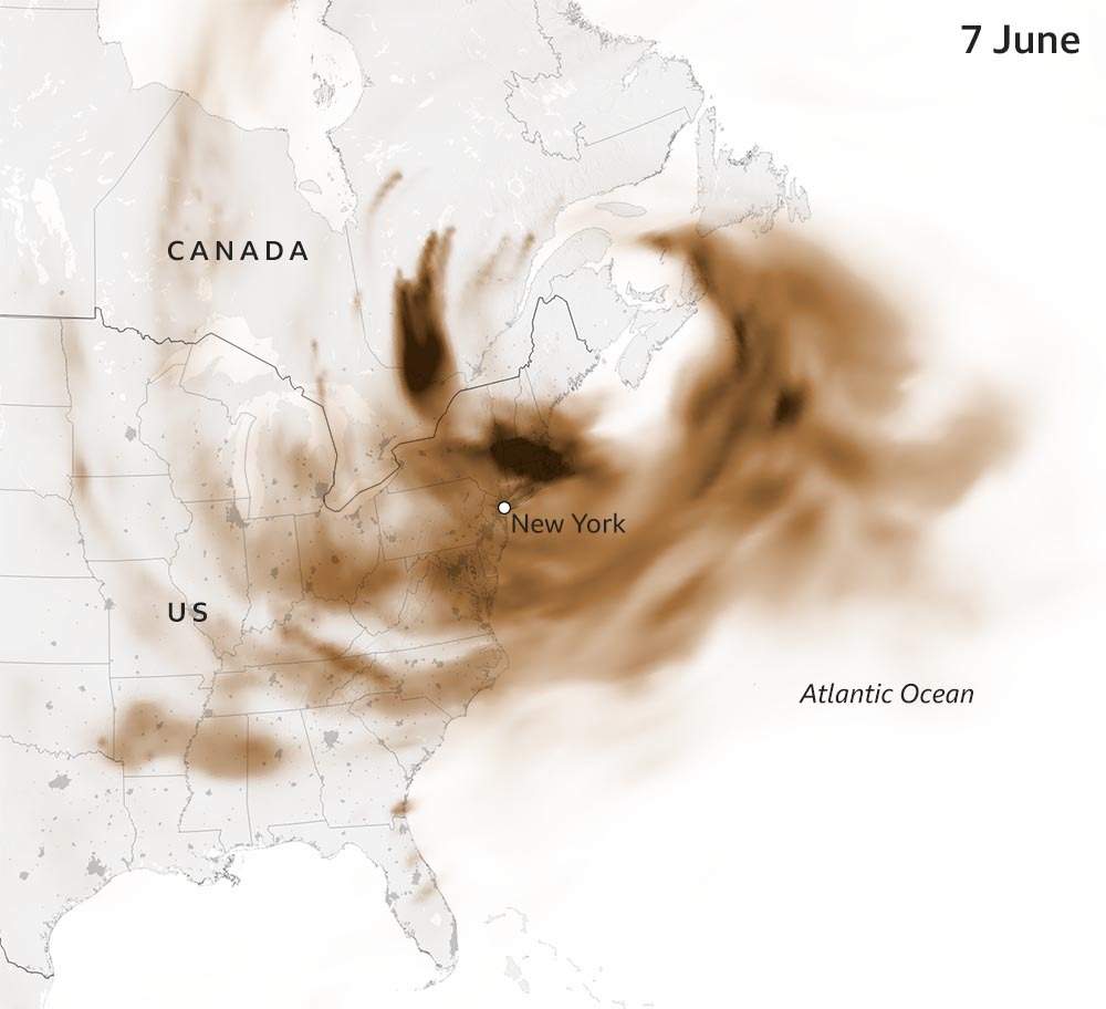
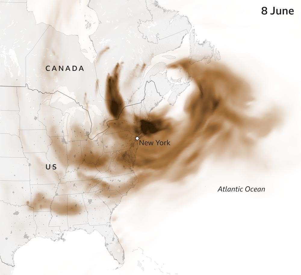
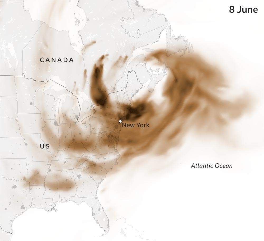
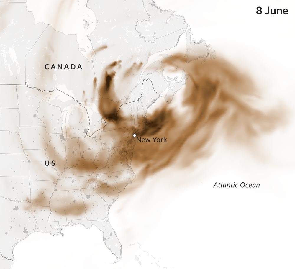
Intense wildfires in Canada have sparked pollution alerts across swathes of North America as smoke is blown south along the continent's east coast.
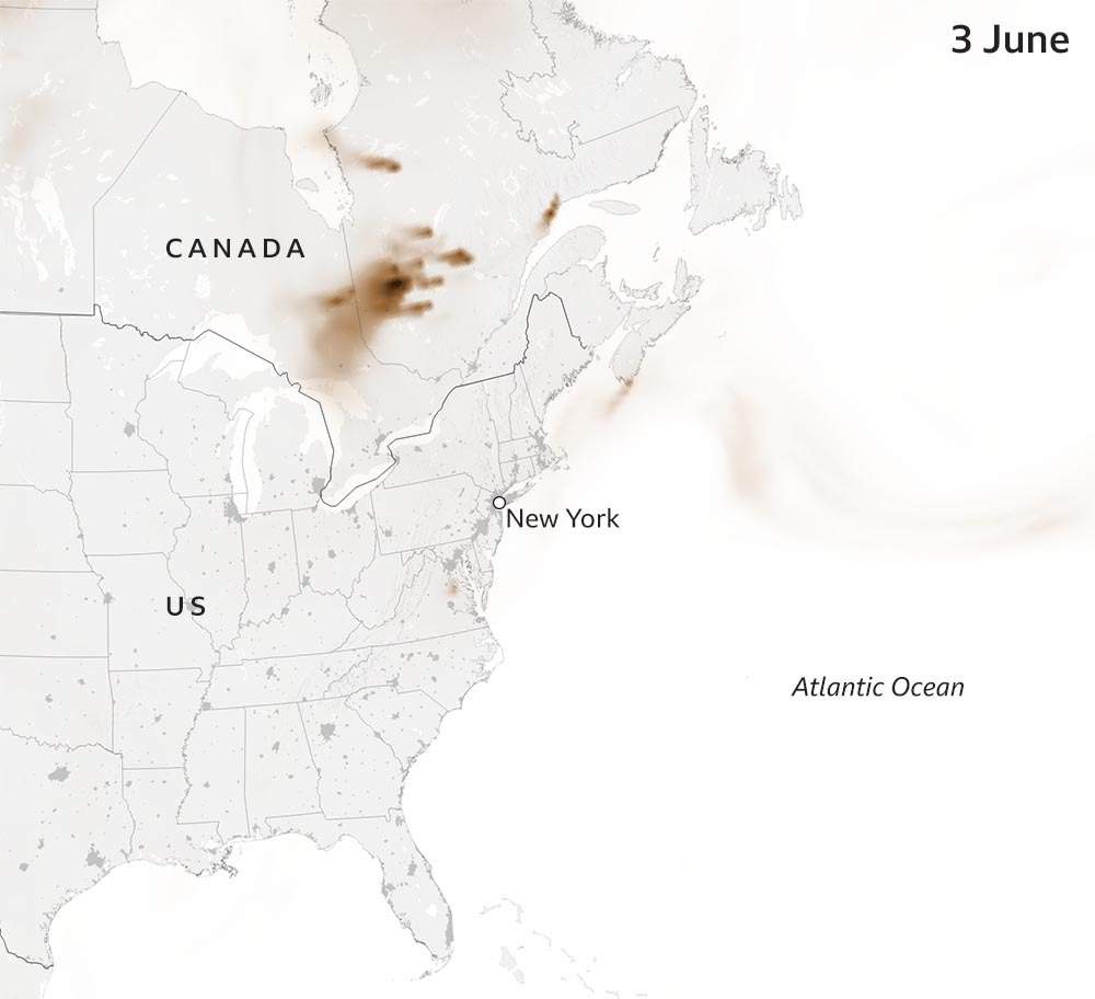
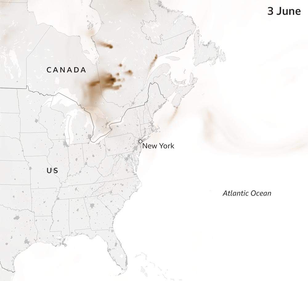
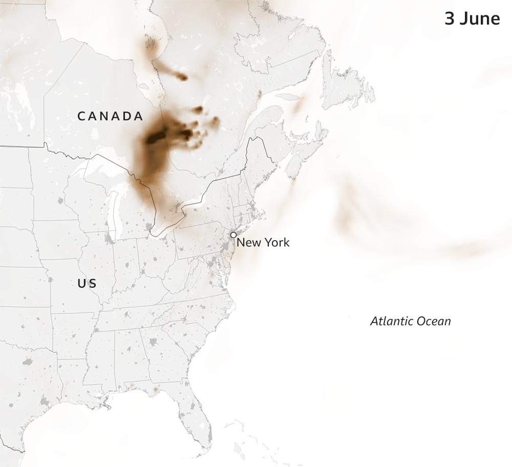
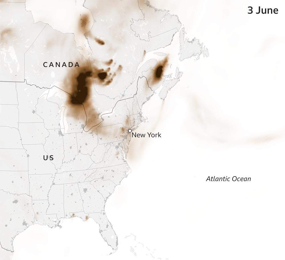
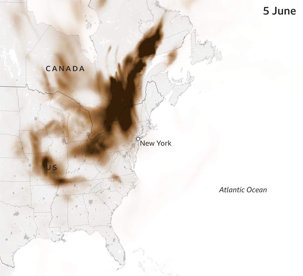
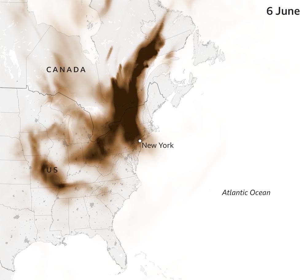
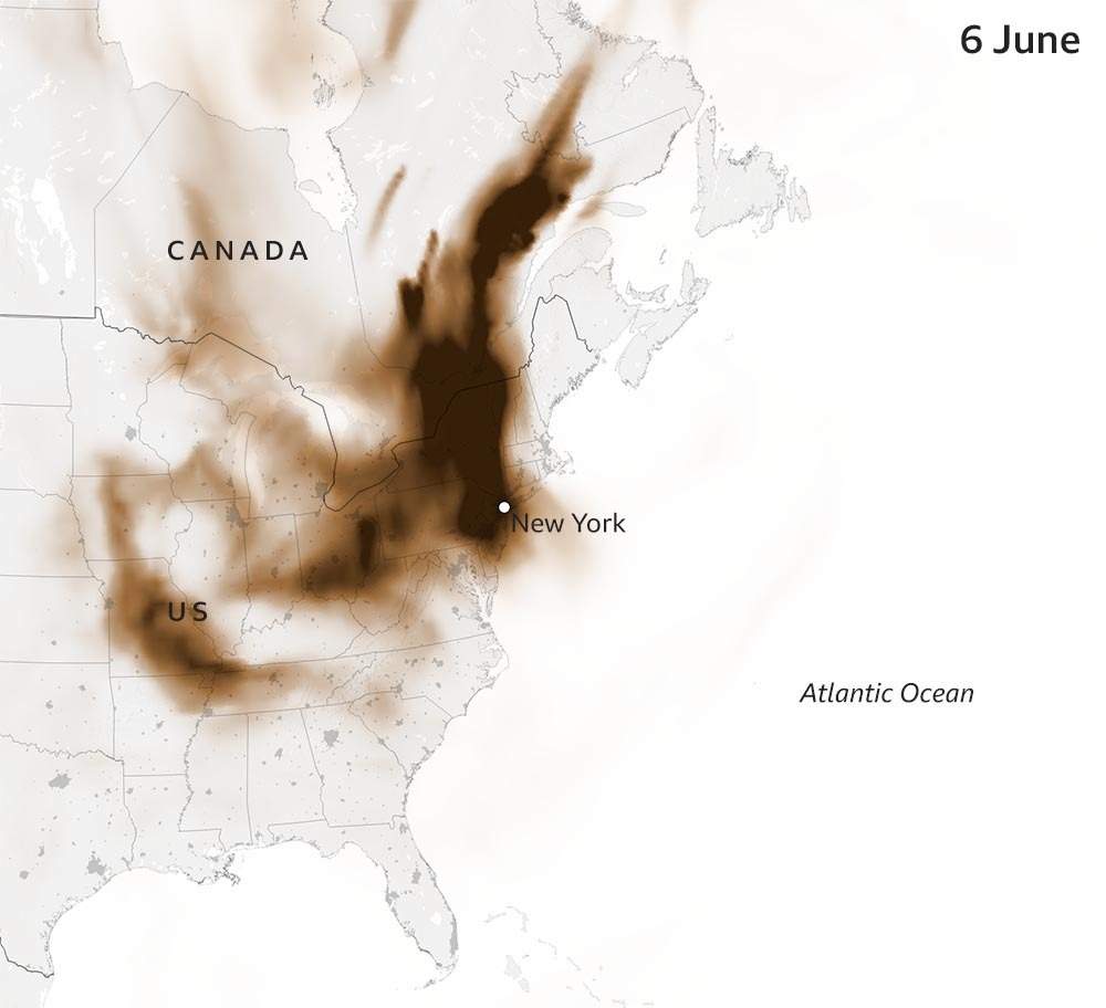
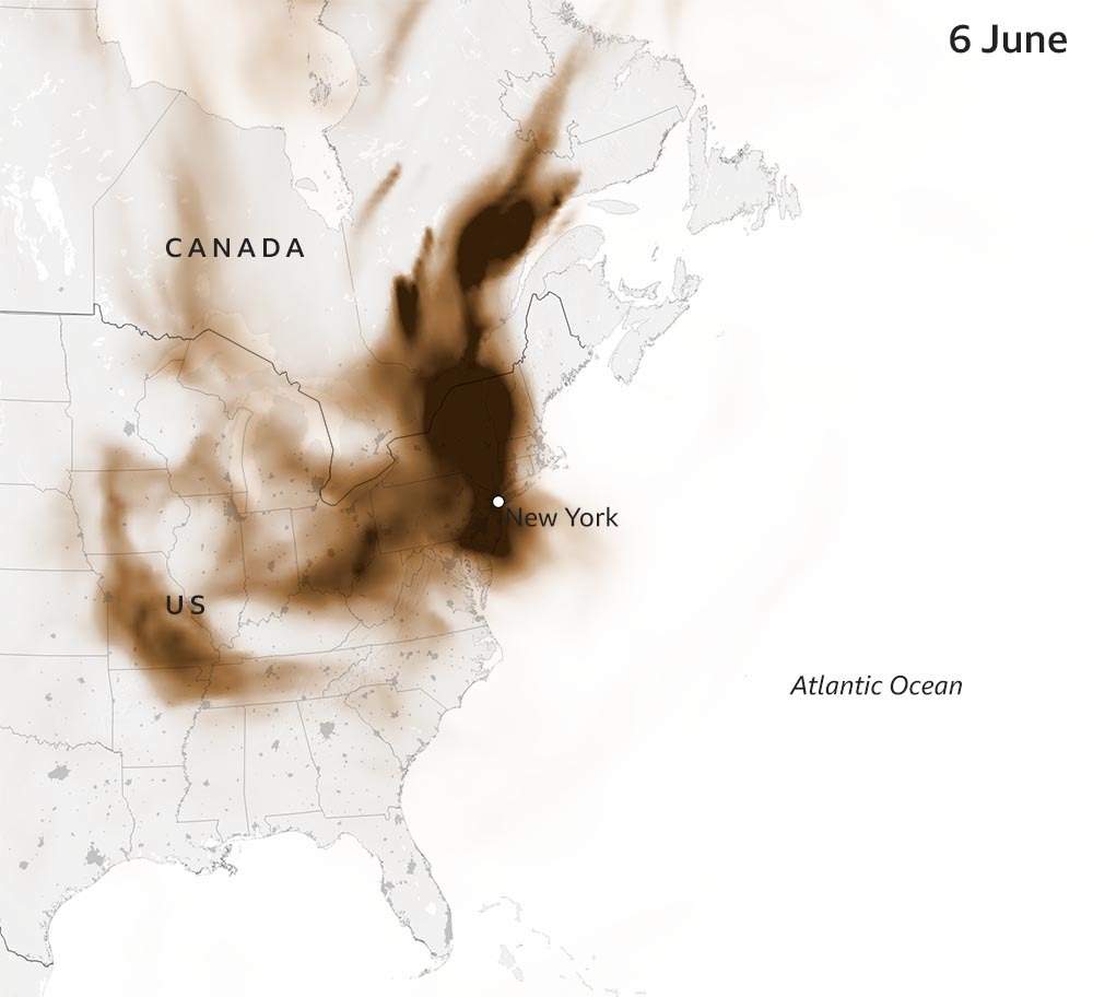
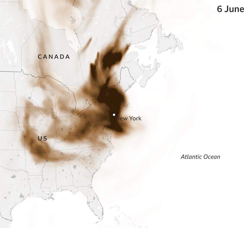
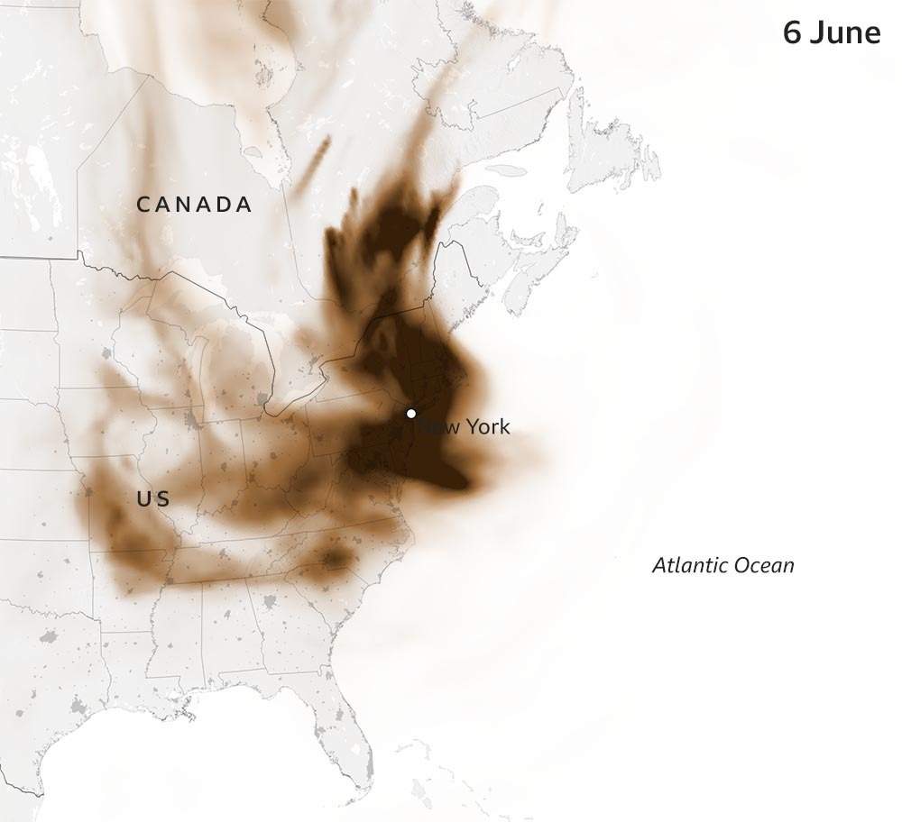
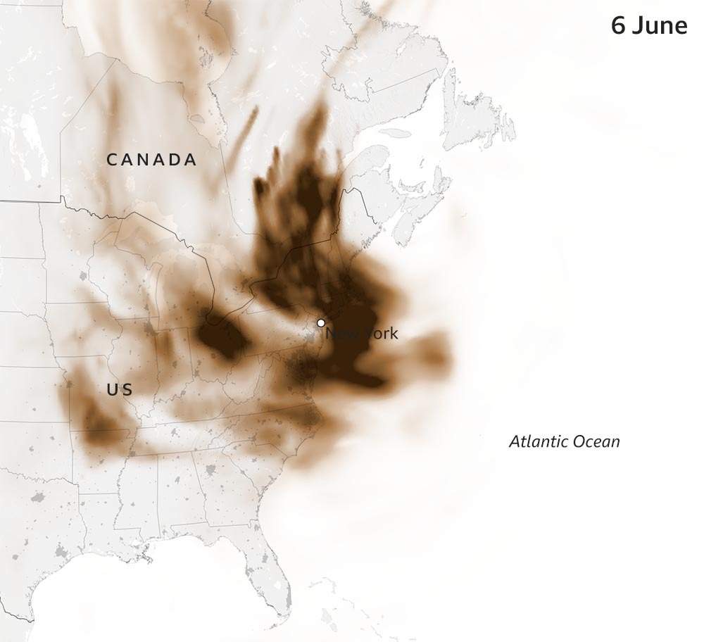
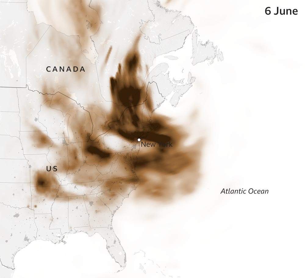
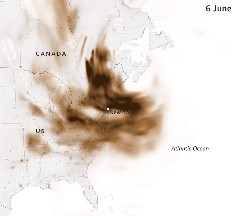
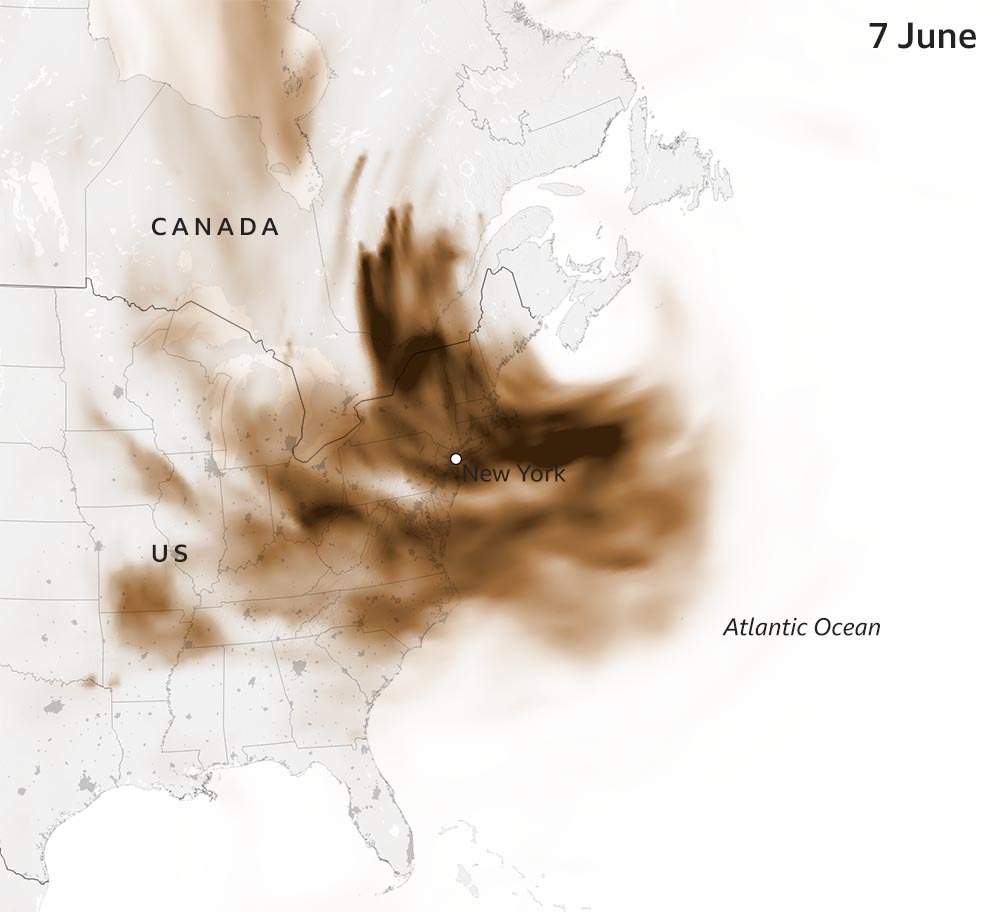
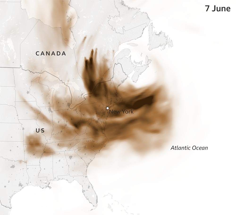
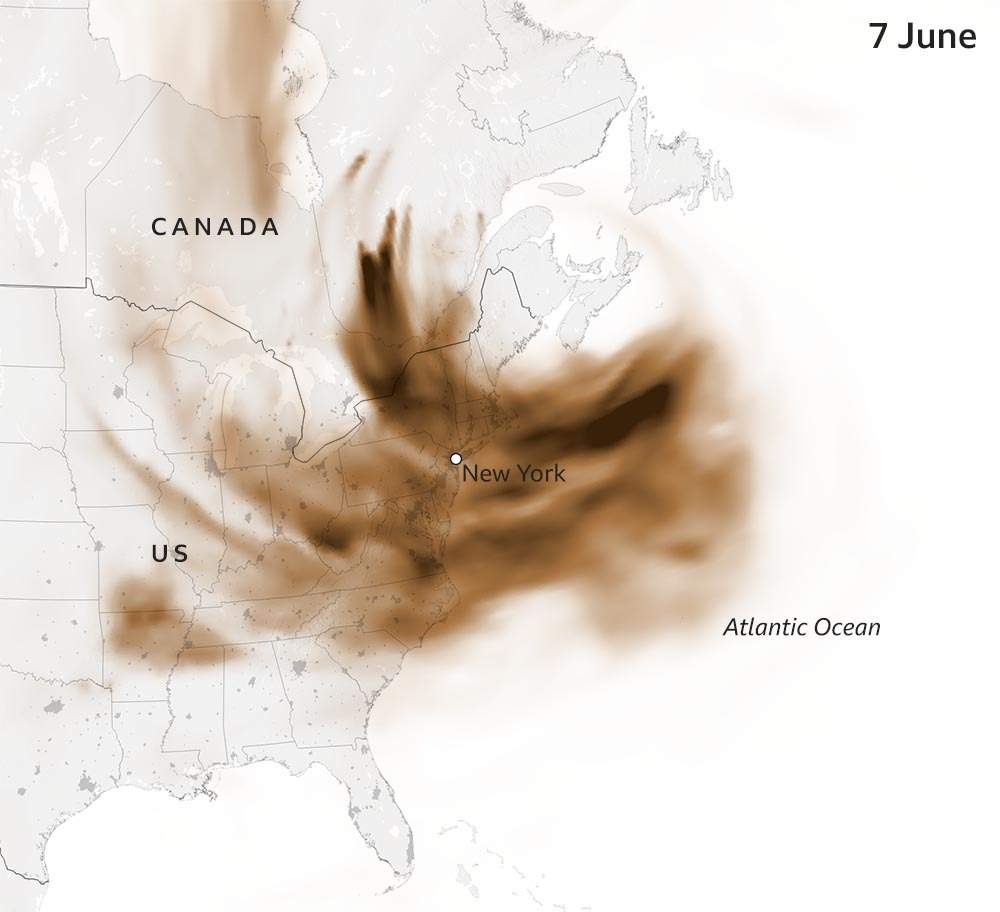
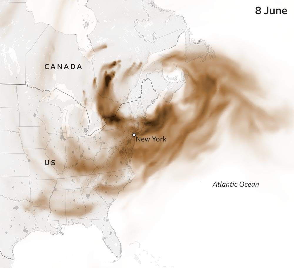
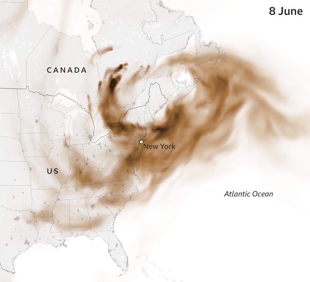
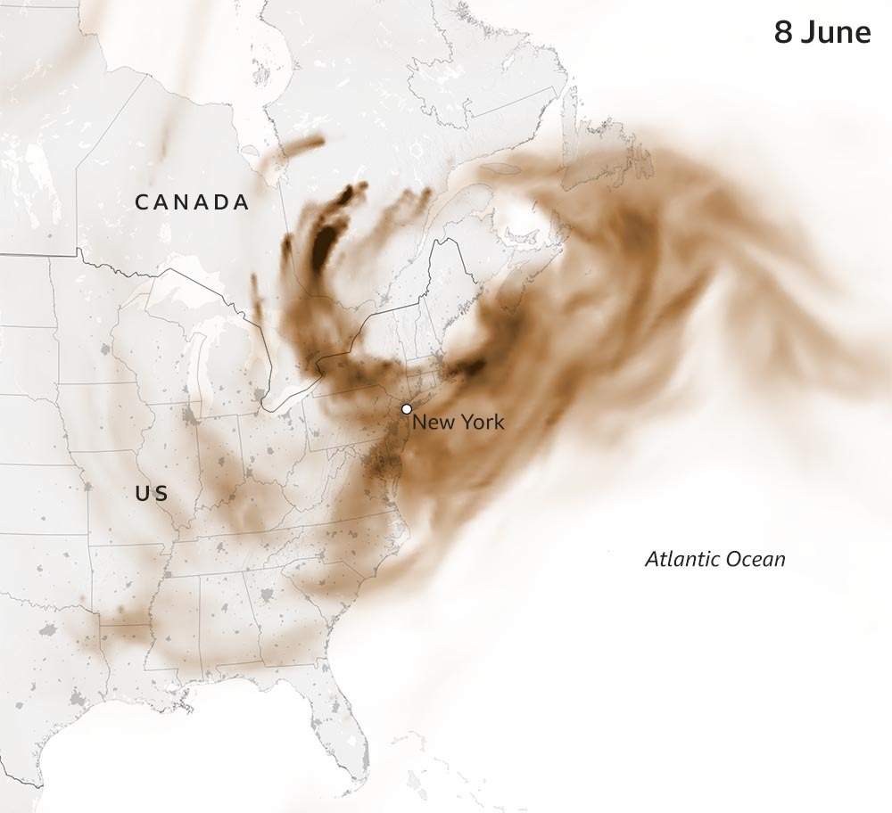
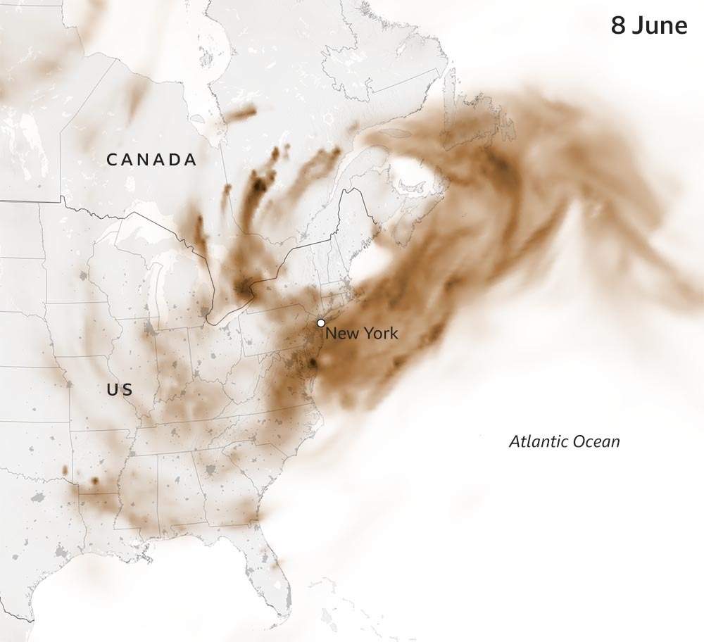
Toronto, Ottawa, New York and Washington DC are among the cities that have already been badly affected and, although conditions have improved in some of those places, unhealthy air quality is forecast to hit several southern metropolitan cities.
Where are the fires?
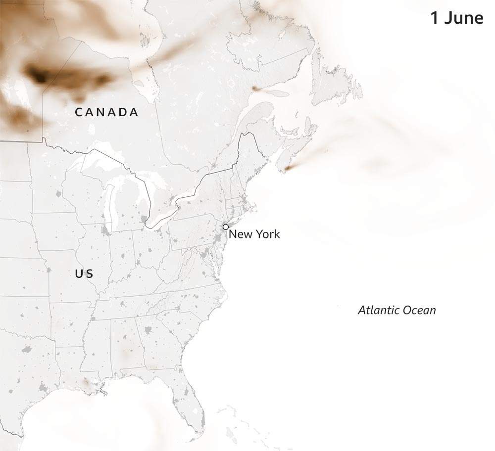
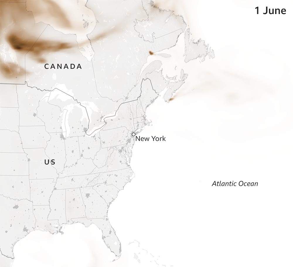
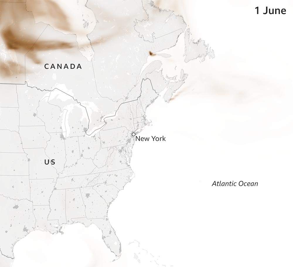
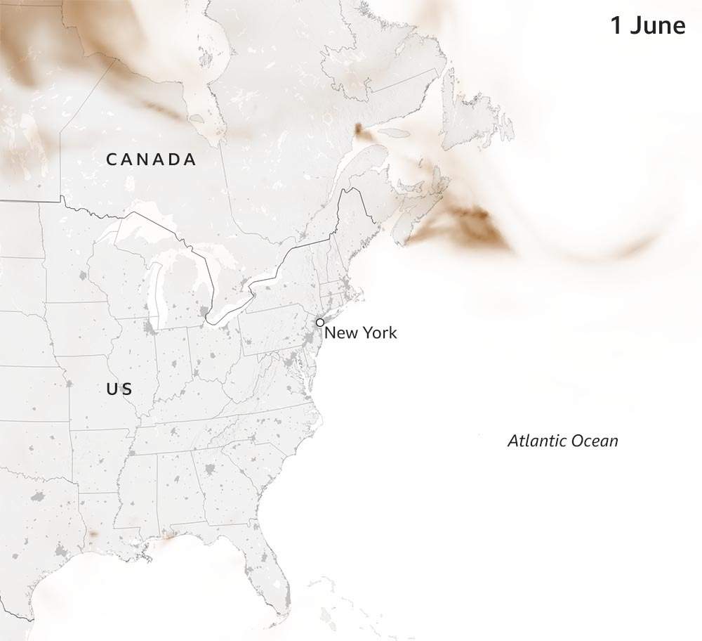
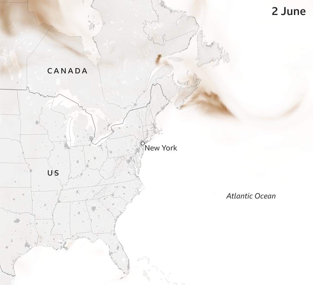
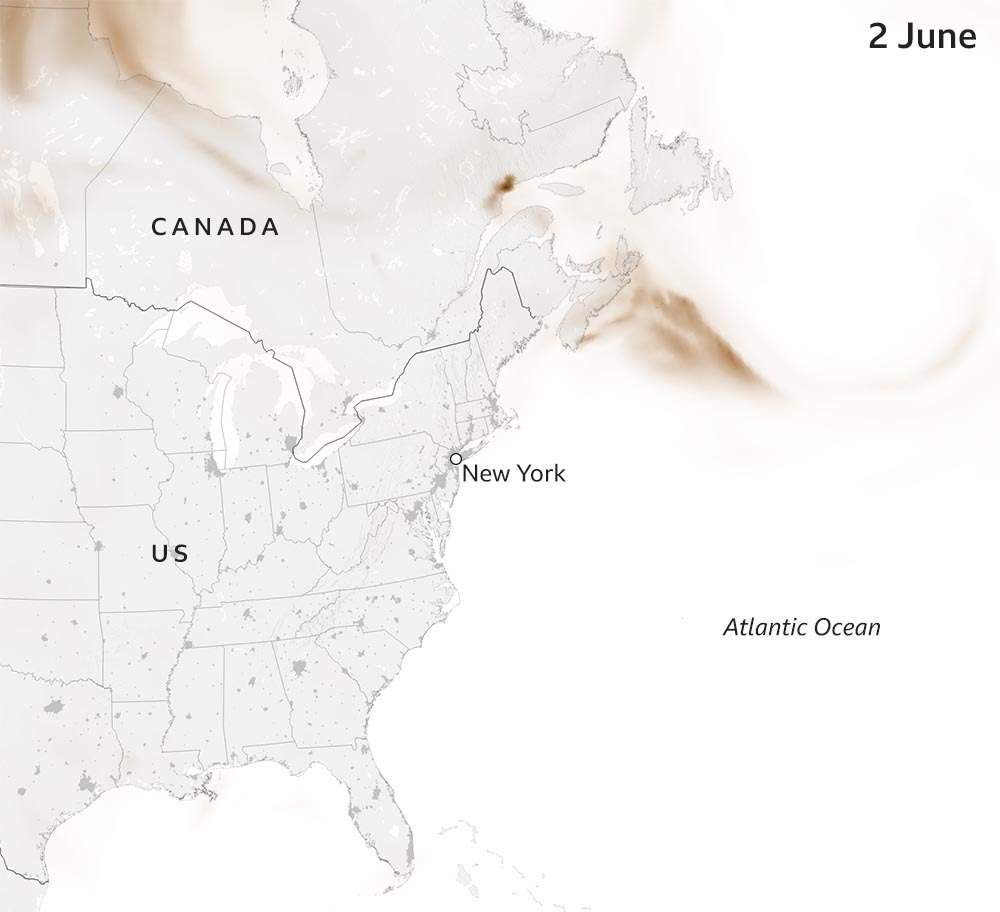
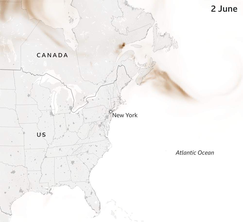
Much of the smoke is coming from Quebec, where more than 150 fires are burning, but there are more than 420 active fires across Canada.
The biggest wildfire complex in western Canada is the Donnie Creek fire in British Columbia which is now blazing over more than 3,000 square km.

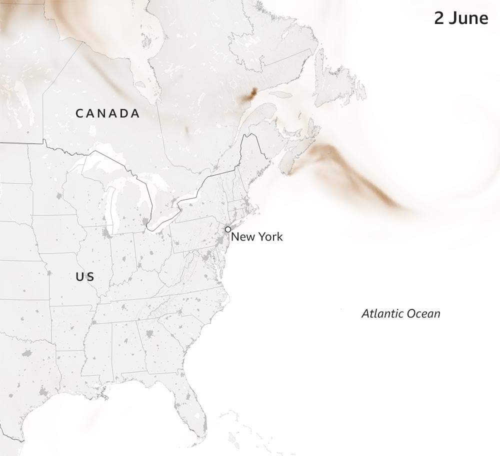
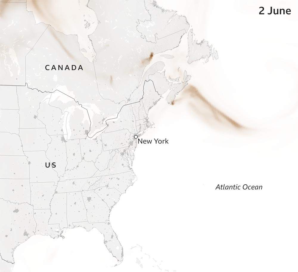
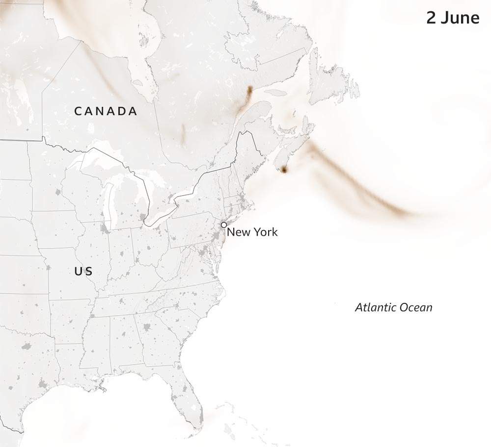
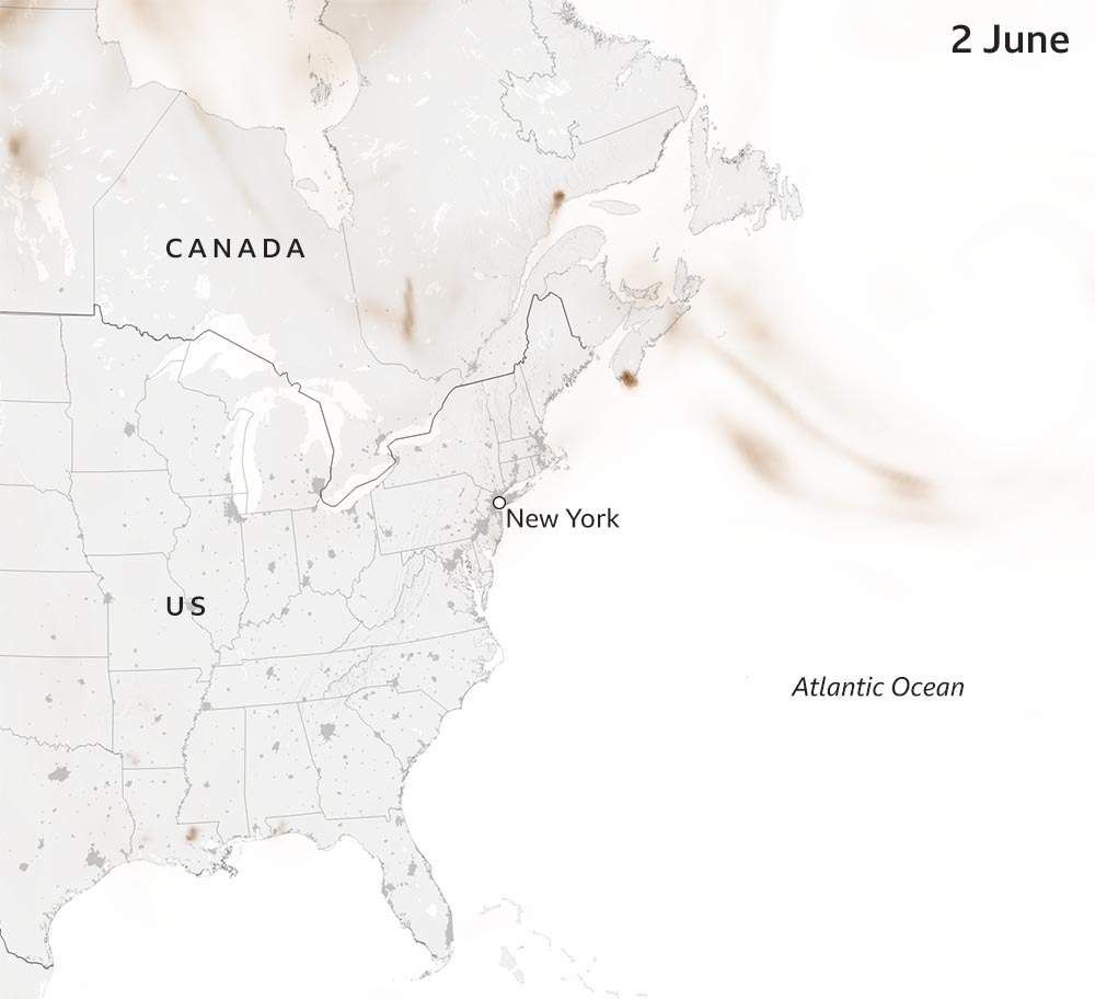
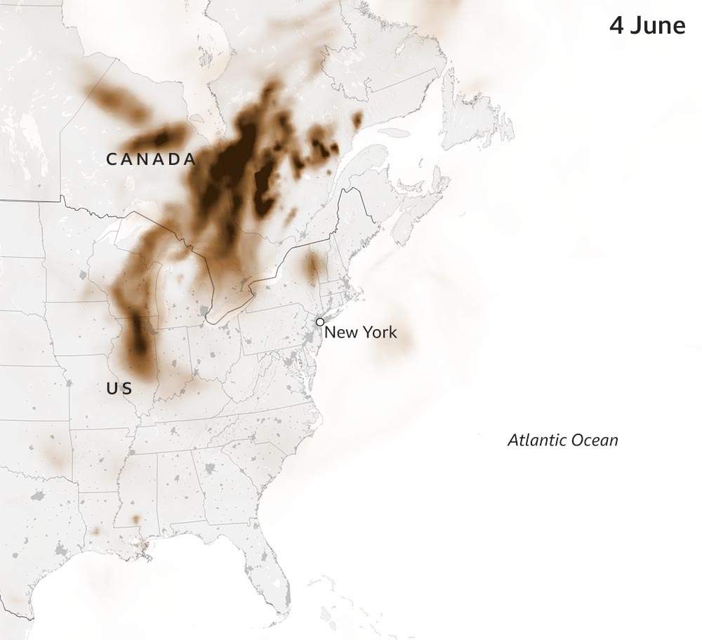
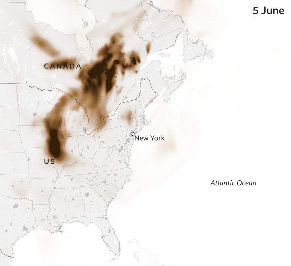
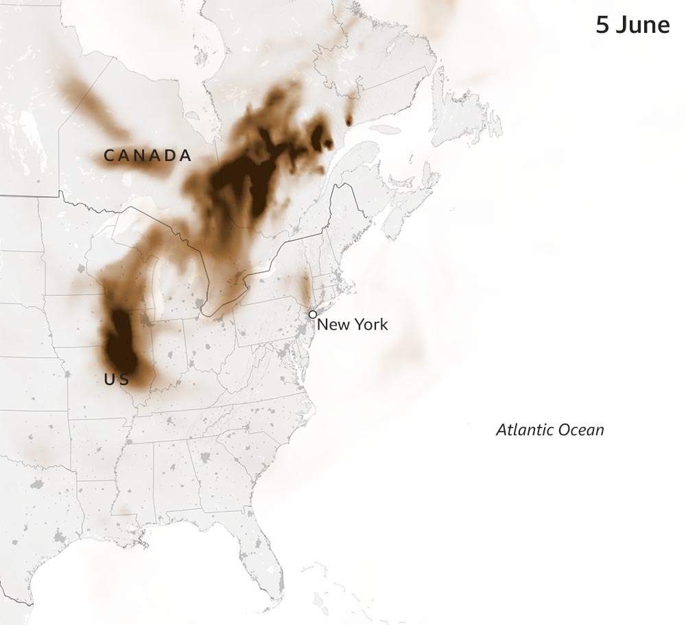
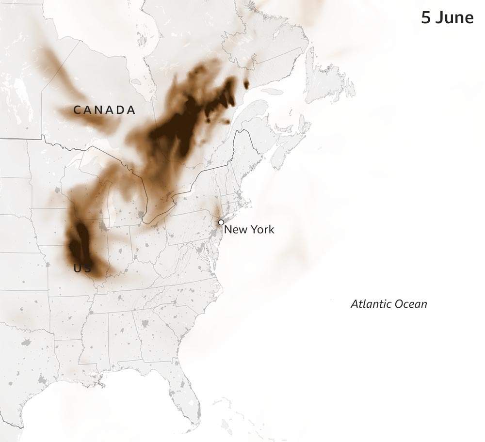
Where has the smoke travelled?
The Canadian government said nearly 100m people in the US and Canada would experience very poor air quality.
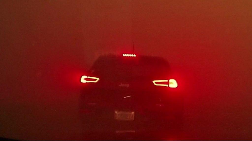
Toronto and Ottawa in the province of Ontario were badly hit earlier in the week - with views from Toronto's landmark CN Tower showing the density of the smoke there.

Environment Canada classified the air quality in Ontario as "very high risk" on Wednesday morning and, despite a brief respite later in the day, authorities warned they were likely to worsen again and remain at a high risk level until the weekend.
Across the border, cities including New York, Washington DC and Philadelphia have also been experiencing some of their worst air quality in years.
An orange haze blanketed the New York skyline and shrouded landmarks including the Empire State Building.
Your device may not support this visualisation
A view of Manhattan Bridge that has become popular with photographers and tourists over the years was given a distinctly sepia tint by the smoke.

And from the top of the Rockefeller Center, the Hudson River could no longer be seen through the skyscrapers that dominate Manhattan.

As the haze descended on the US Capitol building in Washington DC, US President Joe Biden described the fires as a "stark reminder of the impacts of climate change".

The smoke has caused the cancellation of school outings and sporting events, and public health officials have cautioned people not to exercise outside and to minimise their exposure to the smoke as much as possible, as the air poses immediate and long-term health risks.
Why is the smoke causing such problems?
Nasa said winds usually carry smoke from wildfires in the Quebec area east and out to sea but a low pressure area over Prince Edward Island has driven the smoke southwards to the United States.

Atmospheric scientist Ryan Stauffer said the surface smoke pollution from New York to the DC region is the most significant since at least July 2002 when Quebec fires caused a similar problem - and could end up being worse.
Are there more wildfires than usual?
The short answer is yes. It is on course to be a record year with more than 3.5 million hectares - 12 times the 10-year average for this time of year - already burned this year, according to the Canadian Wildland Fire Information Service.

Experts have pointed to a warmer and drier spring than normal as the reason behind the trend and these conditions are projected to continue throughout the summer.
Most of the 2,000 fires recorded this year are thought to have been started by humans but some, particularly in Quebec, were sparked by lightning strikes.
How bad is the air quality?
Data from the US Environmental Protection Agency's Air Quality Index (AQI) shows that cities in North America had the worst air quality in the world on Thursday morning.
Some parts of Janvier in Alberta, for example, had a peak AQI of 338, while areas of Washington DC reached 293 - a level above 200 is rated as very unhealthy and once it reaches 300 it is considered hazardous by the agency.
And looking at the daily averages you can see how air quality in some cities has been affected this year compared with last year.

A similar table for a selection of other cities around the world shows that the daily averages have changed much less.

How long will it last?
A new area of low pressure is expected to move up from the south this weekend and will bring fresher conditions to the north-east and mid-Atlantic states.
However, at the same time a ridge of high pressure across eastern Canada could trap the smoke there and even make conditions worse until rain hits next week.
BBC Weather forecaster Chris Fawkes looks at when the wildfire smoke might clear
Reporting and graphics by Chris Clayton, Dominic Bailey, Kady Wardell, Tural Ahmedzade, Erwan Rivault and Kate Gaynor
- Published8 June 2023
- Published29 June 2023
- Published12 May 2023
- Published29 May 2023
