Explorer 6: 60 years since first Earth photo from space
- Published

In 1959, Explorer 6 took this photo over Mexico, which was the first image of Earth taken from space
In August 1959, an unmanned satellite called Explorer 6 took the first photos of Earth from space, on a mission that marked the first steps towards the mission to the Moon.
The spacecraft, which was shaped like a ball with large wing-like solar panels, was sent into space to monitor radiation in the Earth's atmosphere. While nearly 17,000 miles above Mexico, the craft captured the first ever photo taken by a satellite.
The image, which was taken on 14 August 1959, is very basic by today's standards. It shows a sunlit area of the Central Pacific Ocean and cloud cover in the area. The image was beamed back to a station in Hawaii and took 40 minutes to send.

This is the spacecraft which took the photo
Solar energy
Only three of the solar panels worked properly on Explorer 6. This meant that the craft only had about 63% of power that it was intended to have - and this decreased over time. The last contact with the craft was made on 6 October 1959.
However, the solar technology developed to power satellites like Explorer 6 is now used across the globe, from giant panels on rooftops to small cells powering smaller gadgets and appliances.
Another famous photo
Not only was the research vital ahead of the Apollo Moon missions, without Explorer 6 we wouldn't have another famous picture of the Earth from space.
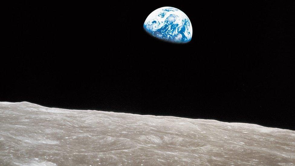
Almost a decade later, the crew of Apollo 8 took a famous picture of the planet rising over the lunar landscape. It was named Earthrise. This image helped people to understand the world better and take an interest in environmental issues at the time.

The Explorer Six mission laid the foundations for future missions to the Moon and this iconic photo from Apollo 8 called Earthrise
- Published6 August 2019

- Published20 September 2019

