Why do countries disagree about the height of Mount Everest?
- Published
- comments

It has taken ten years but we're finally close to finding out the height of Mount Everest.
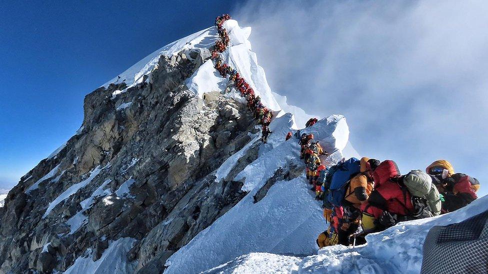
The world's highest mountain sits over the borders between Nepal and China - so they've teamed up to measure how tall it actually is.
The two countries had disagreed over its size in the past because they were using different measuring points.
However, in 2010, they decided to settle their differences for the good of the mountain.
Both countries set off independently to measure it but an agreement in 2019 means they have to reveal the size together.
We should already know the answer but the coronavirus pandemic delayed the findings further.
The height of Mount Everest changes depending on the amount of tectonic activity, with the 2015 Gorkha Earthquake in Nepal the most recent event to potentially change it.
The Big Question: How do you measure a mountain?
This is the first time the countries where Everest sits have measured it. All measurements before this point have been done by explorers from the United States, India or Europe.
The height of Everest was first measured at 8,840m by the Great Trigonometric Survey (GTS) of India in 1856.
That's around the height at which passenger planes fly.
If that doesn't sound that high to you - imagine 643 double-decker buses stacked on top of each other - that's how high the summit is!
I wonder if after all this time it will be the same height?
- Published26 June 2019
- Published25 May 2019