How a river was restored after years of re-routing

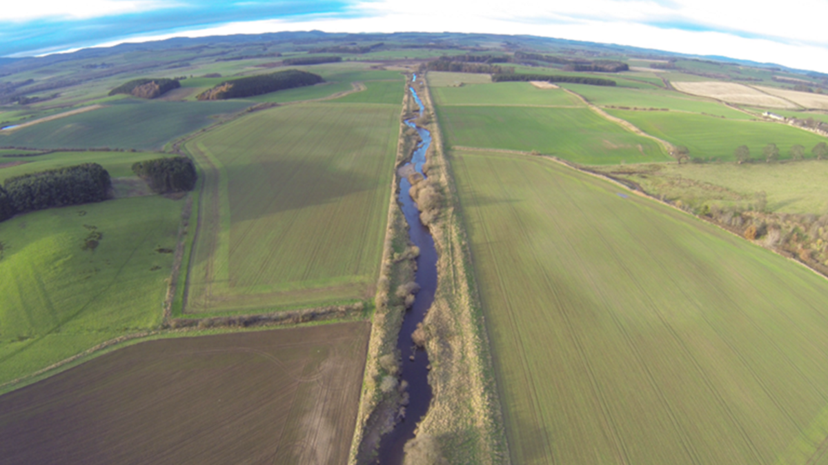
New meanders have been created to allow the river to deter away from its straightened route
- Published
Work to bring a river back to its natural state after centuries of re-routing has been completed.
The River Breamish on the Harehope Estate, south of Wooler in Northumberland, was straightened for agricultural purposes.
A 1km (0.6 mile) section of the river has now been returned to its former shape through the Life Wader project, which used a mixture ancient maps and modern technology to trace its original route.
Jim Heslop, environment programme manager for the Environment Agency (EA), said the scheme had created new habitats, improved water quality and protected the area from floods.
The restoration, which is part of a wider River Till Restoration Strategy, named after the river the Breamish flows into, saw contractors installing silt traps, shallow ponds, wetlands and embankment breaches to divert the river.
Mr Heslop said its restoration was a "fantastic step forward for nature".

The river's route before natural channels were restored
The River Till and its tributaries flow through Northumberland National Park.
Protected species, including Atlantic salmon and all three native species of lamprey, can be found in the Till catchment area.
The team studied maps from the 1600s courtesy of the archives at Alnwick Castle, which showed original floodplains.
This, combined with 3D modelling of the terrain, helped trace the river's original meanders.

Project workers spent time studying the Alnwick Castle map to trace the river's historic route
The EA said the river would develop its own "final design" and following recent rainfall it has already spilled onto its floodplains, forming wetlands.
Habitats in and around the new channel are developing and being used by wildlife including heron, kingfishers and Damsel flies.
Philip Kearney, project manager at Tweed Forum, which delivered the project on the ground, said the "landscape is beginning to heal".
"The cooperation of the landowner has been essential as we've worked together to restore the river's natural processes," he added.

The original meandering river system was reinstated and reconnected to its floodplain
While the works have now been completed, the EA said the channel was officially classed as in an "unfavourable condition".
The restored River Breamish will be monitored to track improvements, with findings shared to support similar restoration projects across the UK.
The Life Wader Project is part of a five-year, £5.8m nature recovery project co-funded by the European Union and due for completion in December 2026.
Follow BBC North East on X, external, Facebook, external, Nextdoor and Instagram, external.
Get in touch
Do you have a story suggestion for BBC Tyne?
Related topics
- Published4 June