Flood warnings in place as river reaches peak

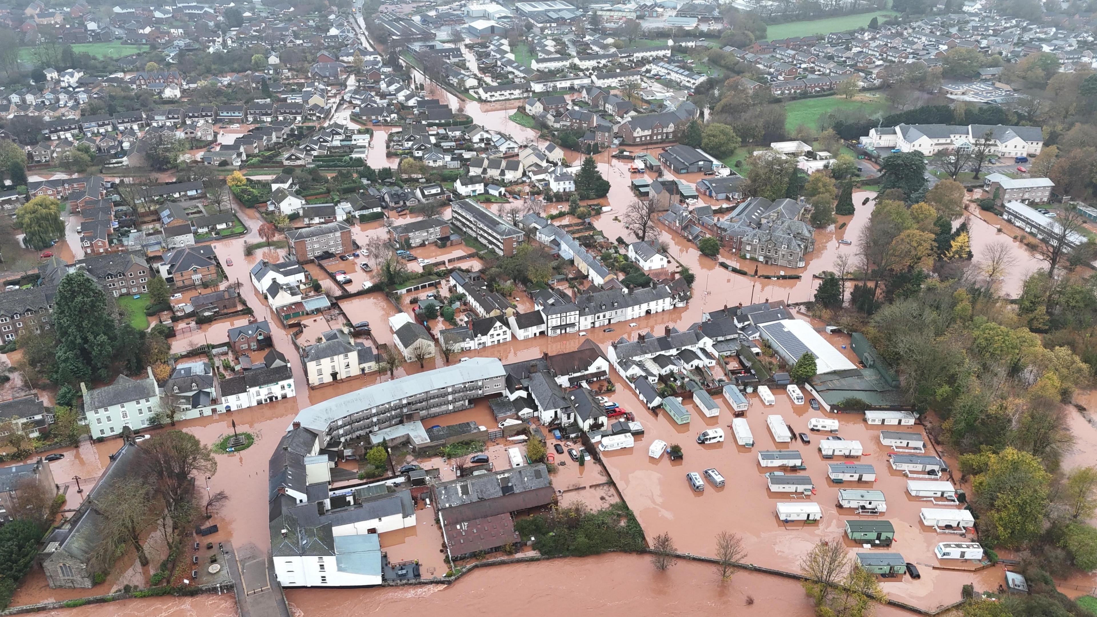
Weather Watcher Gryning captured York under water on Saturday afternoon
- Published
River levels in York are set to peak after Storm Claudia brought torrential rain on Friday and Saturday.
Flood warnings remain in place in North and South Yorkshire along the River Ouse and River Rother.
Residents in York city centre were urged to act on their flood plans, with flood gates closed and the Foss Barrier in operation.
The Environment Agency (EA) said while no further significant rainfall was expected, properties on King's Staith and riverside areas from Lendall Bridge to Millennium Bridge were most at risk.
The level of the Ouse at the Viking Recorder measuring station was 3.55m at 07:00 GMT and was expected to peak at around 3.57m.
Property flooding is possible when the river measures above 3m (10ft).
Elsewhere in North Yorkshire, the EA said flooding was expected at Naburn Lock outside York.
Trains return to normal
Meanwhile in South Yorkshire a flood warning remained in place at Beighton near Sheffield.
Properties in Woodhouse Lane, Rotherham Road and at Crown Works Industrial Estate were advised to put protective measures in place.
Train services were disrupted throughout Saturday, with delays and cancellations on lines between Manchester and Leeds and on the South Yorkshire tram service.
National Rail said it expected routes to run normally on Sunday after weather warnings associated with Storm Claudia were lifted.
Get in touch
Tell us which stories we should cover in Yorkshire
Listen to highlights from North Yorkshire on BBC Sounds, catch up with the latest episode of Look North.
Related stories
- Published3 hours ago
- Published16 hours ago