Warm, wet and windy - South West weather in 2024

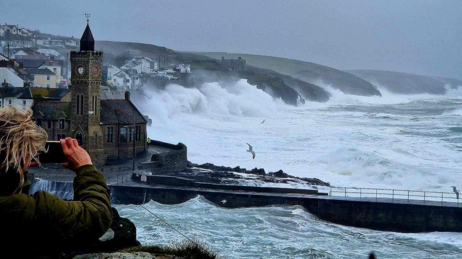
Storm Kathleen was one of the many storms which wreaked havoc in the South West during 2024
- Published
Several storms blew through the South West during what was a warm and wet 2024 for the region.
Overall, it was an unusual weather year, with the high Atlantic sea surface temperatures driving a powerful jet stream, resulting in a highly active storm season.
Along with the storms, which brought gusts of 96mph (154.5km/h), many people across the South West were able to see the aurora borealis as the Northern Lights brought a splash of colour to the skies.
The South West also had to contend with its coolest summer for nearly a decade and a lot of wet weather.
Stormy conditions
It was also one of the busiest storm seasons since the Met Office started naming storms in 2015.
Henk, Isha, Jocelyn, Kathleen, Lilian, Ashley, Bert, Conall and Darragh all caused disruption either from strong winds or heavy rain or both.
On the 2 January, Storm Henk brought heavy rain and strong winds – including a gust of 81mph (136.7km/h) at Exeter Airport.
With rivers full and the ground already saturated from the persistent rain throughout December, the extra rainfall from Henk resulted in significant flooding problems.
Storms Isha and Jocelyn, the ninth and 10th named storms of the 2023/24 storm season, arrived in quick succession in late January, with heavy rain and gusts of wind close to 70mph (112.6km/h) in west Cornwall.

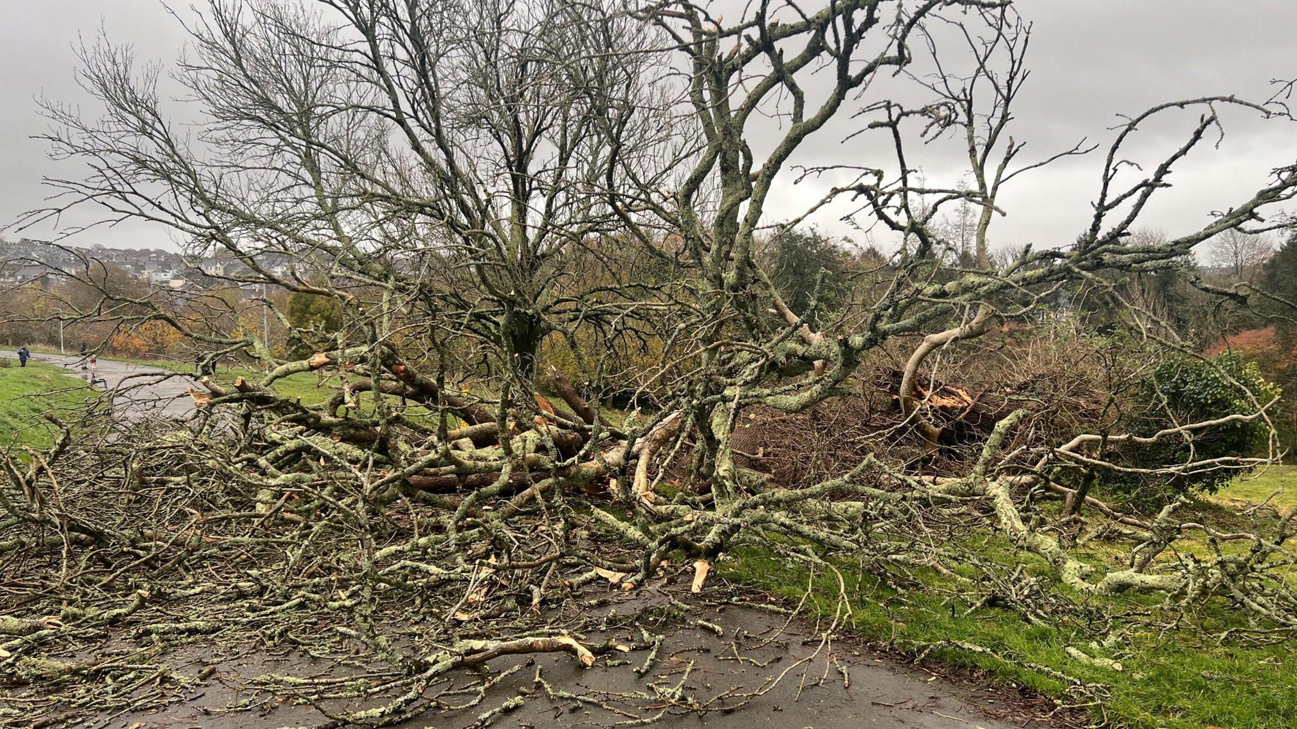
Storm Henk caused damage at Okehampton Station
The region experienced the warmest February on record, with the average temperature reaching 7.5C (45.5F).
In the South West, the 10 warmest Februarys on record since 1884 now include 2019, 2022, 2023 and 2024, highlighting a trend in rising winter temperature.
The south-west of England also experienced the wettest February since 1836, with many parts of southern England recording well over twice the average rainfall.
In May, the strongest solar storm in 20 years led to many people in the UK catching a glimpse of the aurora borealis.
The display was down to a peak in the 11-year solar cycle, the storm's high geomagnetic activity rating made the Northern Lights visible as far south as Cornwall and the Channel Islands.

The aurora borealis was spotted several times during the year across the South West
May and spring were the warmest and wettest on record and, on 6 and 7 April, Storm Kathleen arrived.
It was an unusually severe storm for this time in spring, and the most significant April windstorm to affect the UK since 2013.
Storm Lilian was the 12th and final named storm of the 2023/24 storm season when it arrived in August.
It was the first time "L" had been reached, making this the most named storms in a season since the scheme was introduced.
Lilian was the most significant August windstorm to affect the UK since storms Ellen and Francis in late August 2020.
Cool summer and wet autumn
The summer of 2024 was the coolest summer since 2015, with an average mean temperature of 14.37C (57.86F), which is 0.22C (0.12F) cooler than the long-term average.
The last time the mean temperature was this low was in 2015, when the summer's average was 13.91C (57.04F).
Autumn was one of the wettest on record, with September being unusually wet and parts of Dorset and Somerset seeing more than 200% the average monthly rainfall.

Dorset and Somerset had double the average amount of rain in September
Storm Ashley, the first named storm of the 2024/25 season, brought wet and windy weather to the South West in late October and then in November.
Storm Bert brought exceptionally wet weather across south-west England.
More than 150mm (5.9in) of rain fell in a couple of days, and strong winds saw gusts of 76mph (122.3km/h) at Berry Head in Devon and 70mph (112.6km/h) at Mountbatten in Plymouth.
However, inland stations also recorded very high gusts, including 76mph (122.3km/h) at Yeovilton in Somerset, 72mph (115.8km/h) at North Wyke in Devon and 69mph (111km/h) at Merryfield in Somerset.
Record gusts
Finally, Storm Darragh arrived in early December and the Met Office issued a red warning for wind covering north Devon and north Somerset.
Arriving two weeks after Bert, Storm Darragh also brought heavy rain to western areas, with a further 50mm (1.97in) to 100mm (3.94in) falling across upland areas of south-west England on 6 and 7 December.
The highest gust of wind was 96mph (154.5km/h) at Berry Head - which was Berry Head's highest December gust speed on record.

The Met Office issued a red weather warning in the South West for Storm Darragh
Gusts of more than 69mph (111km/h) were widely recorded, but in some areas these also occurred further inland.
At Cardinham in Cornwall, near Bodmin, a gust of 71mph (114.2km/h) was recorded, which was the highest December inland gust on record - going back 34 years - in the South West.
A gust of the same speed was also recorded in Yeovilton in Somerset.
Thousands of homes were without power for several days due to the sustained nature of the winds and the unusual northerly direction.
Follow BBC Cornwall on X, external, Facebook, external and Instagram, external. Follow BBC Devon on X, external, Facebook, external and Instagram, external. Send your story ideas to spotlight@bbc.co.uk, external.
- Published6 December 2024

- Published23 November 2024

- Published24 November 2024

- Published11 April 2024

Related internet links
- Attribution
