New weather warning issued with risk of flooding

The Met Office issued a new warning for Friday through to Saturday morning
- Published
Flooding could hit parts of Wales with a yellow warning for rain and a second warning issued for Friday.
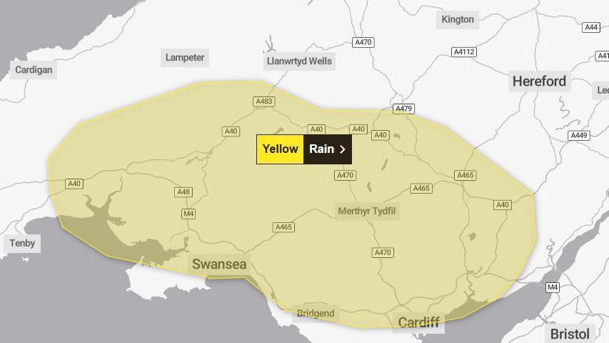
For Wednesday, the warning is in place until 23:59 GMT with south and mid Wales expected to bear the brunt of the wet weather.
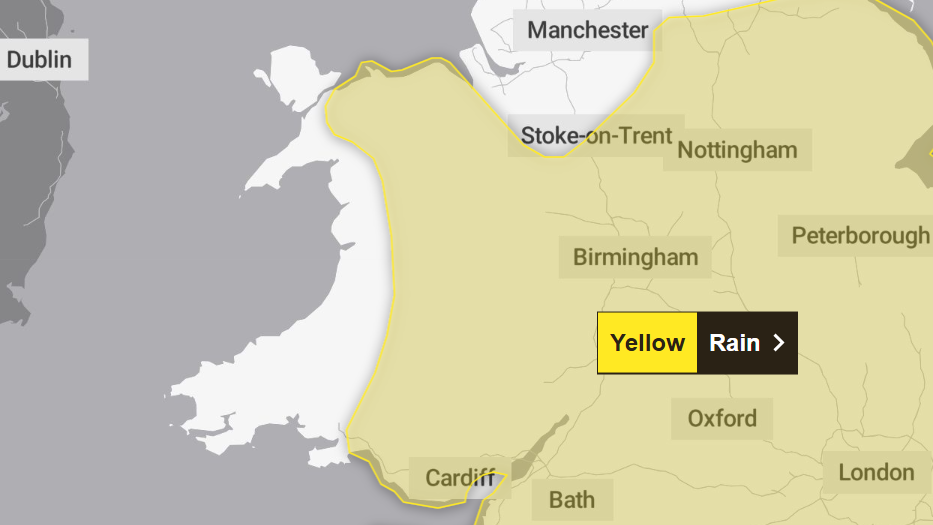
Friday's warning is in place from 06:00 GMT until 06:00 GMT on Saturday with parts of north, mid and south Wales to be impacted, according to the Met Office.
The downpour comes days after flooding in Carmarthen that was described by one business owner as the "worst in living memory".

Wednesday's warning sees south and mid Wales expected to bear the brunt of the wet weather
The Met Office warned spray and and surface water may also make travel difficult.
The forecaster predicted between 40-50mm of rain could fall on higher ground, with 20mm-30mm expected more widely on Wednesday.
These are the areas affected by Wednesday's weather warning are:
Blaenau Gwent
Bridgend
Caerphilly
Cardiff
Carmarthenshire
Merthyr Tydfil
Monmouthshire
Neath Port Talbot
Newport
Powys
Rhondda Cynon Taf
Swansea
Torfaen
Vale of Glamorgan
The Met Office said that heavy and prolonged rain during Friday into early Saturday could lead to some flooding and disruption.
It said that accumulations of 30-50mm are expected "quite widely, with some places receiving 60-80 mm, and potentially in excess of 100mm over east-facing hills in southeast Wales".
"This, following recent wet weather, could lead to some surface water and river flooding impacts," it added.
"Although some uncertainty exists in the areas of heaviest rainfall, impacts appear more probable across southeast Wales."
The areas covered by Friday's weather warning are:
Blaenau Gwent
Bridgend
Caerphilly
Cardiff
Carmarthenshire
Conwy
Denbighshire
Flintshire
Gwynedd
Merthyr Tydfil
Monmouthshire
Neath Port Talbot
Newport
Powys
Rhondda Cynon Taf
Swansea
Torfaen
Vale of Glamorgan
Wrexham
Details of the yellow weather warning, and an accompanying map of those areas affected, can be found on the Met Office website., external
Related topics
More top stories
- Published1 day ago

- Published1 day ago

- Published1 day ago
