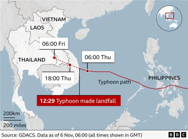
Powerful typhoon hits Vietnampublished at 15:23 GMT 6 November
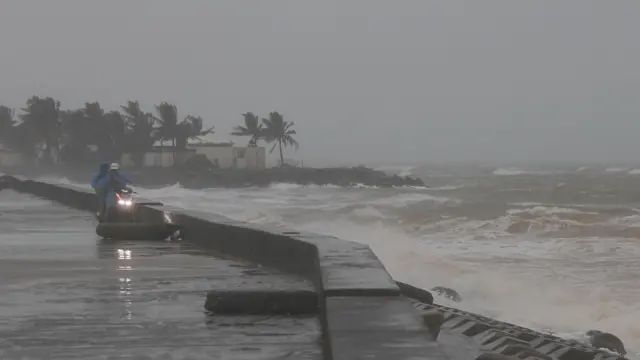 Image source, DAU TIEN DAT/EPA/Shutterstock
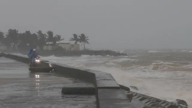
People watch waves crashing on the beach ahead of Typhoon Kalmaegi in Cua Dai, Da Nang
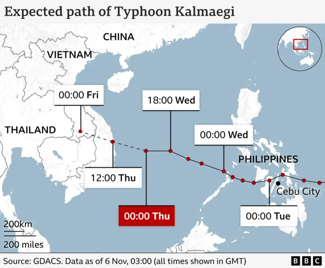
Vietnam has been hit by Asia's most powerful tropical storm so far this year, Typhoon Kalmaegi, which made landfall on Thursday with winds of 92 mph (148km/h).
The government says the storm hit the provinces of Dak Lak and Gia Lai, where thousands of people have been evacuated from their homes, and several airports are closed.
The storm has torn the roofs off houses, uprooted trees and shattered glass panels on buildings.
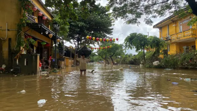
In Dak Lak, some people have reported their homes have collapsed and flooded, as strong winds and rain batter the area.
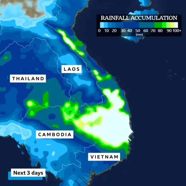
Vietnam's weather service has warned of the risk of flooding and landslides.
Before the storm began, Vietnam was already battling serious floods after heavy rains in recent weeks.
Some 260,000 soldiers are on standby to help with storm relief.
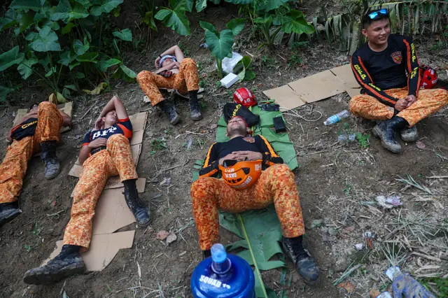
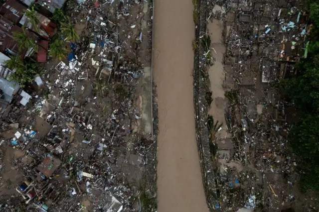
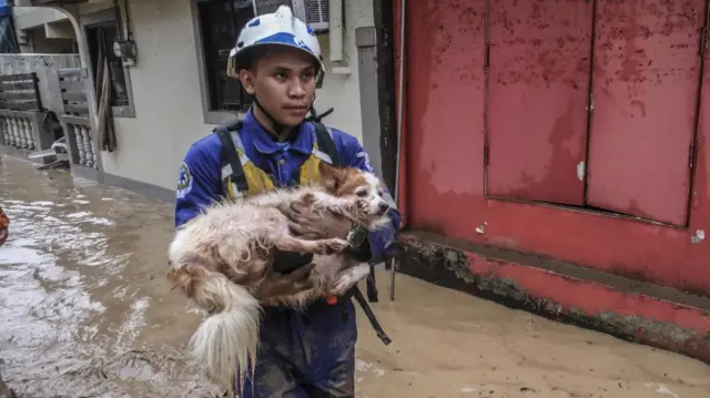
Typhoon Kalmaegi has already caused widespread destruction in the central Philippines, killing at least 114 people.
We are now pausing our live coverage, but you can stay up to date with the latest on Typhoon Kalmaegi here.