Mount Etna mapped by radar satellites
- Published

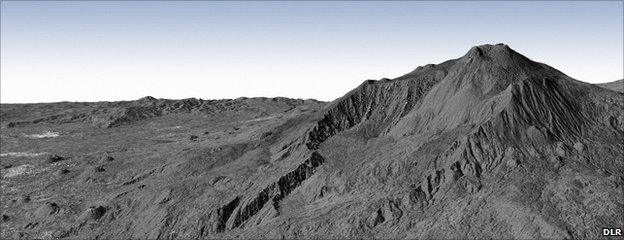
A radar view of Mt Etna: The city of Catania is visible as a collection of white points to the left
Two German radar satellites flying in tight formation above the Earth have returned their first combined images.
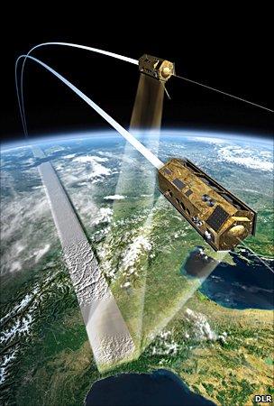
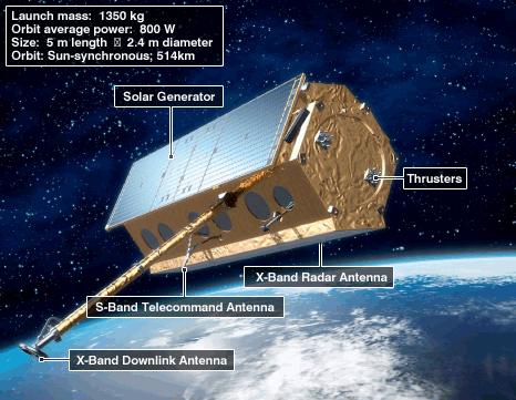
TanDEM-X and TerraSAR-X are circling the globe just 350m apart as they get set to make the most detailed 3D map of the Earth's surface ever acquired.
Their close proximity allows them to view the same patch of ground simultaneously but from slightly different angles.

The satellites trace a helix across the sky as they move just a few hundred metres apart
This remarkable stereo vision has been demonstrated in an image of Mount Etna.
The German space agency (DLR) said on Tuesday that the picture was the first of its kind to be made by satellites flying in such a close formation.
It shows the Italian volcano on the east coast of Sicily. On the left of the image, in the foothills of the volcano, the city of Catania is visible as a collection of white points.
This 3D view of the mountain was generated from data recorded by TanDEM-X and TerraSAR-X, external in their new interferometric mode in which one spacecraft acts as a transmitter/receiver and the other as a second receiver - a so-called bistatic radar arrangement.
The pair will soon begin an intense observation campaign that will pin down the variation in height across the globe to a relative accuracy of better than two metres.
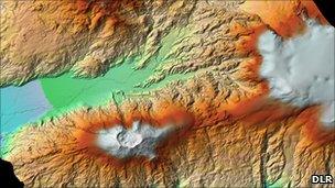
This seamless digital elevation model (DEM) will be put to myriad uses - everything from improving the safety of aircraft navigation to understanding better which areas of ground are most at risk during a flood.
TerraSAR-X was launched in 2007. TanDEM-X was put in space in June, since when it has been brought closer and closer to its more established sibling.
The very close proximity manoeuvres were conducted step-by-step last week.

A DEM image of Eyjafjallajoekull volcano in Iceland (centre, bottom) which erupted this year
The orbits of the two spacecraft have been given a very small offset which means they trace paths across the sky that look like the strands of a double helix. This should ensure they never bump into each other.
They will be brought even closer together in the next few months - down to separation of 200m - whereupon they will begin building their global DEM.
The pair's radars work by constantly bouncing microwave pulses off the ground and sea surface. By timing how long the signal takes to make the return trip, the instruments can determine differences in height.
The TanDEM-X/TerraSAR-X venture is operated on the basis of a public-private partnership. The German space agency owns the hardware; EADS Astrium builds it; and Infoterra GmbH has exclusive rights to commercialise the data.
Responsibility for controlling the spacecraft falls to the German Space Operations Centre (GSOC) in Oberpfaffenhofen.

- Published15 October 2010
- Published26 June 2010
- Published21 June 2010
- Published9 June 2010