Nepal quake landslides 'could have been far worse'
- Published

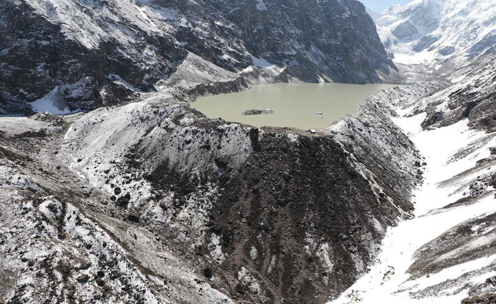
Undamaged: Tsho (Lake) Rolpa is considered one of the most dangerous glacial lakes in Nepal
The impacts stemming from the big earthquakes that struck Nepal earlier this year could have been much, much worse, say scientists.
An international team has just published a review of the events, showing the number of landslides was far lower than people had feared.
And the group could find no evidence of Himalayan glacial lakes suffering significant damage - a key concern.
The assessment has been published in Science magazine, external.
It has also been presented here in San Francisco at the Fall Meeting of the American Geophysical Union - the world's largest annual gathering of Earth scientists.
"There were a lot of surprises," said study lead Jeffery Kargel from the University of Arizona, Tucson.
"The nature of the earthquakes' influence on the landscape, from the largest scales to the smaller scales, was not really as we would have expected," he told BBC News.
Jeffery Kargel: "Few landslides, but some were nonetheless horrific"
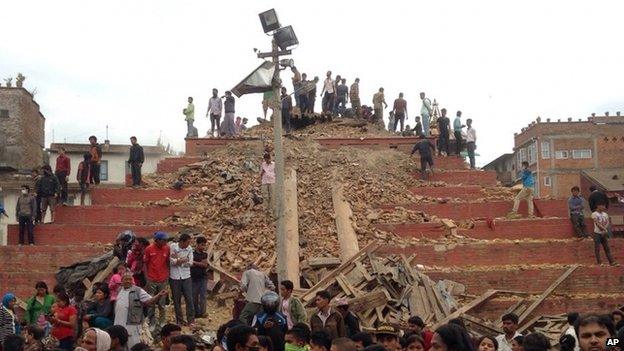
By any measure the Nepal quakes in April and May were devastating: more than eight and a half thousand people lost their lives.
But researchers believe that even this horrific outcome was slight compared with what could have happened.
The main Magnitude 7.8 tremor on 25 April buckled the Earth's surface, making a broad swathe of the high Himalayas slump down while lifting up the adjacent Kathmandu basin. This whole region was also shifted 2m to the south.
Scientists' immediate reaction was to expect many tens of thousands of landslides to be triggered, but a huge volunteer effort to scour satellite images could identify only 4,312.
Similarly, researchers thought that many lakes that had built up behind the rocky deposits of glaciers would be breached by the tremors, sending torrents of water down Nepalese valleys. However, satellite photos and subsequent on-the-ground inspections could find no serious damage.
Quite why this should be is still under study, but scientists think several factors could have contributed.
One concerns the nature of the shaking: although energetic, it was relatively smooth. Another idea is that the rock strength in the region may have been underestimated. Vegetation, like rhododendron forests, could also have played an underappreciated role in holding the landscape together.

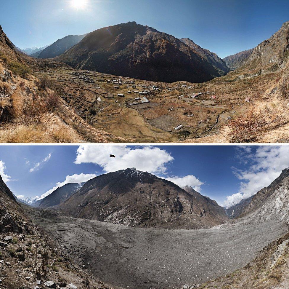
Langtang Valley: A comparison of before and after the landslide
None of this diminishes the awfulness of what happened. And the paper published in Science goes into some detail about what happened in the famous trekking village of Langtang, north of Kathmandu.
Here, some two million cubic metres of debris came down the mountainside.
Brian Collins from the US Geological Survey visited the aftermath: "It started off as a snow and ice avalanche somewhere above 5,000m and then slid over 1,000m before going off a cliff and into free-fall for about 500m; and that free-fall was really the damaging aspect of it.
"It had collected a lot of material on the way down and it landed directly on the village."
The scientists have calculated that the mass of snow, ice and rock hit the valley floor with the energy equivalent to half a Hiroshima nuclear bomb. That part of Langtang not buried was destroyed in an airblast, says Jeffery Kargel, the assessment's senior author.
"There's another part of the village that was completely blown away by the landslide or avalanche winds, which we estimate were somewhere in the EF-5 Tornado range, strong enough to completely blow away stone-slab hotels." More than 350 people perished at Langtang.

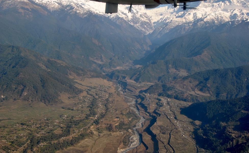
A bird's-eye view of the northern part of the Pokhara Valley and its deposits
But, again, even this extraordinary event is put into perspective by a companion paper published in Science magazine, external.
This details investigations of historic earthquakes in Nepal that occurred around 1,000 years ago. These tremors were likely Magnitude 8 events, or greater, and the landslides and debris movements they triggered completely transformed the landscape around them.
The team found that Pokhara, the second largest city in Nepal, is actually built on top of all this material.
Co-author Oliver Korup, from the University of Potsdam, Germany, said: "Most of it came from a high-lying mountain basin in the Annapurna Massif, 3,000m above sea level. And the debris spread out over nearly 150 square km, and invaded several river valleys up stream, against the flow direction, for up to 7km. [For comparison], the Downtown San Francisco area would be buried beneath at least 50m of debris."
Jonathan.Amos-INTERNET@bbc.co.uk, external and follow me on Twitter: @BBCAmos, external
- Published6 May 2015
- Published25 April 2015
