Weather experts say new El Niño possible later this year
- Published

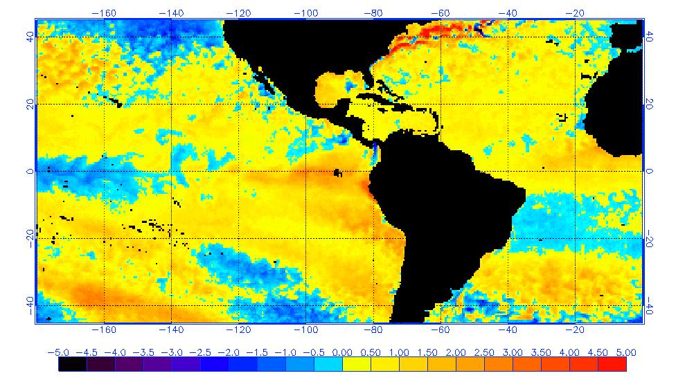
Sea surface temperatures off the coast of South America show above average readings near Peru
Scientists from the World Meteorological Organisation (WMO) say there is a possibility of a new El Niño event forming later this year.
In 2015 and 2016, a powerful El Niño drove up global temperatures and played a role in droughts in many parts of the world.
Normally the weather phenomenon only re-appears every two to seven years.
Neutral conditions are most likely later this year but there is also a 40% chance of a new El Niño forming .
The complex and natural weather event is marked by an upwelling of warm water in the Pacific that accumulates off the west coast of North and South America, causing stormy conditions locally.

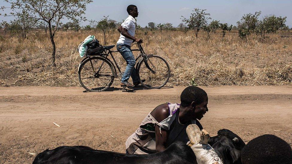
El Niño was believed to have played an important part in causing a drought in Malawi
The so-called "Super El Niño" of 2015 and 2016 is said by experts to have had a role in driving global temperatures to record highs.
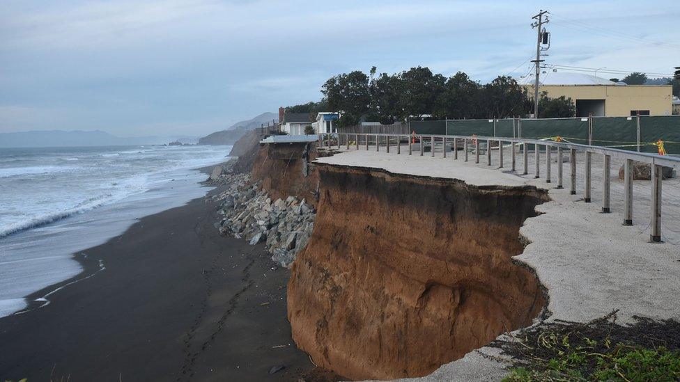
Earlier this week researchers detailed the impact of the event on winter beach erosion in California, which was 76% above normal according to the study, external.
However, the influence of El Niño is felt right around the globe, affecting monsoons in Asia and droughts in Africa.
Cooling off
Often after an El Niño, you get a marked reversal of conditions - a so-called La Niña event, external.
According to the WMO, the recent cooler ocean conditions were only intermittently indicative of La Niña, and in January this year they returned to a neutral state.
So weak was the overall impact that many scientists dubbed the event "La Nada" - which translates as "the nothing" in Spanish, the original source of the "La Niña" and "El Niño" terms.
Meteorologist Matt Taylor explains what El Nino is
However, off the coast of Peru there's a different picture.
Ocean temperatures in the region have increased by 1.5C above average, creating "a coastal El Niño", which scientists say could develop into a more widespread event although overall, neutral conditions are still more likely.
To achieve an official El Niño status, temperatures across a large part of the equatorial Pacific have to be at least 0.5 degrees above average and sustain for three months.
"It is a bit unusual but not completely unprecedented," said Dr Rupa Kumar Kolli from the WMO.

California suffered record levels of beach erosion as a result of El Niño
"At least for the fist half of this year, the neutral conditions will continue, if this coastal El Niño actually expands and becomes a typical El Niño, we will know that with more confidence after the spring."
Researchers say that by May they will have a far better picture. But they believe that given the potential impacts that an El Niño can bring, it is better to raise the possibility now so that authorities can be prepared.
"If actually the El Niño does take off, then it has a lot of implications for many of the monsoon regions," said Dr Kolli.
"It is associated with a weak monsoon in much of South and South East Asia - and drought in some parts of Africa. People should be aware of these possibilities."
Follow Matt on Twitter, external and on Facebook, external.