Space lasers to track Earth's ice
- Published
Thorsten Markus on IceSat-2's laser: "We make a measurement every 70cm"
With new space missions come new and improved capabilities. And for those interested in what's happening to the ice on Planet Earth, we have two ventures this year that are going to make a major contribution to our understanding.
Ice is the "climate canary". The loss, and the rate of that loss, tell us something about how global warming is progressing.
In the Arctic, the most visible sign is the decline of sea-ice, which, measured at its minimum extent over the ocean in September, is reducing by about 14% per decade, external.
At the other pole, the marine floes look much the same as they did in the earliest satellite imagery from the 1960s, but land ice is in a negative phase.
Something on the order of 160 billion tonnes are being lost annually, with most of that mass going from the west of the White Continent.
The two 2018 missions of interest that will pick up these trends and extend them into the future are Grace Follow-On, external and IceSat-2, external.
The former is the successor to the highly successful US-German gravity spacecraft that operated from 2002 to 2017.
Grace is actually a pair of satellites that pursue each other around the globe in formation with a separation of 220km.
They accelerate and decelerate in turn as they pass over variations in the local gravity field. It is a very small effect - a change in distance equivalent to the thickness of a human hair - but discernible to the microwave ranging instrumentation carried on the satellites.
Because the gravity variations are a function of changes in mass, the pair are able, literally, to weigh the ice sheets sitting below them on land as they pass overhead.
Its from the first Grace mission's observations, for example, that we know Greenland is currently losing about 280 billion tonnes of ice to the ocean every year, external.
It's a significant contribution to the 3.4mm per annum rise in global sea levels, external.
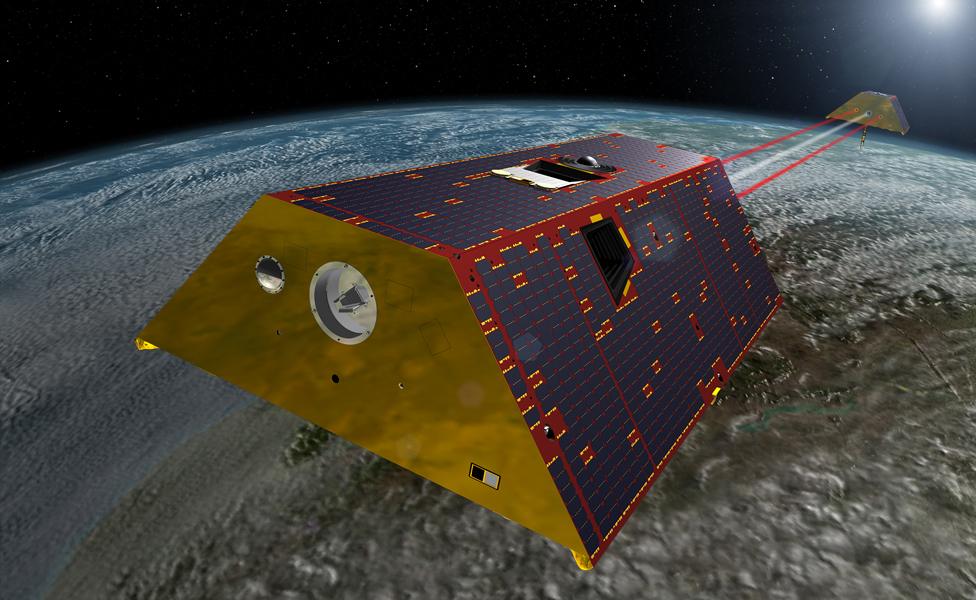
Grace-FO will use microwave and laser-ranging as it passes over ice fields
Grace Follow-On will work in the same way as its predecessor did, but it will also demonstrate a laser range-finder.
"It's a first in space, and it allows us to do the ranging with much higher precision - a factor of 10 to 20 times better," says US space agency (Nasa) deputy project scientist Felix Landerer. "So, we go from that human hair thickness down to the scale of large viruses."
Stop and think about that for a second - measuring the distance between London and Sheffield to the accuracy of the width of a large virus.
This impressive German laser technology will form the basis of the orbiting instruments that will eventually be used to detect the cataclysmic collisions of the biggest black holes in the cosmos. Stay tuned. That mission to sense gravitational waves - it's called Lisa - will launch in the 2030s.
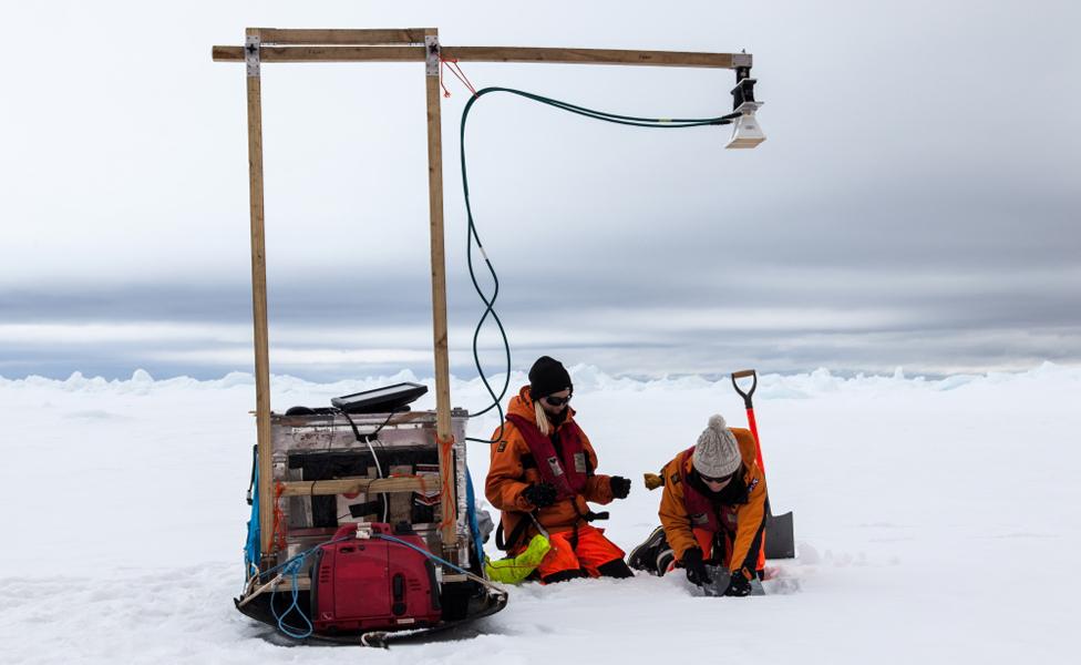
Dr Tilling (L) has been testing how deeply radar penetrates into the snowpack
Back here on Earth, the other ice project this year also involves a laser. IceSat-2 will fire six green beams of light at the Arctic floes and land ice-sheets to measure their shape.
Simple but effective: the satellite times the return of the reflected beams and converts that into a range, which in turn is converted into an elevation.
Again, the new satellite is a successor. The previous effort in the 2000s, known as IceSat-1, showed remarkable promise as an ice-sensing tool. However, its mission was blighted by fragile diode technology, and it could only use its laser for a handful of months a year.
"IceSat-2 is a micro-pulse laser," says Nasa project scientist Thorsten Markus. "The strength of the laser pulses is much, much smaller than it was on IceSat-1, and we also have a very high pulse repetition frequency of 10kHz. Basically, the laser is always on, which makes it much less stressful on the diodes.
"We've had some diodes running [in test form] for seven, eight years now. So, conceptually, one laser should last a whole mission of seven years and we have two lasers onboard," he told BBC News.
The hope is IceSat-2 will be up and operating before Europe's ageing CryoSat mission, external dies.
CryoSat has been pursing very similar objectives, except its "tape measure" is a radar altimeter.
A period of overlap would allow for an inter-comparison. This is not wholly straightforward. The laser on IceSat and the radar on CryoSat don't range to exactly the same surface.
In the former's case, the light beams are reflected off the very top of any snow covering the ice. In the latter's case, the radar can penetrate the snowpack for many tens of centimetres, depending on conditions, before scattering back to the spacecraft.
Scientists have to use modelled assumptions based on the regional climatology to account for any bias.
"It's an important consideration," says CryoSat scientist Anna Hogg from Leeds University, UK.
"If you get an extreme melt year, you can actually get a new ice layer forming in the snowpack as water trickles down from the surface and refreezes. That's what happened during 2012 when the whole of Greenland experienced melt.
"Afterwards, CryoSat saw a step change in elevation equivalent to a 0.5m increase just because the scattering horizon had risen. It made it look like Greenland had grown ice, whereas in reality it had very probably lost mass."
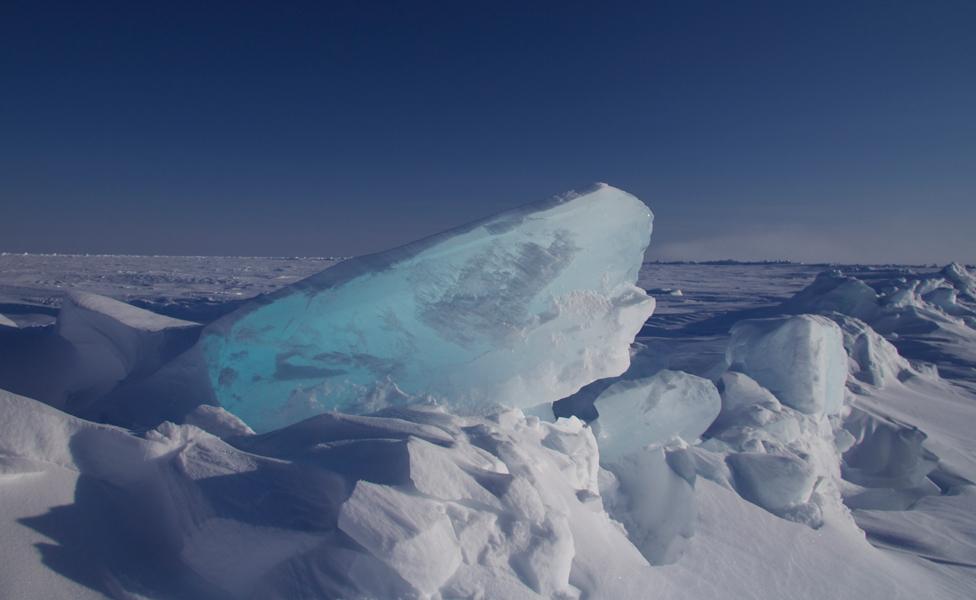
IceSat-2, like Cryosat, will measure the thickness of sea-ice
Dr Hogg has just returned from Antarctica where she has been drilling cores to try to understand better the layering in the snowpack and its influence on the radar's return signal.
She did this as CryoSat flew overhead, in addition to an aeroplane equipped with two types of radar ranging instrument. One used the same radio frequency (Ku-band) as Cryosat; the other used a higher frequency (Ka-band) which should scatter a lot closer to the actual surface of the snowpack.
The thinking in Europe is that if CryoSat has a follow-on, it should be dual, Ku-Ka band to try to get a more direct measure of the amount of snow lying on top of the ice. This would be particularly important for sensing sea-ice thickness.
In the Arctic, CryoSat does this by measuring the height (the freeboard) of the floating ice sticking just above the ocean water and then calculating the corresponding submerged (the draft) ice. It is roughly 1/9th above and 8/9ths below.
"That becomes problematic in the Antarctic where the snow can be so heavy that it compresses the ice to the point that it's sitting at the water-line; in other words, there is no ice freeboard," explains Leeds colleague Rachel Tilling.
While Dr Hogg was examining snow-layering conditions on land in recent weeks, Dr Tilling was doing the same with the marine floes surrounding Antarctica.
She's hopeful that the data gathered as she cruised across the Weddell Sea will lead to some of the first robust satellite sea-ice thickness maps for the region. And, certainly, this effort should be greatly assisted in the short-term if IceSat and the existing CryoSat can also run alongside each other for a good period of time. That's because the differences in how each senses the surface would lead to a much improved description of snow loading, too.
"It's a new opportunity that we haven't had before and can only mean we will get more accurate sea-ice thickness measurements. That's exciting," Dr Tilling told BBC News.
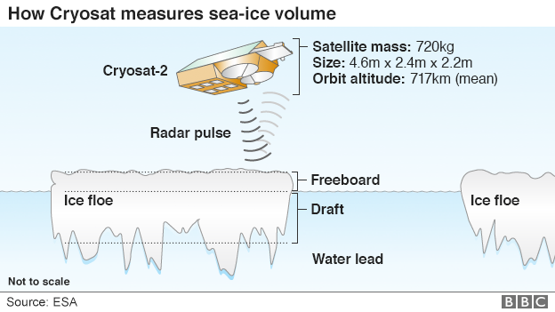
Cryosat's radar has the resolution to see the Arctic's floes and leads
Some 8/9ths of the ice tends to sit below the waterline - the draft
The radar senses the height of the freeboard - the ice above the waterline
Knowing this 1/9th figure allows Cryosat to work out sea-ice thickness
The thickness multiplied by the area of ice cover produces a volume
IceSat-2 will do exactly the same as Cryosat but with a laser instrument
Jonathan.Amos-INTERNET@bbc.co.uk, external and follow me on Twitter: @BBCAmos, external