GEBCO-NF Alumni robots win ocean-mapping XPRIZE
- Published
Jyotika Virmani: "Some in the industry said what we were trying to do was too audacious"
A robotic boat and submersible have won the XPRIZE to find the best new technologies to map the seafloor.
The surface and underwater combo demonstrated their capabilities in a timed test in the Mediterranean, surveying depths down to 4km.
Put together by the international GEBCO-NF Alumni team, external, the autonomous duo are likely now to play a role in meeting the "Seabed 2030" challenge, external.
This aims to have Earth's ocean floor fully mapped to a high standard.
Currently, only 20% of the world's sub-surface topography has been resolved to an acceptable level of accuracy.
A new wave of robots is needed to map the ocean floor
"The global scientific community has come together to try to meet this challenge, but if we're going to achieve it then we will need new technologies," said Dr Jyotika Virmani, the executive director of the Shell Ocean Discovery XPRIZE.
"Through this competition, I think some of those technologies are now ready. Some are more robust than others but with a little more R&D I believe we will have a slew of different approaches, which is the way we've got to do this," she told BBC News.
The GEBCO-NF (Nippon Foundation) Alumni team was always a strong favourite to win the $7m (£5.5m) Shell Ocean Discovery XPRIZE, external. Its members all had extensive experience in the relevant fields.
The group triumphed by packaging an existing, state-of-the-art solution with a novel twist.
So, while its HUGIN autonomous underwater vehicle (AUV) is an established industry tool for echo-sounding the depths, its uncrewed surface vessel (USV) that deployed and recovered the sub was developed specially for the competition.
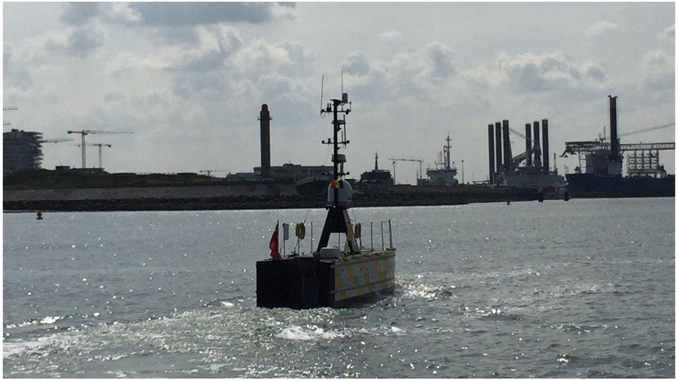
This boat, called Sea-Kit Maxlimer, was designed in Essex, UK.
It actually made headlines in another setting three weeks ago by carrying oysters and beer between Belgium and England - the first ever commercial cargo run across the North Sea by a water-going robot.

A number of teams also competed to track a simulated pollutant in the water

All the teams that made it to the Mediterranean final were asked to despatch their un-piloted vehicles to a competition box some 15 nautical miles (28km) from the Greek port of Kalamata.
On arrival, the chosen technologies had just 24 hours to make an extensive, high-resolution (5m or better) bathymetric (depth) map; and take multiple pictures of the seabed.
The GEBCO-NF Alumni team covered 278 sq km in its allotted time, returning more than 10 images of identifiable geological features.
At a gala ceremony in Monaco on Friday, the group was presented with the Grand Prize winner trophy and $4M. The runner-up, the Kuroshio team from Japan, external, was awarded $1m.
Dr Rochelle Wigley, the project coordinator for the Alumni, said the prize money would be reinvested into the development of future ocean-mapping initiatives.
"We want to test our system in different environments, in other deep oceans. We're looking to do an off-shore mapping project around the UK in the next six months, and then hopefully do a transatlantic crossing with Sea-Kit within a year," she told BBC News.

Team Tao likes to think of its BEMs as the "cubesats of the oceans"
As part of the competition, the XPRIZE also ran a separate trial in collaboration with the US National Oceanic and Atmospheric Administration (NOAA).
This got teams to "sniff out" a simulated pollutant in waters off Puerto Rico and track it to its source.
The prize was split between junior high school team Ocean Quest, external from California, claiming $800,000 as the winner, and Tampa Deep Sea Xplorers, external, from Florida, taking $200,000 as runner-up.
Both managed to lock on to the pollutant (in reality just a harmless dye), but neither quite managed to trace its origin in the time permitted.

Some of the deepest waters in the Mediterranean are off the Greek coast
The XPRIZE organisers sprang something of a surprise at their Monaco gala by announcing an additional "Moonshot Award" worth $200,000.
This went to the British-based Team Tao, external, which was set up by Tyneside-based subsea engineering specialist Soil Machine Dynamics Ltd (SMD) and Newcastle University.
Team Tao did not meet the minimum criteria for success in the Mediterranean final, but the judges believed its highly innovative approach should nonetheless be marked out for special praise.
The group has developed "Bathypelagic Excursion Modules" (BEMs) - or as team-members like to call them: "the cubesats of the ocean". It's a reference to the miniaturised technology now emerging in the realm of space exploration
Deployed from a USV, these are compact, low-cost, torpedo-like devices that descend and ascend in the water, using their echo-sounders to map the seafloor as they move across a grid. But their up and down manoeuvres enable the modules to also sample the water column.
Team Tao envisages equipping the BEMs with multiple sensors.

Most of what we know is the result of low-resolution satellite mapping
Better seafloor maps are needed for a host of reasons.
They are essential for navigation, of course, and for laying underwater cables and pipelines.
They are also important for fisheries management and conservation, because it is around the underwater mountains that wildlife tends to congregate. Each seamount is a biodiversity hotspot.
In addition, the rugged seafloor influences the behaviour of ocean currents and the vertical mixing of water.
This is information required to improve the models that forecast future climate change - because it is the oceans that play a critical role in moving heat around the planet.

The Sea-Kit boat and its Kongsberg Hugin AUV will now be tested in other ocean basins
Jonathan.Amos-INTERNET@bbc.co.uk, external and follow me on Twitter: @BBCAmos, external
- Published9 May 2019