Satellite will gain hi-res view of greenhouse effect
- Published
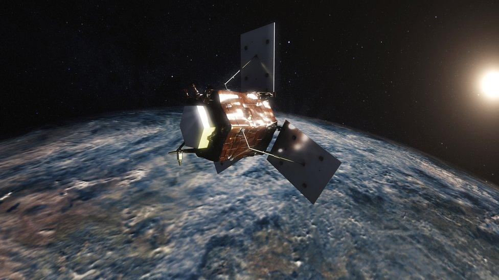
Artwork: UK based companies have been advising on the best way to build the satellite
Europe will launch a satellite to obtain a high-resolution view of Earth's greenhouse effect.
The Forum mission will carry a spectrometer to sense the far-infrared radiation coming up off the Earth.
It's in this long wavelength portion of the electromagnetic spectrum that water vapour and carbon dioxide absorb energy very efficiently, warming the planet in the process.
Remarkably, it's not a region that has been mapped extensively before.
This means scientists are missing a number of key features in their climate models, including the detailed workings of some of the feedbacks in the planet's atmosphere that amplify or mitigate warming.
These omissions would include the behaviour of certain types of cloud.
"Satellite missions up until now have mostly measured wavelengths in the mid-infrared - that's shorter than 15 microns," explained Dr Helen Brindley from Imperial College London and the UK National Centre for Earth Observation.
"We're now looking to measure longer than 15 microns which has never been done before from space, with very high accuracy and with what we call very high spectral resolution which means we can really see the fingerprints of different gases in the atmosphere, particularly water vapour, and really get an idea of how the energy is changing with time," she told BBC News.
Forum is an acronym that stands for Far-infrared Outgoing Radiation Understanding and Monitoring.
The satellite concept was selected for development on Tuesday by delegates to the European Space Agency's (Esa) Earth observation programme board at a meeting in Frascati, Italy.
It falls in the organisation's Earth Explorer class. These are experimental missions that do novel science in areas of pressing environmental interest. Forum would be the ninth in the series.
It is expected to go into orbit on a Vega rocket around 2025 or 2026. The budget is targeted not to exceed €260m (£230m).
The project has strong UK scientific support, led from Imperial, but also considerable industrial engagement.
The British arms of Airbus and Thales Alenia Space are directing the two consortia currently advising on the best way to build the half-tonne spacecraft.
Dr Helen Brindley from Imperial College London explains how Forum will work
Earth's surface temperature would be many degrees below zero were it not for its atmosphere.
Incoming shortwave radiation from the Sun is absorbed at the surface and re-emitted at longer wavelengths, in the infrared.
In the absence of water vapour, carbon dioxide and other greenhouse gases in the air, this energy would pass straight back out into space.
But the molecules of these gases trap the radiation, warming the planet. And most of that absorption, more than 50%, occurs in the far-infrared.
Meteorological satellites routinely observe at mid-infrared wavelengths to get an idea of where water in the atmosphere will build into new weather fronts. But given the significance of water vapour to the greenhouse effect, it begs the question why the far-infrared is not also routinely being mapped.
That comes down to technology, says Esa's Dr Hilke Oetjen. The necessary innovations have only recently become available, and even though such observations are now possible, Forum will still have to spot map the atmosphere as it circles the globe at 7km/s.
"The problem is not the spectrometer instrument; it's the detectors. They're relatively new," explained the agency's Forum project scientist.
"We also have to use this 'step and stare' technique. We need that because we're integrating (the information) for seven to eight seconds for one measurement, which is an enormous amount of time given how fast a satellite flies."
Step and stare will see the satellite sample a 15km-wide spot in the atmosphere about every 100km. Nonetheless, this should give a very good picture of the far-infrared energy budget across the entire globe every month. If the mission operates for its initial four-year period, Forum will capture all the seasonal and inter-annual behaviour that the scientists need to start to improve their models.
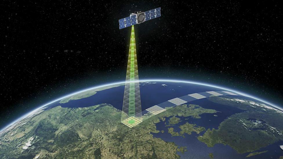
The satellite will "stare" at a spot for a few seconds before "stepping" to the next sampling location
The work should ultimately take out some of the uncertainty that currently surrounds the projections of future climate change.
This will come from a better representation of features such as ice clouds in the models.
"We've effectively tuned our models of what cirrus clouds look like to the measurements we have in the mid-infrared and the visible, said Dr Brindley.
"What I suspect we'll find is the models are not necessarily right for the far-infrared and we'll have to adjust those models with improved understanding of things like the size and shape of ice crystal particles. That will probably have implications for whether those clouds are heating or cooling the planet."
Beth Greenaway, the head of Earth observation and climate at the UK Space Agency, welcomed the selection of Forum.
She said: "Thanks to investment from the UK Space Agency, Britain could be a big player in this mission and the 'go ahead' from Esa was based on fantastic science from Imperial College London and the cross-European Mission Advisory Group, supported by detailed technical mission feasibility from studies led by UK industry teams.
"The selection of Forum - over some other very credible missions - is a real indication of the strength of the UK's Earth Observation capability which spans across universities and companies."
Jonathan.Amos-INTERNET@bbc.co.uk, external and follow me on Twitter: @BBCAmos, external
- Published16 September 2019
- Published5 September 2019
- Published14 January 2020
