Tonga eruption: Robot boat to map explosive volcano's aftermath
- Published
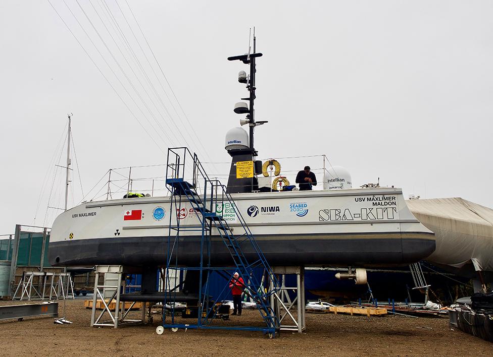
Sea-Kit's USV Maxlimer is prepared for despatch to the Pacific
The UK is sending a robot boat to survey the Tonga underwater volcano that blew its top in January.
Hunga-Tonga Hunga-Ha'apai's eruption caused one of the fiercest volcanic explosions in more than a century as gas-rich magma met cold seawater.
It sent a plume of ash and vapour halfway to space and generated a tsunami that swept across the Pacific.
The uncrewed surface vessel will gather data to help researchers understand precisely what happened.
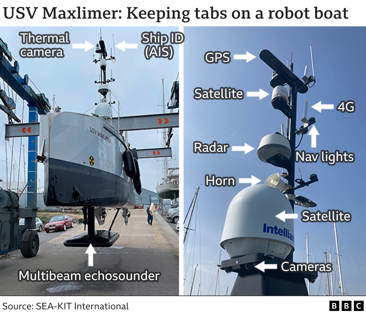
Called Maxlimer, the 12m-long robot based in Essex, England, will spend several weeks directly on top of Hunga-Tonga's submerged opening, or caldera, mapping its current shape.
It will also lower cameras and instruments to measure environmental conditions, such as the oxygen content of seawater and its turbidity, or cloudiness. These are factors that would impact marine life.
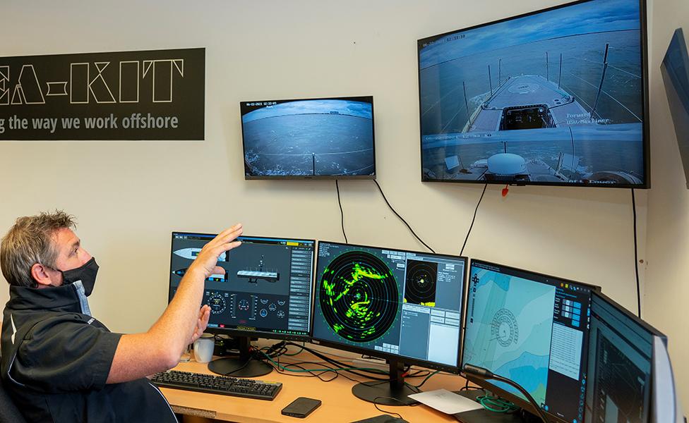
Maxlimer can be controlled from anywhere on the planet via satellite
Sea-Kit International, external, the small British company that developed Maxlimer, is able to monitor and control the USV from anywhere. And during its survey, to take place in June, mission operations will be run out of the firm's headquarters in the village of Tollesbury on the Essex coast.
That's a separation of 16,000km (10,000 miles). It's all done over satellite.

The project is being funded by the Nippon Foundation of Japan and organised by New Zealand's National Institute of Water and Atmospheric Research (NIWA), together with Seabed2030, which is an international effort to properly chart Earth's ocean floor.
NIWA will begin the investigations around the volcano this month using its Research Vessel Tangaroa.
It will deploy a multitude of instruments to measure water properties and to retrieve samples from the seafloor.
But the crewed ship will not be permitted to spend extended periods over the caldera. Only Maxlimer will be allowed to do that - for obvious reasons.
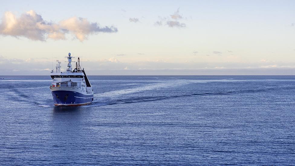
NIWA's RV Tangaroa will set sail next week to begin the survey project
"Other vessels taking part would struggle to get health and safety sign-off. But an uncrewed surface vessel can do 'the dull, the dirty and the dangerous'; and this is potentially quite dangerous," explained Wendy Hems, the mission lead for Sea-Kit.
"Obviously, we don't want to lose Maxlimer but it's safer for people to do it this way and we're going to get a lot of data because of it," she told BBC News.
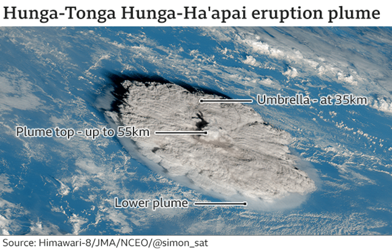
Hunga-Tonga Hunga-Ha'apai began erupting at the end of 2021. The explosion unleashed a few weeks later on 15 January was astonishing.
It touched literally every corner of the globe as atmospheric waves spread out in all directions to complete a full circumnavigation.
Scientists continue to debate the energy involved in the blast but by most measures it was at least as powerful as the 1991 eruption of Mount Pinatubo in the Philippines, and may even have got close in scale to the catastrophic 1883 Krakatoa event in Indonesia.
Certainly, the volcanic plume was seen to climb to incredible heights by satellites - to at least 55km (35 miles) in altitude. The so-called Kármán line, which is often quoted as the atmospheric boundary with outer space, is at 100km (60 miles).
Of course, for the Kingdom of Tonga, it was the effects on people and property that mattered.
"The tsunami ran up to 15m (50ft) above sea level, and inundation was up to 1,700m (a mile) inland," said Taaniela Kula, of the Tonga Geological Services.
"These waves in one evening destroyed over 600 structures, including at least 300 residential houses, displacing 1,525 persons and causing four deaths. As a country we're building back slowly. We hope this research will help in an effort to protect our nation and others like us in the future."
Scientists think the ferocity can be explained in part by the relatively shallow depth of the seawater covering the caldera, which was about 200m at the time.
This was just enough to drive strong interactions with molten rock when it rose up into the caldera. If the water was much deeper, its weight would have suppressed activity.
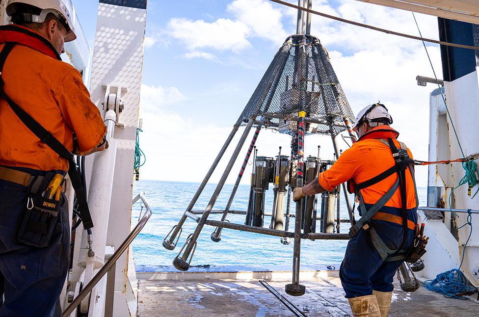
Scientists will take core samples to assess the changed nature of the seafloor
The Tonga Eruption Seabed Mapping Project (TESMaP) is keen to learn what the opening to the volcano looks like now.
It's possible that some portion of the volcano's flanks collapsed in the eruption. Almost certainly there were sediment slides. Such movements could have been generators for the tsunami.
Both RV Tangaroa and Maxlimer will deploy echosounders to trace the depth and shape of the seafloor at high resolution.
The volcano has an elevation of some 1,800m from the ocean bed. By the time the two vessels have surveyed the seamount, they will have acquired data across at least 8,000 sq km (3,000 sq miles).
Between New Zealand and Tonga there are 76 undersea volcanoes that run along the seafloor ridge known as the Kermadec Arc. Eighty percent of these volcanoes are known to be active.
Kevin Mackay is a marine geologist with NIWA and will lead the Tangaroa cruise.
He said: "When Hunga-Tonga Hunga-Ha'apai erupted with tragic and devastating results, we knew we were going to have to rewrite the science books to understand what happened on 15 January. Through this project, we will gain in-depth knowledge of the post-eruptive changes and the marine environment around Hunga-Tonga because our understanding currently is poor, especially in the deep ocean."
