UK storms: Mapping the floods
- Published
With the UK being hit by a series of storms, flood waters continue to rise in parts of the South and West. The maps below highlight the impact of the latest severe weather.
On Wednesday 12 February hthe Met Office issued its first "red warning" of 2014, with winds of more than 100mph forecast.
The storm left tens of thousands of homes without power and caused severe travel disruption, with rail services badly affected and some roads closed.
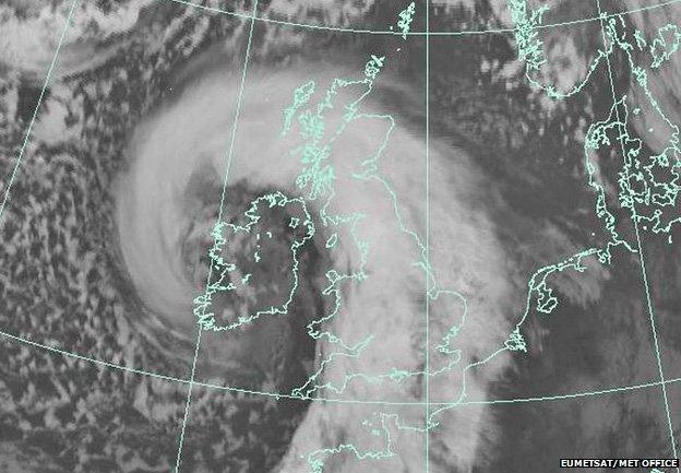
This satellite image from the Met Office shows the storm over the UK at 13:00 GMT on Wednesday
Meanwhile, river levels continued to rise, with a number of severe flood warnings in place for Berkshire, Surrey and Somerset, and hundreds of less serious flood warnings and alerts for other parts of the country.
Severn and Wye
The River Severn and the Wye Valley have been affected, with Worcester and Gloucester particularly badly hit by flooding from the Severn.

Thames Valley
Major flooding began to hit the Thames Valley from 8-9 February, with the River Thames breaking its banks along large stretches from Oxford to Kingston-upon-Thames, in Greater London.
Among the worst-affected places are Staines, Chertsey, Shepperton, Egham and Wraysbury, with others still on severe flood warnings.
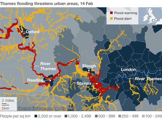
The flooding is affecting heavily populated areas and hundreds of people have been evacuated from homes in Surrey.
Some places along the Thames are predicted to see the highest river levels in more than 60 years.

Reading and Maidenhead
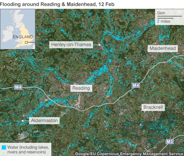
The European Commission's, external emergency management service Copernicus, external released satellite images on 12 February showing the extent of flooding around Reading and Maidenhead in Berkshire.
The image below shows bodies of water in the area, including rivers, lakes and reservoirs.
Somerset
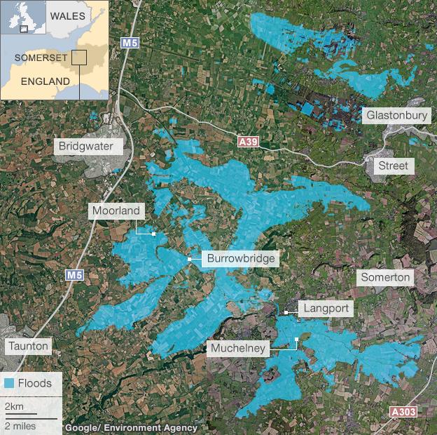
A major incident was declared in the Somerset Levels on 24 January, and the water has continued to rise in places, with the village of Moorland now mostly evacuated.
Prime Minister David Cameron has announced a £10m fund to assist farmers, who have been forced to relocate their livestock.
More rain ahead
BBC forecasters say the equivalent of a month's rain is expected to fall in parts of southern England over the next few days.
January 2014 was the wettest for more than 100 years, and if rain continues to fall forecasters predict this winter could become the wettest on record.
.gif)
Groundwater flooding
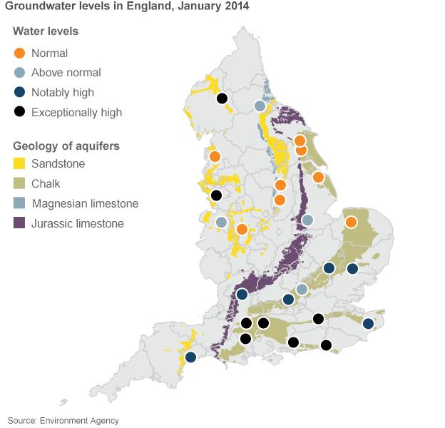
All this rainfall has resulted in record measurements for groundwater levels in some parts of the country.
There is now an increasing risk of groundwater flooding, where water seeps up through the ground because the earth is so saturated it cannot hold any more.
Groundwater flooding could begin to affect areas not near rivers but above underground aquifers, and scientists warn that the risk of flooding could continue for weeks or even months.
