RAF's Sentinel spy plane used for floods mission
- Published
Jonathan Beale joined the crew of the Sentinel over the Thames Valley
Sergeant Chris Bradbury of the RAF's Five Squadron gives us the obligatory safety briefing before takeoff.
Pointing to the location of the life vests and life raft he quips that given an emergency it might be more likely than normal that we will be landing on water.
These are though extraordinary times.
Never before has the RAF's most sophisticated "spy" plane been tasked to map flooding.
Nor is it normally deployed operationally over the UK. The Sentinel usually flies over war zones.
In Afghanistan it has been used to track the movement of insurgents in support of British and Nato troops. It flew over Libya to scent out Colonel Gaddafi's forces.
More recently it flew over Mali in support of French forces sent to prevent the country falling into the hands of Islamist extremists. For the crew that is "normal". This is not.
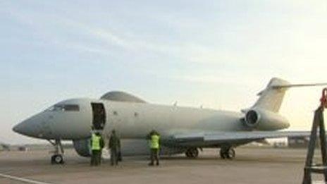
The Sentinel is more usually used over war zones
But the mission, though in part carried out to help train crew, is much closer to home, in every sense.
As we follow the course of the Thames, Sergeant Kev Crowhurst of the Army Intelligence Corps mentions that he has a grandmother and aunt living close to the river.
His aunt's house has already succumbed to the waters. His gran is just managing to stay dry. Sergeant Crowhurst adds: "This is personal."
Powerful sensors
They are more than pleased to be helping map the scale of the flooding in the hope that their intelligence can help with the relief efforts on the ground.
The airframe of the Sentinel is just like the executive jet favoured by billionaires and rock stars.
But instead of the luxury fittings, the leather seats and gold taps, it has been stripped to the bare essentials and loaded with powerful sensors and banks of computers.
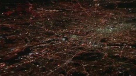
The plane's specialist mapping system captures the River Thames flowing through London
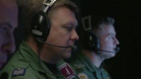
RAF sergeant Chris Bradbury hopes the intelligence will help with relief efforts on the ground
Its distinctive lumps on the top and bottom of the aircraft carry radar and communications equipment.
Once the plane's Synthetic Aperture Radar is switched on they can scan an area of more than 500 square miles in less than 10 minutes.
It also uses a Moving Target Indicator. Designed originally to identify tanks and armoured vehicles, in this scenario it can be used to follow vehicles to see which roads can still be passed.
And all this at night time. The radar works in both day and night and can see through clouds.
We are not allowed to film the monitors for security reasons. But they show detailed black and white imagery of the ground eight miles below.
Vast swathes of land
Even an untrained eye like mine can make out trees and hedges as well as the partially submerged roads and railway lines.
A skilled image analyst, and there are three on board, can see much more.
Back at base more analysts will pore over the data and add colour to show where the water is rising. That data can then be used by the civil authorities on the ground to identify where best to focus their efforts.
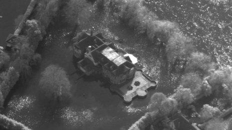
The RAF's Tornado jets have also been carrying out missions to capture highly detailed aerial pictures of the floods
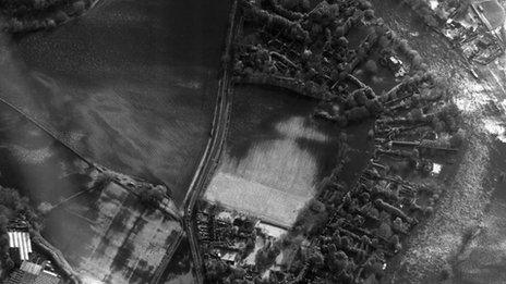
The Tornado's images help to build up a picture of areas worst hit by the flooding
Flight Lieutenant Jim Mackareth, the Mission Commander, says that unlike helicopters and lower flying aircraft the Sentinel can cover vast swathes of land in a matter of minutes.
During tonight's five hour flight they will have mapped out the Thames Valley, the Somerset Levels and then tracked the flow of the river Severn.
That is thousands of square miles. Jim is hoping for more work in the future. To make their intelligence really count they would need to fly over the same area again to track the ebb or flow of the floodwaters.
The adrenalin may not be coursing through the crew's veins in the same way that it did during their mission over Libya just a few years ago, when they were hunting down Scud missiles.
But they know this work can help save lives too. It might also help secure their own future.
The RAF Sentinel is currently due to be retired at the end of combat operations in Afghanistan - another of the defence cuts identified in 2010.
But one that might now get reversed.
- Published14 February 2014
- Published14 February 2014
- Published13 February 2014