Storm Franklin hits UK with flooding and high winds
- Published

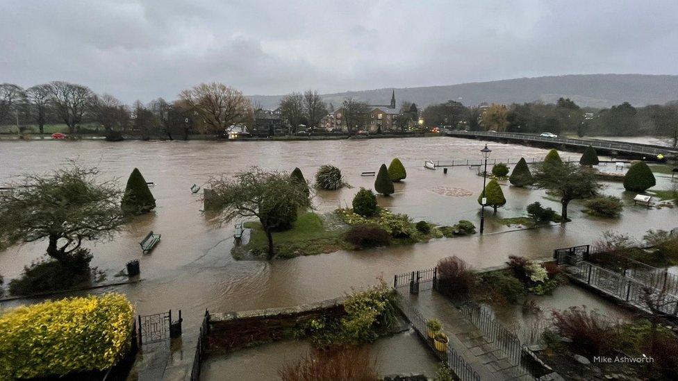
The River Wharfe in Otley, West Yorkshire, after bursting its banks
Storm Franklin has hammered parts of the UK with strong winds and heavy rain.
There is severe flooding in parts of Northern Ireland and flood warnings remain in place across England, Scotland and Wales.
"Severe disruption" means Network Rail is advising customers to check before they travel on the railways.
Franklin comes days after Storm Eunice killed three people and left 1.4 million homes without power.
The highest wind gust speeds on Monday morning reached, external 79mph in Capel Curig in Wales, and 78mph in Orlock Head, Northern Ireland. On Sunday night, 87mph was recorded at the Needles on the Isle of Wight.
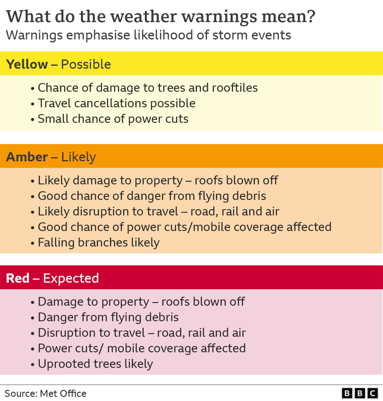
The Met Office issued two weather warnings, external for earlier on Monday: an amber warning for wind in Northern Ireland, and a milder yellow warning for wind covering Wales, Northern Ireland, most of England and parts of south-west Scotland.
Storm Franklin is the third named storm in a week - following Dudley and Eunice - the first time this has happened since the storm-naming system was introduced in 2015.
Windy conditions at Birmingham Airport
On Monday evening, UK Power Networks said, external it had restored electricity to 98% of properties across east and south-east England but 8,500 remained without power.
Energy minister Greg Hands said power outages were a "horrible thing" to happen to households and lessons would be learned for the energy network.
He said: "Quite often very significant lessons do get learned - the 105 emergency number for power outages was a lesson learned from a previous storm."
Manchester Airport diverted nine flights on Monday morning because of storm winds. It is understood the planes were holding to land before being diverted, but the airport says the weather has not affected departures.
British Airways has said winds made it difficult to unload baggage from its planes - causing delays for passengers after landing. The airline has also struggled to land and restock planes on time, affecting inbound and outbound movements.
Elsewhere, the O2 arena in London will remain closed until Friday, when a UB40 concert is expected to go ahead as planned, after Storm Eunice shredded sections of the roof.

'I wouldn't rule out another named storm'
George Goodfellow, from BBC weather, says the forecast for the rest of the week is best described as unsettled: "We're expecting further spells of wet and windy weather for most of the coming week, and some parts of the UK will see strong winds at times.
"It looks as though the strongest winds will generally be towards the north west of the UK. Whether the winds will be strong enough to warrant the Met Office naming another storm is a bit uncertain.
"Warnings are usually issued based on the risk of disruption/hazardous weather, so I think the question is will it become significantly windier than normal. If so then warnings are likely, and I wouldn't rule out a named storm."
Storms have been more frequent in the last week because of a strong jet stream running across the Atlantic and the UK - the coming week sees the jet stream move "a little further north".


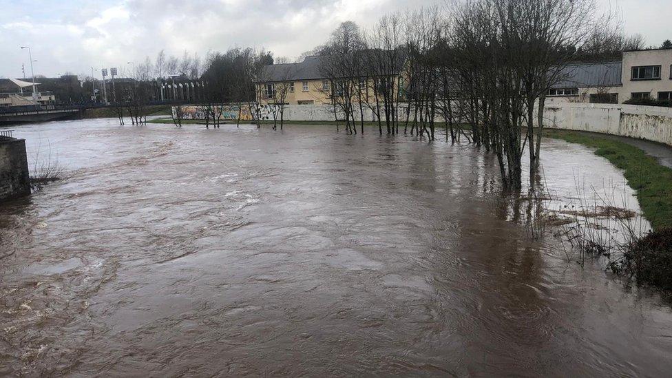
Northern Ireland has seen severe flooding with locals trying to prevent rivers from bursting their banks
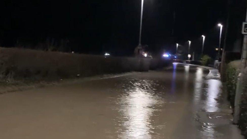
In Northern Ireland, heavy rain has caused severe flooding, with counties Londonderry and Tyrone the worst hit.
Northern Ireland Electricity said at the peak there were 10,000 homes without power during the early hours of Monday morning - that number has now fallen to around 330.

A car is left covered in foam in Portstewart, County Derry
Parts of the River Severn and the Bristol Channel coast are on flood alert and emergency teams have erected flood barriers to try to stop the waters from reaching homes.
County councillor Karl Lewis said Llandinam in Powys, central Wales, had been left looking like a "disaster zone".
The M48 Severn Bridge is now open in both directions, external, while QE2 bridge at Dartford has also reopened.
National Rail is advising customers to check their routes before travelling.
CrossCountry trains, which runs services from Aberdeen, through Birmingham and to the South West, is "strongly recommending" that people do not travel on Monday.

Flooding played havoc at Rotherham Central station
Great Western Railway (GWR) and South Western Railway joined CrossCountry trains and "strongly" advised against travel on Monday, and said disruption on routes are expected.
Southeastern railway withdrew its "do not travel" advice but warned its customers that they should expect delays and allow extra time for their journeys.
Chiltern Railways warned, external disruption will continue into Tuesday morning, "including trains and carriages being in the wrong places". It said customers should only travel on Monday "if their journey is absolutely essential".
In West Yorkshire, the Thackley railway tunnel closed due to flooding.
And Rotherham Central station will remain closed until at least Tuesday, external - a picture shared by Leeds City Station on Twitter shows the extent of the track flooding.
Allow X content?
This article contains content provided by X. We ask for your permission before anything is loaded, as they may be using cookies and other technologies. You may want to read X’s cookie policy, external and privacy policy, external before accepting. To view this content choose ‘accept and continue’.


GRAVITY DEFYING TRICKS: James Woods introduces possibly the greatest skier you've never heard of
BOOST YOUR BRAIN: Find out how to banish brain fog with these free and simple steps

- Published20 February 2022

- Published19 February 2022
