UK weather: Why have there been so many storms this year?
- Published

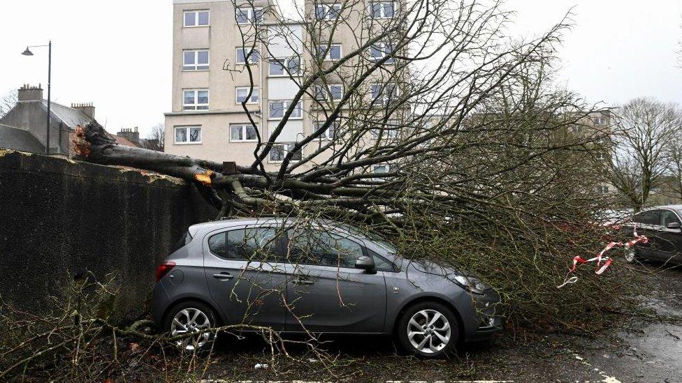
Storm Isha brought chaos to the UK and led to at least two deaths
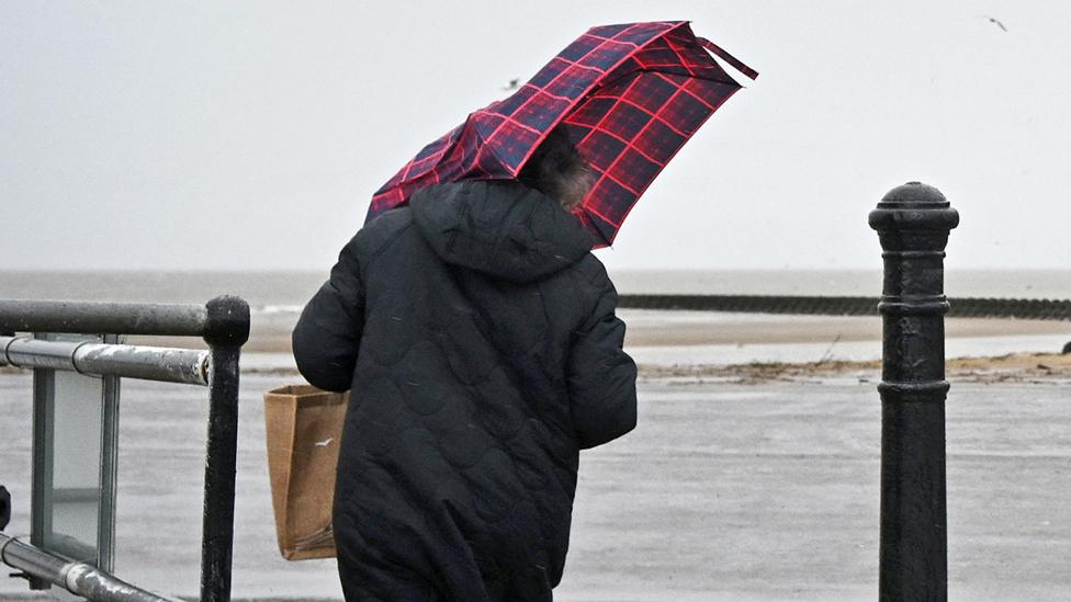
It has been a particularly stormy autumn and winter so far.
Since August, we have had at least one named storm a month affecting the UK. December brought three and there have already been three in January: Henk, Isha and Jocelyn.
Jocelyn is the 10th named storm of the season and comes hot on the heels of Isha, which killed at least two people.
In a typical UK autumn/winter, there would be six or seven named storms - getting to the letters F or G.
The current storm season has brought the most named storms since 2015/16, the season the Met Office started naming storms. That season we got up to the letter K, with Katie the 11th and final storm.
However, even if the number of named storms this winter goes on to surpass 2015/16's total, we still will not be able to say we have had the UK's most active storm season.
That is because the winter of 2013/14 was the wettest on record and was considered to be the stormiest period for two decades. As we were not naming storms at that time, we cannot confidently compare this year to the years before 2015.
Not every storm season brings a named storm. There were none during the autumn and winter of 2022/23. We had to wait until August 2023 before Storms Antoni and Betty were named.
The trouble with comparing storms
Comparing storminess year on year is not straightforward, especially as we have only eight previous storm name lists to look at.
This is because there is no strict criteria that must be met by the Met Office, Met Éireann or the Royal Netherlands Meteorological Institute, who work together to name the storms that affect us.

If two more storms are named, 2023-24 will have had the most since records began
The decision to name a storm is down to the potential impact the weather may bring. For example, a storm system could be forecast to bring 70mm of rain in a short period of time, but it will only be named when it has the potential to cause disruption or damage, like flooding.
But, if it had been drier previously, that rainfall might not lead to flooding so that weather system may well not be named.
Why has it been so stormy this year?
The main driver for storms is a powerful jet stream - fast moving winds high in the atmosphere - which meanders west to east across the Atlantic.
Areas of low pressure and storm systems develop on the movement of the jet stream and are directed to the UK.
The jet stream itself is influenced by the temperature contrast between the Pole and mid-latitudes. Over the last few weeks, very cold Arctic air has spread across the United States, leading to a big temperature difference, allowing a powerful jet stream to generate storms.
We can also look at the bigger global picture.
Suzanne Gray, Professor of Meteorology at the University of Reading, says: "The number of storms that impact us each year can be influenced by meteorological phenomena occurring elsewhere across the globe such as the current El Niño event in the tropical Pacific region."
El Niño is associated with warmer-than-average sea surface temperatures in the Pacific that can affect weather across the world.
It is thought El Niño tends to bring wetter and windier weather in autumn and the start of winter to the UK, before a period of colder than average weather.
Interestingly, the last El Niño period was 2014 to 2016, the last time we had so many autumn and winter storms in the UK.
What about climate change?
We know climate change is making our weather more extreme so that when it rains, that rain tends to be heavier with a greater chance of flooding.
It is more difficult to link storms to climate change because "there are several different influences that are likely to be affected by climate change", says Professor Gray.
She says: "There is some evidence though that storms with strong winds (windstorms) will become slightly more frequent in the future in north-west Europe and also become more clustered, so that we experience several storms one after the other".
How many more storms might there be this winter?
Forecasts going into the first week of February suggest we will see something a little more settled in our weather patterns so the risk of a Storm Kathleen coming our way is currently low.
Beyond that forecasts become more tricky and are made with lower confidence.
There are suggestions the calmer weather will continue through February with temperatures about average but there are also some signals of the weather turning much colder.
You can read more about that in the BBC Weather monthly outlook.
Related topics
- Published24 January 2024
- Published22 January 2024