Flooding could 'sever' Bristol's transport network
- Published

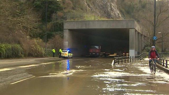
Flooding caused by high tides, such as this one in 2014, could become more frequent in Bristol
Bristol's transport network could be "severed" by flooding, a report says.
The city council has been warned that climate change could cause problems on the road network, leading to city centre "gridlock".
A report presented to a cabinet meeting on Tuesday said 30,000 properties in Bristol could be vulnerable to flooding by the end of the century.
Councillors signed off the outline business case for building £255m in new flood defences along the River Avon.
Critical infrastructure such as roads and railway stations could become affected by higher tides and stronger storms, the report said.
It went on to say that more than 1,000 homes and businesses near the city centre and about 400 properties in neighbouring areas are currently at risk of being flooded "in either a severe river or tidal flood from the River Avon".
This would "sever" the region's transport network and cause gridlock in the city centre, it added.
It is thought that Bristol's transport network, from the Portway and riverside arterial routes to Bristol Temple Meads railway station underpass, could sometimes become impassable due to flooding.
"By 2130, all major roads around the station will be subject to flooding more than once a year on average," the report added.

Hartcliffe in Bristol was hit by floods in 2016
It is proposed that about nine miles (15 kilometres) of new flood defences need to be built, with raised defences set to be constructed along the River Avon from Swineford to the east of the city, through the centre and out to Shirehampton.
Construction for the project, expected to cost £255 million, will begin in 2029 and will end in 2036.
Bristol City Council, the Environment Agency and the West of England Combined Authority (Weca) will work together to build the flood defences.
The report added: "Climate change is increasing sea levels and peak river flows meaning that widespread flooding of central Bristol is likely to become relatively frequent.
"Storms can increase flows coming down the river or can force tidal water to surge up the Severn Estuary. Large parts of Bristol's centre are vulnerable to the River Avon overtopping low spots and also causing water within the harbour to flood properties.
"The predominant flood risk and potential for the most severe damage to much of the city centre is from high tides combining with storm surges.
"This forces water up the river, overtopping many low spots around the harbour and causing the Floating Harbour to flood properties."

Roads around Bristol Temple Meads station could be hit by future flooding, the report said

Follow BBC West on Facebook, external, X, external and Instagram, external. Send your story ideas to: bristol@bbc.co.uk , external
Related topics
- Published6 January 2024
- Published10 November 2023
- Published3 January 2014