Flood-risk homes and roads in Cornwall mapped out by scientists
- Published

Sand dunes at the popular tourist beach Crantock, Newquay, have become much more dangerous in 2024
Coastal roads, car parks and even buildings may need to be moved in coming decades due to the impact of climate change, scientists have said.
A £6m research project in Cornwall is using "cutting edge modelling" to predict how sand dunes will retreat.
The modelling should then be applicable to coasts elsewhere.
The aim was to allow space for dunes to "evolve naturally", help people prepare and avoid "inappropriate development", project leaders said.

Surf coach Peter Abdell said he was worried about his business "disappearing"
Peter Abell said he was worried about his north coast business and family home one day being lost to the sea.
The owner of King Surf surfing school at Mawgan Porth said: "The biggest concern for me is the business disappearing... and the second concern is the property. We don't want to lose our family home.
"And one of my biggest concerns is the road," he added.
"We understand this road should never have been put there in the first place... But, because there is a main road running through here, there are businesses and it is the hub of the community. I think we should do everything we can to protect it."

Mawgan Porth is one coastal community which could be at a greater risk of flooding in future decades
Prof Gerd Masselink, who is leading the project Making Space For Sand, external, said: "Dunes and beaches will retreat, and that might be 30, 40, 50 meters in the next, sort of, 50 years.
"If there's anything in the way of that retreat, then it will have to be moved.
"Usually they are car parks, caravan parks, those sorts of things; and sometimes it's houses."
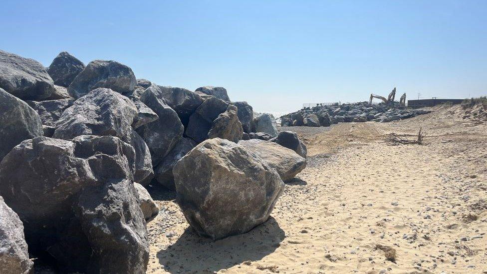
He added: "There might be some some cases where where the decision might be to protect... but the option is not to protect the whole coastline - there's simply not enough money to do that."

Researchers are gathering data at beaches using drones
The project is gathering data at 40 beaches over five years to predict how dune systems will evolve under the "increasing strength of storm events" associated with climate change, as well as sea level rise.
Cutting-edge computer modelling is aiming to draw "almost a line on the map" showing where Cornwall's coast was likely to be in the next 100 years, project staff said.
The findings will be provided to planning teams making decisions on future development around the coast.

The research is gathering drone footage of dunes at Perranporth
Kit Stokes, senior research consultant, said: "The coastline does a very good job of protecting us - sand dunes are like a giant sea wall effectively... and they will only be able to do that if we give them the space to evolve naturally.
"I could see how it might seem controversial to let nature take its course. But, really, the ultimate goal of the project is to help build community resilience to future flooding.
"What we really want to avoid is hotels and houses and businesses being built right on the coast - those are areas that are going to change drastically."
He said there were several seaside communities in Cornwall, such as Polzeath, Mawgan Porth and Perranporth, which would see "more and more nuisance flooding in coming decades and, maybe over the next 100 years, more catastrophic flooding".

Dominic Walford from the fire service surveys the steep dangerous sand dunes
Nick Bennett, landlord of the Merrymoor Inn, said: "I think we should put in defences as best we can, but the government hasn't got millions and millions of pounds to just chuck at things.
"What we need to do is look at how we stop the rising sea levels - that's what we've got to do first."
The project is one of 25 nationally which have been funded by Defra as part of the £200m Flood and Coastal Innovation Programme, which is managed by the Environment Agency.

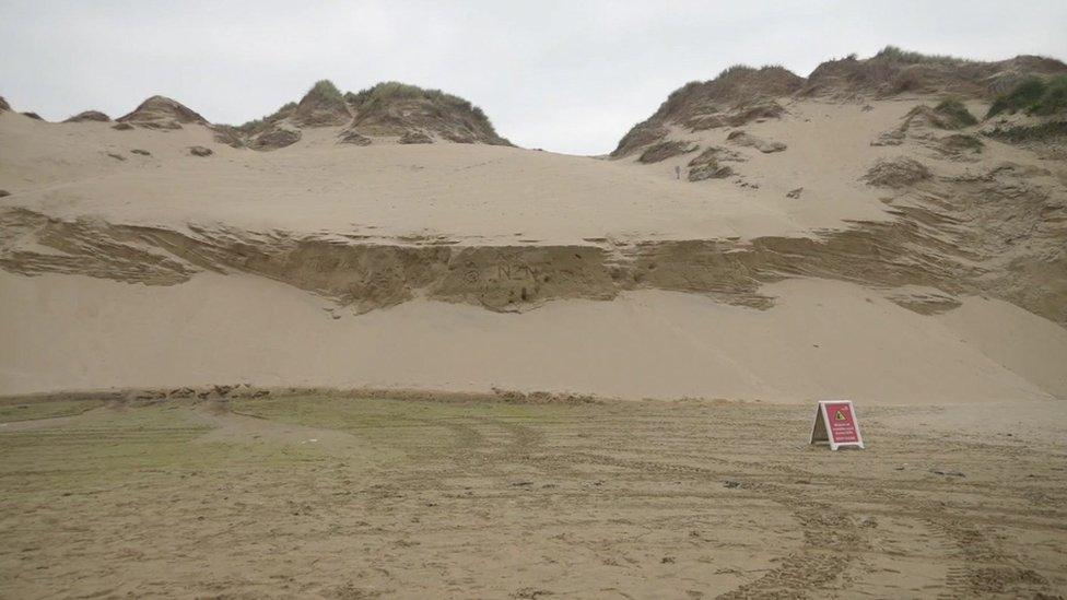
The main beach dune entrance has been closed at Crantock due to erosion making it liable to collapse
A spokesperson for Cornwall Council, which the project is being delivered through, said: "We are engaging with a number of coastal communities and coastal landowners to help identify and co-design ways in which we can adapt and become more resilient to climate change while maintaining vibrant coastal communities."
The council added that Making Space for Sand was working alongside several existing policies and strategies, including the government's National Flood and Coastal Erosion Risk Management Strategy, external and the Shoreline Management Plan for Cornwall, external.
At some beaches there is a different kind of imminent danger.
Steep sand cliffs at Crantock near Newquay had become "much more dangerous" in 2024 as tides continued to race higher and cut into the surface, experts said.

Historic farm boundaries have been revealed in the cliff face at Crantock
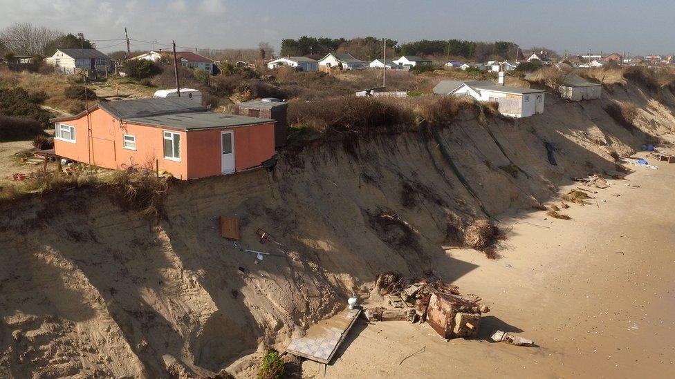
It is estimated the dunes have receded by up to 30ft (9m) in a year, causing several main access routes to the beach to be closed.
Dominic Walford, from Cornwall Fire and Rescue Service, said: "The waves are coming much higher up the beach, they're eroding the cliffs and eroding the sand dunes, particularly this year; much, much more than previous years."
Mr Walford warned that beach-goers were often too close to "very dangerous dunes".

Holidaymakers Carol and Steve said they were grateful of their warning
Carol and Steve Macgillivray, who were on holiday from Birmingham, were recently warned during a beach visit about they danger of the spot they initially decided to take.
Mr Macgillivray said: "Very understandable... We should have known better."
Mr Walford told the BBC: "If the dunes do come down, you could quite easily have 10, 15 tonnes of sand on top of you very, very quickly. We could easily have a fatality."
Agencies including the fire service, RNLI, UK Coastguard, Crantock Surf Life Saving Club and landowners the National Trust have stepped up warnings, with signs, patrols, posts on social media, fliers and posters in the town.
The pattern of erosion began following storms in 2014 and the dunes are now the most dramatically eroding in the south west of England, scientists said.
People were regularly spotted close to the sand cliffs despite warnings, they added.

Follow BBC Cornwall on X (formerly Twitter), external, Facebook, external and Instagram, external. Send your story ideas to spotlight@bbc.co.uk, external.
- Published9 May 2024
- Published2 May 2024
- Published4 April 2024
- Published2 October 2023
- Published26 May 2023
- Published31 January 2023