Whaley Bridge: How well was the dam maintained?
- Published
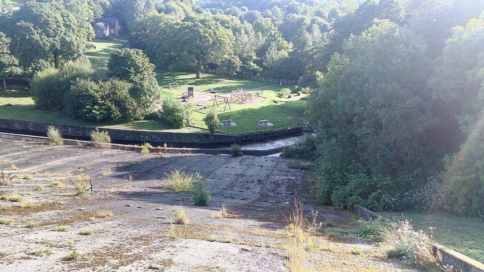
One resident said the dam has been "very overgrown" in the past few years
Photographs showing weeds growing on Whaley Bridge's dam have prompted some to question whether the spillway was maintained properly.
One resident, who lives near the dam, sent the BBC photos - taken in 2016 and 2017 - which he said showed concrete with "vegetation growing out of it".
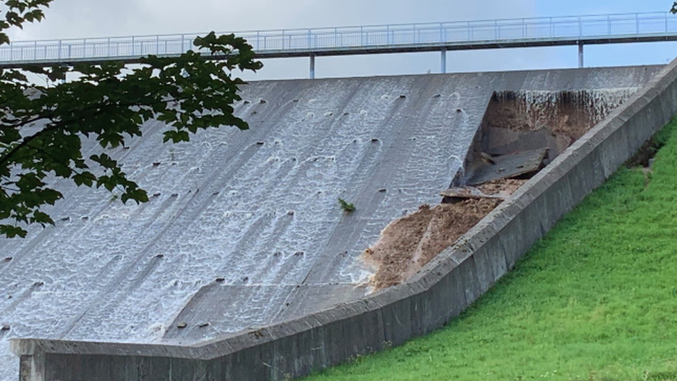
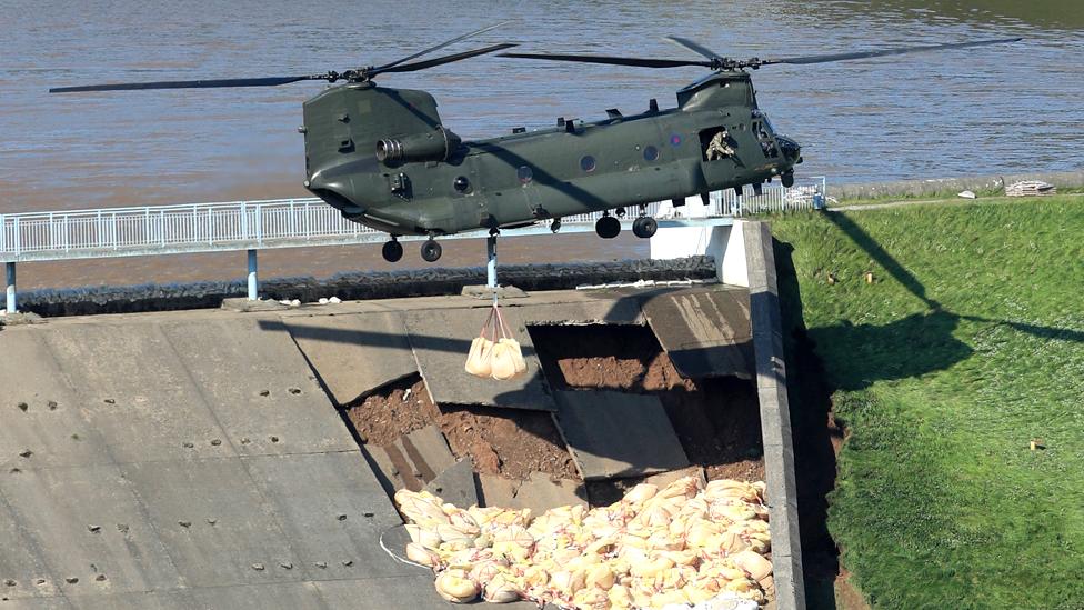
Hundreds of people were evacuated from the town last week when heavy rain damaged the auxiliary spillway.
It is designed to channel overflowing water away from the reservoir.
The BBC has asked several experts to analyse the pictures.

'Some sort of ingress of water'
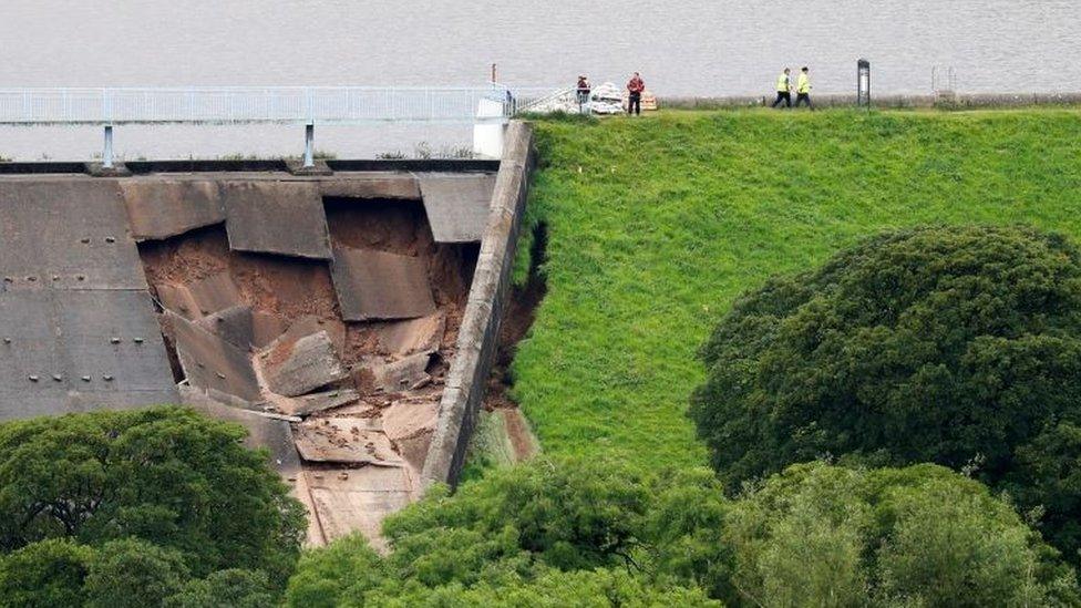
Roger Meredith thinks water could have got underneath the concrete slabs
Roger Meredith was a construction engineer at Tarbela dam in Pakistan. This is an earth-filled dam like the one at Toddbrook Reservoir but is much bigger - 2,743 (1.7 miles) long compared with Toddbrook's 200m (0.12 miles) length.
He thinks the presence of vegetation on the spillway is not a good sign.
"It isn't good because whatever vegetation is there, its roots are going through the joint of the slabs or where the slabs are cracked," he said.
"There has to be some sort of ingress of water there somehow."
He said concrete slabs on water-retaining structures should have "water bars" in between the joints to stop water being able to get through. However, he was not able to see any bars in photos of the collapsed spillway.
"It looks like the slabs are not reinforced with steel," he said. "There has been ingress of water either through cracks or through the joints between the slabs.
"Somehow water has got in under the slabs and popped the slabs off."
Toddbrook Reservoir: Footage shows fast-flowing water before collapse
Mr Meredith also thinks there is a problem with the design of the auxiliary spillway.
"When you look at the spillway the side kicks in, it's not straight. So you are increasing the amount of water trying to get down that side," he said.
This is the same side of the spillway where residents have seen water flowing down and pooling in the past. It is also the same side that collapsed.
He added: "Vegetation in itself is not a major concern. It does obviously demonstrate that water could penetrate the spillway slab. Water penetrating the spillway slab is the reason the slab failed."

What must inspectors do?
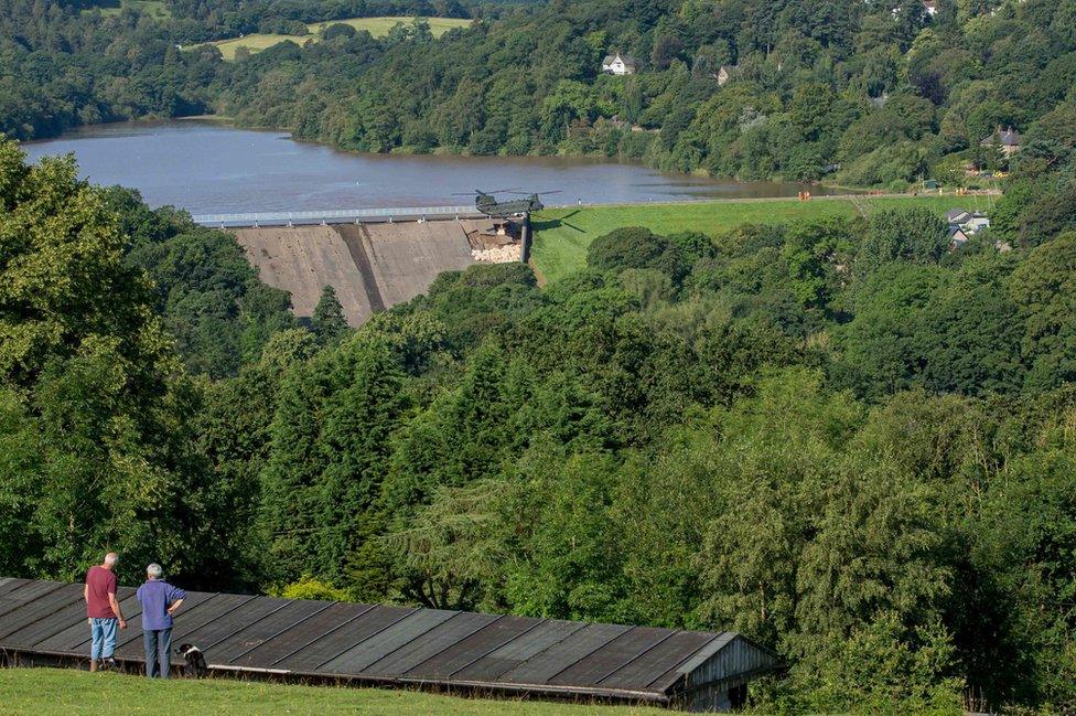
The Canal and River Trust said the dam was "absolutely fine" when inspected in November
All reservoirs in England and Wales with a capacity above 25,000 cubic metres above ground level must comply with the Reservoirs Act, external.
Every dam must have a supervising civil engineer and an inspecting civil engineer to file annual safety reports to Defra, according to Richard Coackley, former president of the Institution of Civil Engineers.
"That's part of an Act of Parliament that goes back 100 years," he said.
The Canal and River Trust said the annual inspection of Toddbrook Reservoir in November was "absolutely fine".
This coincided with an independent inspection taking place every 10 years, and the trust said this was fine too.
"Our engineers also inspect the reservoir twice-weekly and this is how we picked up the problem," said a spokeswoman.
Scotland has its own, separate, Reservoirs Act, which requires owners to file safety reports with the Scottish Environment Protection Agency.

'Vegetation is an issue'
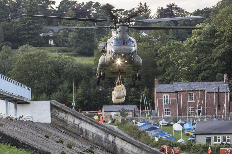
Photos taken after the collapse show vegetation growing out of the auxiliary spillway
Dr Panagiotis Michalis has been researching dams since 2010 and has assessed several in the UK as part of consultancy work through the University of Strathclyde.
He believes dams are a "ticking bomb" because of their ageing infrastructure and thinks incidents like the one at Whaley Bridge will become more common.
"In the UK the majority of the dams are more than 100 years old. That means they've exceeded their design lifespan," he said.
"Back then their design standards didn't take into account future climatic conditions that are happening now, so they have an outdated design."
He described the vegetation in the photos as a "yellow flag".
"Vegetation is an issue in dams, especially if this vegetation is coming out of concrete panels like the ones of this particular dam," he said.
"The vegetation might have opened ways inside the concrete, allowing water to infiltrate inside its clay core that has led to erosion."
However, he said the vegetation "does not look to be so extensive" and the collapse of the dam "cannot be attributed just to vegetation, but probably a number of factors".
One of these factors, he believes, was the dry weather followed by heavy rainfall.
"The problem is we are passing from extreme dry periods where the reservoir is very low, to extreme rainfall events and flooding which fills the reservoir very quickly," he said.
"The water level fluctuations of the reservoir have a significant impact on the deformation of these dams."

What do the photos show?
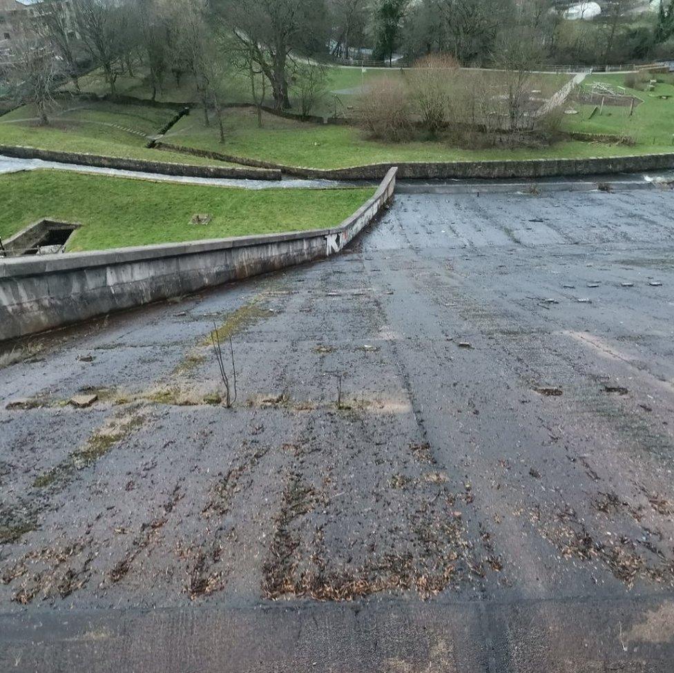
This photo shows vegetation growing through the side of the auxiliary spillway, which has since collapsed
In one of the pictures, vegetation can be seen growing out of the concrete slabs on the side of the spillway that has partially collapsed.
The auxiliary spillway is much newer than the rest of the dam, and is thought to have been added in 1969. Water does not normally flow over this spillway in large quantities, so its effectiveness has not been tested until now.
The BBC spoke to two people who live near the dam, both of whom said they had been concerned for years about the condition of the structure.
One said: "Everybody has been concentrating on it [the collapse] being global warming, but I think the biggest factor in all of this is the absolute lack of maintenance of the dam".
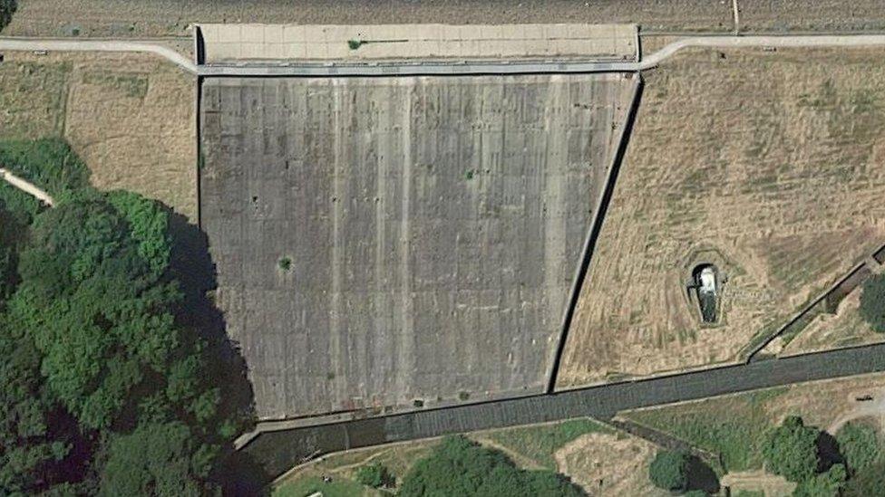
Vegetation can be seen on the spillway in this Google Earth image
Images from Google Earth show there was still vegetation growing out of the concrete slabs earlier in 2019. Photos taken after the collapse also show vegetation growing out of the remaining slabs.
One resident said the spillway was not level and water pooled in the area which has now failed.
"You would always see water in that part of the dam," he said.

'No cause for concern'
Rachel Pether is a dam engineer who carries out safety inspections of reservoirs.
"As an All Reservoirs Panel Engineer I would say that there is nothing in the photos that would cause me concern, and nothing that would indicate that the dam is not being maintained properly in general," she said.

Concrete blocks 'misaligned'
Manousos Valyrakis, a lecturer in water engineering at the University of Glasgow, said the presence of vegetation indicates moisture may have gathered around that area, and if water gets through this could lead to internal erosion.
"The potentially extended presence of high water pressure for a long enough time may lead to seepage through very small soil openings," he said.
"As this is extended further, more water can go through, opening the soil voids even more."
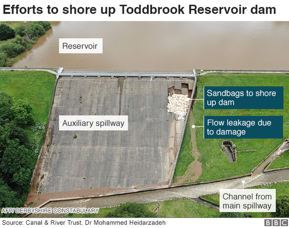
However, he thinks the collapse is more likely to have been caused by "hydraulic destabilisation of the spillway's surface".
"The video I saw before the failure of the spillway, showing it overflow, could possibly indicate a misalignment of the concrete blocks comprising the spillway," he said.
"Due to increased hydraulic forces this misalignment could increase, leading to the catastrophic failure we saw."

Inspection 'signed off'
The Canal and River Trust (CRT), which owns the dam, said it adhered to regulations, external requiring reservoirs to be supervised, inspected and maintained by certified reservoir engineers.
"This includes regular, detailed 10-yearly inspections carried out by an independent Panel Engineer and CRT Supervising Engineer," it said in a statement.
"The last one was undertaken in November 2018 and signed off by the independent Panel Engineer and CRT Supervising Engineer in April 2019.
"As you would appreciate, currently our focus is on managing the situation on site and drawing the water level down and stabilising the dam.
"Understanding historical inspections and maintenance is clearly important and will be part of our ongoing response to this event."

Follow BBC East Midlands on Facebook, external, Twitter, external, or Instagram, external. Send your story ideas to eastmidsnews@bbc.co.uk, external.
- Published4 August 2019
- Published3 August 2019

- Published3 August 2019
- Published2 August 2019

- Published6 August 2019
- Published2 August 2019

- Published2 August 2019
- Published1 August 2019
