CoastSnap to track coastal erosion in south-west England
- Published
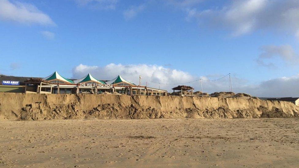
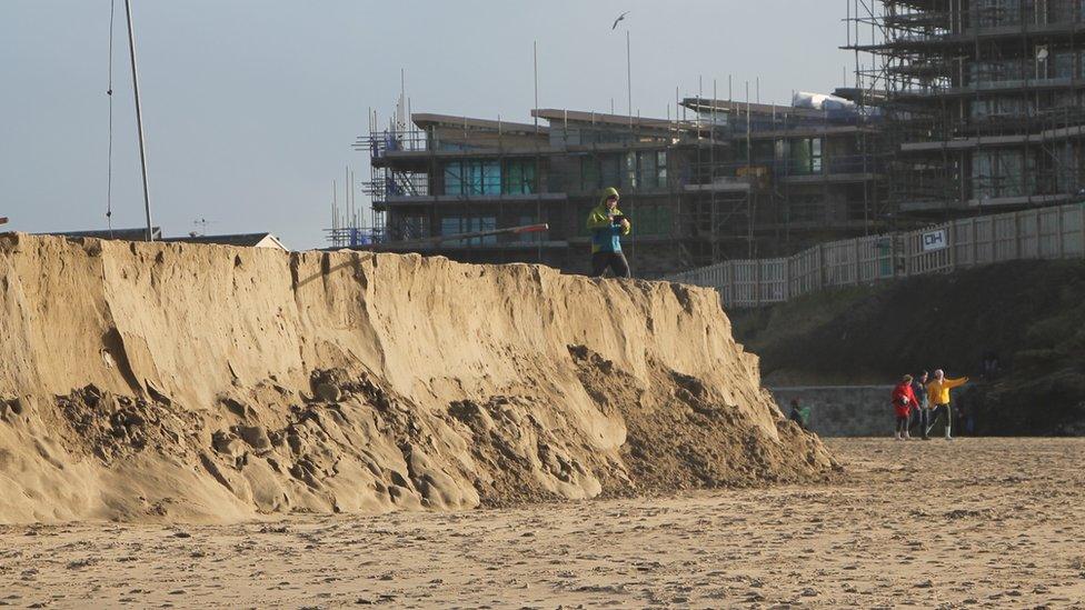
Dramatic sand cliffs appeared at Perranporth beach in Cornwall after storms in 2018
Hundreds of beachgoers' smartphone photos are being gathered to track the impact of rising sea levels and climate change.
About 10 mobile phone mounts are being installed at key points across south-west England, for people to take pictures then upload them to a website.
The data, gathered by Plymouth Coastal Observatory (PCO), will be used to help authorities shape beach management.
It was a "fantastic idea" to engage people, the Environment Agency said.
Dawlish Warren in Devon, Porthmeor in St Ives, Cornwall, and West Bay in Dorset are among those to have the mounts.
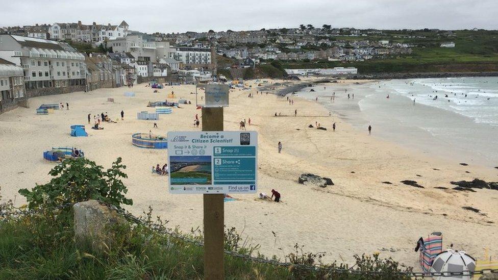
Porthmeor beach in St Ives hosts one of the mobile phone mounts
The Environment Agency has secured funding from the South West Regional Flood and Coastal Committee for the CoastSnap project, which was inspired by a successful scheme in New South Wales, Australia, PCO said.
It aims to collect photos taken across varying tidal stages, linking beach erosion to weather conditions, the seasons and storms.
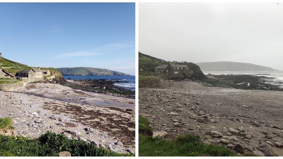
The project will compare beaches in spots such as Wembury in Devon in different seasons and tidal stages
Joseff Saunders, Coastal Process Scientist from PCO, said: "Coastal erosion is a very real problem and it is going to become more apparent going forward."
He said seven phone stations had been put in place in 2020 after a pilot in 2019 and two to three more should be installed before the winter.
"It just exploded this summer after lockdown. Lots of people were out and about and we were getting upwards of 30 to 40 photos submitted a day. A couple of weeks ago we passed the 1,000 mark," he said.
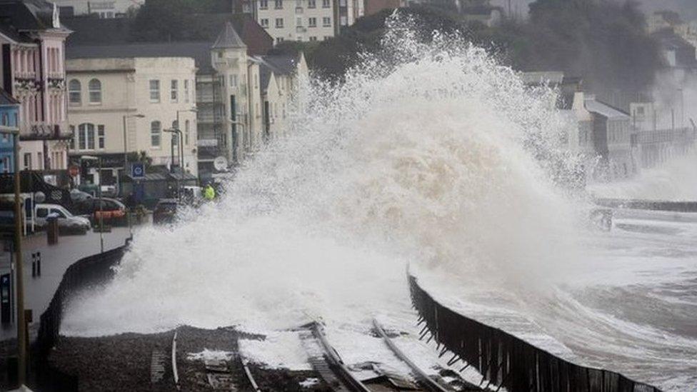
Dawlish Warren, in south Devon, has been chosen as a project location. Storms severely damaged sea defences and the main railway line at nearby Dawlish in 2014
An Environment Agency spokesman said: "We hope the data gained through CoastSnap will help us see how sea level rise and climate change are starting to impact our coast, and that they will enable us to make appropriate decisions about how to respond to these pressures in the future."

Where to find a CoastSnap Station
Perranporth, Cornwall
Porthmeor, St Ives, Cornwall
Westward Ho!, North Devon
Dawlish Warren, South Devon
Wembury, South Devon
East Beach, West Bay, Dorset
West Beach, West Bay, Dorset
More stations are due to follow.
- Published28 September 2020
- Published9 September 2020
- Published30 July 2020
- Published3 July 2020
- Published18 December 2019
- Published4 January 2018
