Ventnor: Cracks and movement monitored at landslip site
- Published
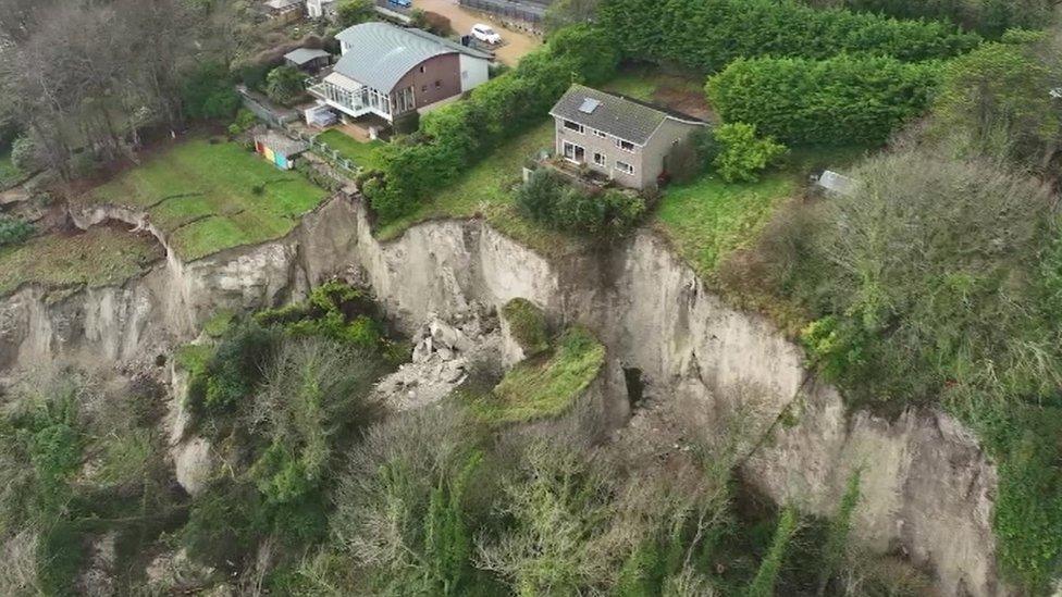
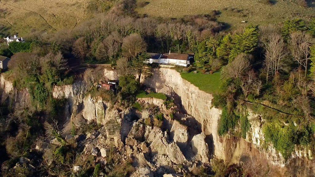
Huge chunks of the cliffs have come away in the landslip at Ventnor
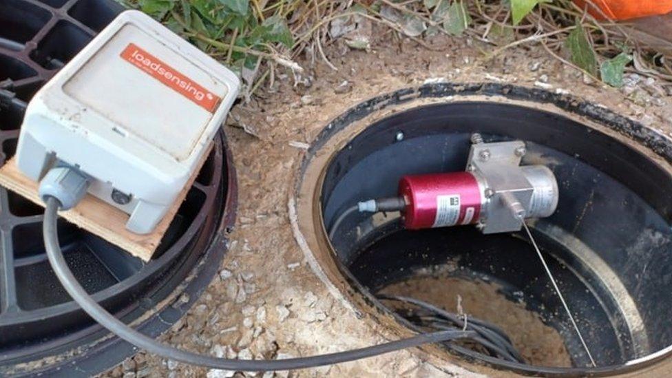
Devices to monitor any further movement in the ground after a huge landslip on the Isle of Wight have been set up.
The specialist equipment has been put in the Leeson Road area of Ventnor following the collapse on 10 December.
It will be used to measure and record activity deep underground as well as conditions under the road which remains closed.
About 16 hectares (40 acres) of land fell away in the landslip.

It is hoped the equipment will indicate the likelihood of any further major collapses
It initially forced residents to leave 20 properties. A small number have been unable to return until further checks are carried out on their homes.
Nearly 30 pieces of equipment have been installed to measure vertical and horizontal movement and any widening of existing cracks.
Natasha Dix, service director for waste, environment and planning at Isle of Wight Council, said: "Visually, the road surface may look perfectly fine but what we don't currently know is what's happening deeper underground.
"This highly-sophisticated equipment will help us to peel back the layers to see the geological conditions underneath the road and whether there is voiding or further ground movement that could lead to a further catastrophic collapse."

Some homes were left perilously close to the cliff edge after the landslip
The council said it remains the intention to reopen the A3055 Leeson Road between Shanklin and Ventnor as soon as it safe to do so.
Drivers are being diverted from Ventnor, via Wroxall, and from Shanklin, via Whiteley Bank.
A public meeting about Leeson Road and access issues is due to be held in May, the authority said.

Follow BBC South on Facebook, external, X, external, or Instagram, external. Send your story ideas to south.newsonline@bbc.co.uk or via WhatsApp on 0808 100 2240, external.
Related topics
- Published11 December 2023

- Published13 April 2024
- Published13 December 2023
