Yorkshire affected by heavy snow and strong winds
- Published

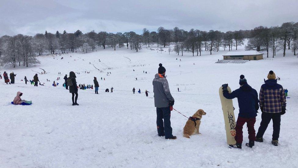
Snow fell near Holmfirth on Thursday morning
Heavy snow is falling in parts of Yorkshire as an amber warning issued by the Met Office comes into force.
A yellow warning for snow covers most of the region but more severe weather was expected in areas including Leeds, Bradford and Sheffield from 15:00 GMT.
Significant disruption was expected to last until Friday afternoon, the forecasting service said.
About 200 schools have closed early and National Highways has issued a severe weather alert to drivers.
The Met Office said 10 to 20cm of snow was likely to fall across much of the region but some places could see up to 40cm and the snowfall would be accompanied by strong winds.
Allow X content?
This article contains content provided by X. We ask for your permission before anything is loaded, as they may be using cookies and other technologies. You may want to read X’s cookie policy, external and privacy policy, external before accepting. To view this content choose ‘accept and continue’.
Several weather-related road closures have been reported in the region, including the A628 Woodhead Pass between Flouch and Hollingworth.
The A57 Snake Pass is also shut and the A66 is closed between Scotch Corner and Brough.
North Yorkshire Police said it was receiving "a lot of calls" about stranded vehicles on Thursday evening, with snow causing particular problems around the market towns of Harrogate and Pateley Bridge.
"A number of people have called to say the conditions on Sutton Bank are dangerous," a spokesperson said.
The force said its control room had been getting calls from the Scarborough area, with officers attending a "serious collision" on Helwath Road.
It comes as drivers have been warned to think carefully before setting off as the RAC said conditions were expected to get worse before they get better.
The organisation said it had seen a 50% increase in the number of breakdowns in the worst-hit areas, including in South Yorkshire.

Sheffield saw heavy snowfall throughout Thursday
On Thursday evening Leeds Bradford Airport said it remained open, external but warned passengers to keep checking their airline's website for the most up-to-date information.
A recruitment fair it was due to hold on Friday has been postponed due to the weather.
Look North climate correspondent Paul Hudson said there had been a combination of rain and snow across the region on Thursday afternoon and conditions were expected to worsen overnight.
"The ground temperatures are actually warmer than normal at the moment because it's been such a mild winter, plus the gritting crews, let's hand it to them, they have been chucking salt on the roads," he said.
"In my experience, once it gets dark and into this evening then temperatures subtly drop and there's less traffic on the roads - that's when you start to see snow settling on the roads."

Severe weather is expected in parts of Yorkshire from 15:00 GMT on Thursday until 12:00 on Friday
Rail passengers have been warned to expect disruption and Network Rail said fewer services were likely to run in areas badly affected by the snow.
Matt Rice, route director for Network Rail's north and east route, urged people to check their journey was possible before they travelled and to take extra care around stations and level crossings.
Network Rail said the following routes could be disrupted:
Leeds to Carlisle
Bradford Forster Square to Ilkley and Leeds
Calder Valley (Leeds to Blackpool/Manchester via Bradford)
Hope Valley (Sheffield to Manchester)
Penistone line (Sheffield to Huddersfield)
Buxton line (Buxton to Manchester via Hazel Grove)

Analysis by Paul Hudson, climate correspondent, BBC Yorkshire
An amber warning will remain in place overnight, as blizzard conditions are expected to develop in Pennine areas, with a real risk of disruption.
Elsewhere, rain and sleet is likely to turn to snow later in the night and into tomorrow morning.
This will lead to potential problems for commuters across other parts of our region.
Freezing conditions will persist into the weekend, although milder air is expected by Sunday.
Follow BBC Yorkshire on Facebook, external, Twitter, external and Instagram, external. Send your story ideas to yorkslincs.news@bbc.co.uk, external.
- Published9 March 2023