Oldest surviving map of London, from 1633, to go on display
- Published

Only three copies of Civitas Londinium, which shows the capital during Tudor times, are known to exist
The oldest surviving complete map of London is to go on display as part of a new exhibition.
Civitas Londinium was created in the 1570s and gives a view across the capital, from the bear-baiting pits of Southwark to the fields of Highgate.
Other maps to feature include a survey of the damage caused by the Great Fire of London and ones highlighting the spread of disease in Victorian times.
They will all form part of a display at the London Metropolitan Archives.

Civitas Londinium shows how different places like Moregate looked in the 1570s compared to today
Civitas Londinium, also known as the Woodcut or Agas map, provides a bird's-eye view of London from the the Tudor period.
Only three prints of it, all dating from 1633, are known to exist, while its creator is also unknown.

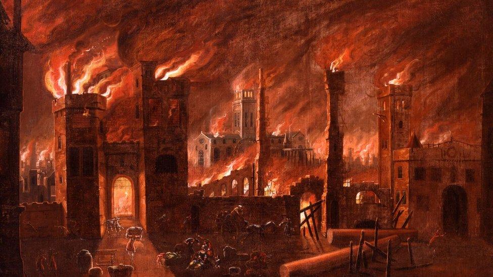
John Leake's map of the city in 1667 shows the extent of the damage caused by the Great Fire of London
The survey created following the Great Fire, called the Ruins of London, was commissioned by the City of London Corporation after the disaster struck the capital in 1666.
It was finished in 1667 and highlights the damage caused by the blaze, which destroyed more than 13,000 houses, nearly 90 churches, the Royal Exchange and St. Paul's Cathedral.

The water pump, identified by John Snow as the cause of a cholera outbreak, can still be found on Broadwick Street
Another map records the deaths caused by cholera during the summer and autumn of 1854 in the parishes of St James, Westminster and St Anne, Soho.
It was through plotting where people died that London physician John Snow, during the outbreak, was able to identify the water pump, external on Broad Street - now Broadwick Street - that was the source of the disease.
Magnificent Maps of London opens at the London Metropolitan Archives on 11 April and will be free to visit.
Wendy Hyde, chair of the City of London Corporation's Culture, Heritage and Libraries Committee, said the exhibition would provide visitors with "a unique and compelling insight into how London was literally put on the map".
All images subject to copyright

Follow BBC London on Facebook, external, Twitter , externaland Instagram, external. Send your story ideas to hellobbclondon@bbc.co.uk, external
Related topics
- Published23 July 2016