D-Day weather maps belonging to Bath meteorologist up for auction
- Published

John Rolfe (right) said it was difficult to come up with the guide price, which has been set between £2,000 and £4,000
A set of six weather maps used by forecasters ahead of the D-Day landings in World War Two are up for sale.
The hand-sketched charts show predicted air pressures over the North Atlantic and Europe from 3 to 7 June 1944, the window of opportunity for the invasion.
The forecasts were passed to General Dwight D. Eisenhower, who then postponed the landings - on the coast of northern France - by 24 hours.
The maps are due to sell in total for between £2,000 and £4,000 on Monday.
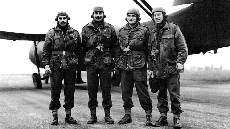
The team of meteorologists included the late Captain David Davidge, from Bath, who was presented with the charts as a gift on his retirement.
His family has now put them up for auction to coincide with the 80th anniversary of the Normandy landings.
"The charts are massively significant," said John Rolfe, director of John Rolfe Auctions, which is hosting the sale.
"This is probably the most poignant lot I've sold in my 20-year career as an auctioneer."

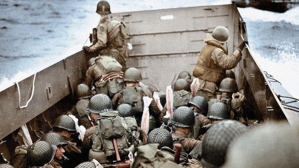
Troops landed on Omaha beach near Vierville-sur-Mer, France, on 6 June 1944
More than a year in the planning, Operation Overlord, as the campaign was codenamed, was originally due to start on 5 June.
This had been judged to be the date most likely to combine calm seas, a full moon and low water at first light.
However, Group Captain James Stagg, chief meteorological officer, recommended the delay as storms had been forecast.
"You can see the isobars on the fourth (of June); it did look incredibly volatile weather-wise and it wouldn't have been an ideal crossing for masses of troops across the Channel," Mr Rolfe said.

The isobars on the maps were hand-drawn to allow information to be shared quickly
The charts are considered by specialists to be very rare, with the only other known set on display in the Map Room at Southwick House, the nerve centre of Allied planning for the D-Day landings, said the auctioneers.
"It's quite remarkable these charts are hand-drawn. With the weather changing, the fact that they were hand-drawn meant they could be done quickly and shared quickly with our allies," said Mr Rolfe.
It was the largest military naval, air and land operation ever attempted and marked the start of the campaign to liberate Nazi-occupied north-west Europe
The invasion involved the simultaneous landing of tens of thousands of troops on five separate beaches in Normandy.
From 06:30 BST on 6 June 1944, the first five assault divisions were delivered to their beaches under cover of a naval bombardment.
"Even though the 6th wasn't ideal, it was certainly much better, judging from these charts," said Mr Rolfe.
"If these maps hadn't been drawn and we had crossed earlier than the 6th, then of course the outcome of the war could be could have been potentially very different for all of us."
The auction house said it had received significant interest in the maps ahead of the sale in Tetbury, particularly from large organisations, but also from "fond collectors of militaria".

A D-Day planning map has been displayed at Southwick House, which in June 1944 was the General Eisenhower's headquarters
Mr Rolfe added it was difficult to come up with the £2,000-£4,000 estimate for the charts, as they were so unique.
"It really is truly impossible, as there's nothing to go on, but we had to come up with a figure but we could be way off," he said.
"We'll only know once we sell them because this is the first time anything like this has ever gone through a sale."

Follow BBC Somerset on Facebook, external and, X, external. Send your story ideas to us on email, external or via WhatsApp on 0800 313 4630, external.
Related topics
- Published14 April 2024

- Published24 February 2024
- Published29 December 2023

- Published8 May 2023
- Published6 June 2024
- Published5 June 2014