Dunwich underwater images show 'Britain's Atlantis'
- Published

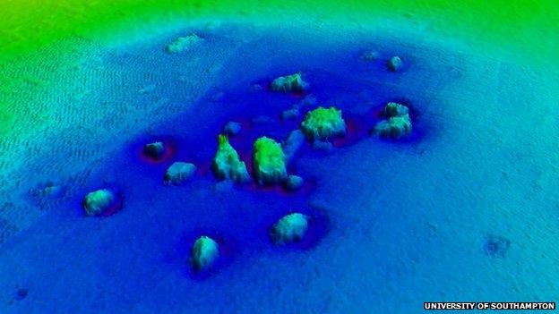
Underwater imaging techniques showed the ruins through the murky water

Underwater imaging techniques showed the ruins through the murky water

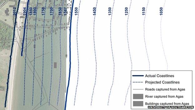
The University of Southampton says the new maps show how Dunwich has been affected by coastal erosion
Underwater images have helped produce what has been called "the most accurate map to date" of "Britain's Atlantis".
Prof David Sear, of the University of Southampton, led the project off the Suffolk coast at Dunwich, which hundreds of years ago was a busy port.
He said using acoustic imaging in the "murky waters" had resulted in maps of where buildings fell after being lost to coastal erosion.
"It's enabled us to see things for the first time, very clearly," he said.
The university began researching the history of the village, which is located between Southwold and Aldeburgh, in 2008.
'Shining a torch'
Prof Sear said: "It's a story about coastal erosion, climate change and people trying to live with that - and frankly not doing very well."
He said previous dives had returned limited results due to the nature of the water.
"People say what's it like on the bottom of Dunwich and I say 'close your eyes', that's what it's like," he said.
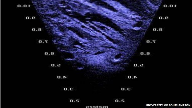
Using acoustic imaging technology, he said, was "like shining a torch onto the seabed" but using sound instead of light.
The technique returned images that showed the resting place of some of Dunwich's medieval buildings, up to 10 metres (32ft) below the surface of the sea.
"They were big structures, churches, a priory, but they fell over a cliff," he said.
"They didn't fall very far so they are in the places where we would expect to find them."
The project, which has been funded by English Heritage, claims to have produced the most accurate maps to date of Dunwich's streets, boundaries and major buildings.
Peter Murphy, coastal survey expert with English Heritage, said: "Everyone was surprised by how much of the eroded town still survives under the sea and is identifiable."
Further research is to be carried out in June.
- Published30 July 2012