New aerial photographs of England 'unlock mysteries of past'
- Published

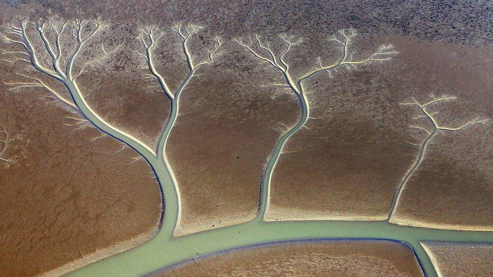
Much of the Gloucestershire town of Tewkesbury was submerged by flooding in 2018
A new photograph archive shows 100 years of changes to the landscape of England.
Historic England has launched a new Aerial Photography Explorer, external which combines maps with more than 400,000 images taken since 1919.
Bristol's Temple Meads station, St Eval Airfield in Cornwall and Salisbury Cathedral are in the collection.
Historic England's regional director Rebecca Barrett said it would "unlock the mysteries of England's past".

Sandford Parks lido in Cheltenham was opened in 1935 when outdoor swimming was hugely popular

St Eval Airfield in Cornwall was opened in 1941, and was often targeted by German bombing raids

The heatwave of 2018 parched the grass at Salisbury Cathedral, revealing the footprint of the former belfry
Around 300,000 of the photographs come from Historic England's Aerial Investigation and Mapping staff who have been taking photographs of England from the air since 1967.
The remaining pictures come from the charity's aerial photography collection which features a total of more than two million photographs including many taken by the Royal Air Force and Aerofilms Ltd.

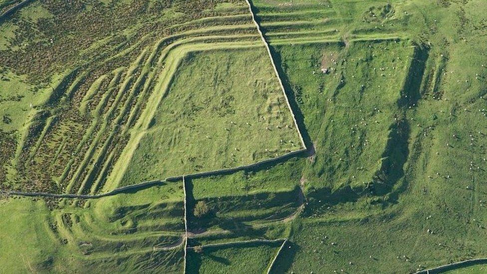
Historically important sites such as Pilsdon Pen Hillfort in Dorset are part of the collection

Bristol Temple Meads station was photographed in 1938

Bishop Rock Lighthouse close to the Isles of Scilly is the most westerly and southerly listed building in England
Many of the more modern photographs show how extreme weather such as flooding or heatwaves can have an impact on the landscape, including revealing the foundations of long-lost buildings.
As more of Historic England's photographic archive is converted to digital files, the collection will expand over the coming years.

Follow BBC West on Facebook, external, Twitter, external and Instagram, external. Send your story ideas to: bristol@bbc.co.uk , external
- Published8 October 2021
- Published15 February 2021
- Published16 January 2021
- Published30 June 2020