York: Hand-drawn 400-year-old map to go on display
- Published

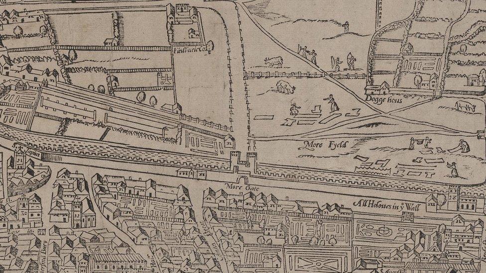
Explore York said the map was so accurate it perfectly matched the Ordnance Survey map of 1852
A 400-year-old map showing parts of York as they were in the early 17th Century has gone on public display.
Samuel Parson's 1624 map of Dringhouses and the Knavesmire is one of the oldest in York Archive's collection and is described as "nationally significant".
Dating back to the reign of King James I, it also includes modern day Bishopthorpe Palace and Middlethorpe.
The map will be on display at Dringhouses Library on Thursday as part of Explore York's Local History month.

The map has gone on show as part of Explore York's Local History month
A spokesperson for Explore York said Parson's map was "incredibly detailed".
They said: "One of the earliest hand-drawn and coloured maps in the York Archives collection, Parsons' map is nationally significant.
"It is an early example of manorial maps and is so accurate that over 225 years later it perfectly matched the Ordnance Survey map of 1852.
"Incredibly detailed, right down to the level of naming the 130 farmers who worked the strips of common land in the parish, it acts as a kind of census of adult males in the Dringhouses parish area in early Stuart England."

Follow BBC Yorkshire on Facebook, external, X (formerly Twitter), external and Instagram, external. Send your story ideas to yorkslincs.news@bbc.co.uk, external.
- Published3 January 2024
- Published22 August 2023
- Published29 March 2022