Storm Gareth: Strong wind and rain across NI
- Published

A surfer makes the most of the waves on the north coast
Storm Gareth, the seventh storm of this winter, has arrived, bringing very strong winds and rain.
Across NI, a yellow warning has been issued by the Met Office from 15:00 GMT on Tuesday until 12:00 on Wednesday.
At Malin Head, County Donegal, gusts reached 80mph (130km/h) while winds were at 62mph (100km/h) at Orlock Head, County Down, on Tuesday afternoon.
Stronger gusts are expected through this evening and overnight with disruption likely in places.
Gusts of 56mph (90km/h) were recorded at Magilligan, County Londonderry, and 53mph (85km/h) in Castlederg, County Tyrone, and Ballypatrick Forest, County Antrim.
Translink has warned that there may be "some delays and disruption possible to bus and train services".
Larges waves will affect coastal areas, especially to the north and north west. A weather warning is in place.
Allow X content?
This article contains content provided by X. We ask for your permission before anything is loaded, as they may be using cookies and other technologies. You may want to read X’s cookie policy, external and privacy policy, external before accepting. To view this content choose ‘accept and continue’.
P&O ferries said sailings between Dublin and Liverpool have been cancelled because of the weather.
The company has advised Larne to Cairnryan passengers to rearrange travel if they can as "delays/cancellations are likely later".
Belfast Harbour said cruise ships and passengers have been forced to remain docked because of the storm.
The latest weather forecast for Northern Ireland
More severe gusts will move in on Tuesday evening, with speeds of 55-65mph (88-105km/h) widely inland, but up to 80mph (129km/h) towards the north-west and north coast.
Storm Gareth could bring large waves to coastal areas, as well as a small chance of damage to buildings, said the Met Office.
Allow X content?
This article contains content provided by X. We ask for your permission before anything is loaded, as they may be using cookies and other technologies. You may want to read X’s cookie policy, external and privacy policy, external before accepting. To view this content choose ‘accept and continue’.
In Derry, the Foyle Bridge has a restricted 30mph (48km) speed limit and is closed to high sided vehicles.
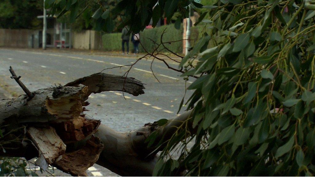
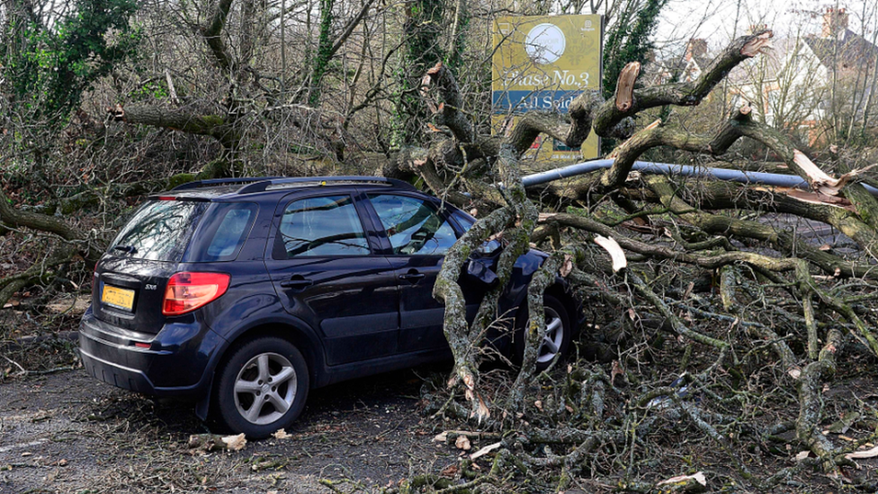
The Broomhill Avenue in the city, which had earlier closed because of fallen trees, has now reopened.
The Liskey Road in Strabane, which had earlier closed due to a fallen tree, has now also reopened.

Tree surgeons clearing fallen trees from Broomhill Avenue in Derry
Newry, Mourne and Down District Council warned the public to "exercise caution" when visiting forests and beaches in the area.
The Coastguard has warned people to avoid exposed coastal areas.

Waves batter the Portaferry Road on the Ards Peninsula
The Atlantic system was named by the Irish weather service, Met Éireann, which has issued a "Status Orange" warning for four counties in the Republic of Ireland.
That is the second highest warning level, and affects Counties Donegal, Sligo, Leitrim and Mayo.
Allow X content?
This article contains content provided by X. We ask for your permission before anything is loaded, as they may be using cookies and other technologies. You may want to read X’s cookie policy, external and privacy policy, external before accepting. To view this content choose ‘accept and continue’.
It warned of "damaging gusts reaching 110km/h to 130km/h" as well as a "risk of coastal flooding due to high seas".
In County Clare, the Cliffs of Moher have been closed to the public due to unsafe conditions. Clare County Council said the site is expected to reopen on Wednesday morning.

Whitehead, County Antrim, feels the force of a previous storm
There is also a risk of flying debris because of the winds.
The winds are expected to gradually ease during Wednesday but it will still be quite windy with a risk of disruption.
Allow X content?
This article contains content provided by X. We ask for your permission before anything is loaded, as they may be using cookies and other technologies. You may want to read X’s cookie policy, external and privacy policy, external before accepting. To view this content choose ‘accept and continue’.
Further wet and windy spells are expected into the coming weekend.
Related topics
- Published8 February 2019
- Published19 September 2018