Storm Ciara: Yellow warning for wind in place across NI
- Published

A yellow weather warning for strong winds is in place across Northern Ireland due to Storm Ciara.
The Met Office has also issued a warning for heavy rain between 15:00 GMT on Saturday until midnight on Sunday.
It said it expects 20mm to 40mm of rain to fall, with up to 80mm over some areas of higher ground within 18 hours.
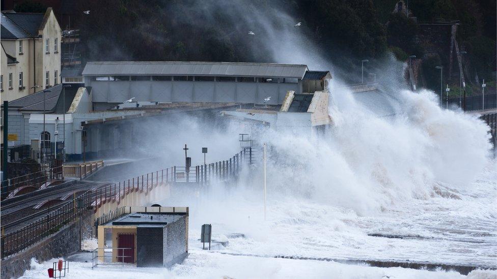
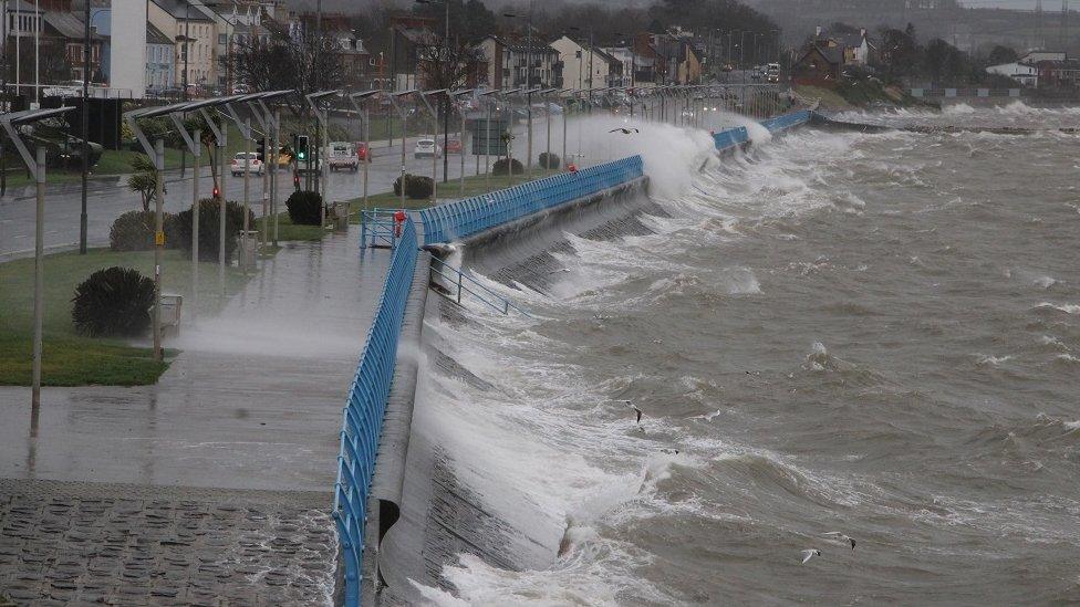
Coastal areas are likely to be affected by large waves and potential flooding.
Gusts of 80 to 100km/h (50-60mph) are likely across inland areas.
They could reach speeds of 115km/h (70mph) and possibly 130km/h (80mph) in exposed hills and coasts.
Met Éireann upgraded its wind warning to its second highest level across the Republic of Ireland for Sunday morning.
Allow X content?
This article contains content provided by X. We ask for your permission before anything is loaded, as they may be using cookies and other technologies. You may want to read X’s cookie policy, external and privacy policy, external before accepting. To view this content choose ‘accept and continue’.
Northern Ireland's government agencies met on Friday to prepare for the severe weather.
The Department of Transport's roads and rivers teams have been checking and clearing road gullies and drainage grills and staff will be on standby across the weekend.
Silent Valley Reservoir, a popular visitor site in the Mourne Mountains, was closed "until further notice" as Northern Ireland Water considers the potential impact of the weather.
Allow X content?
This article contains content provided by X. We ask for your permission before anything is loaded, as they may be using cookies and other technologies. You may want to read X’s cookie policy, external and privacy policy, external before accepting. To view this content choose ‘accept and continue’.
This is the third locally-named storm of the winter season after Storm Atiyah in December and Storm Brendan last month.

Storm Brendan led to power cuts affecting thousands of customers, while part of the sea wall at Carrickfergus, County Antrim, collapsed.
In the Republic of Ireland, weather service Met Éireann has issued a Status Yellow warning for rainfall from 12:00 local time on Saturday to 15:00 on Sunday and a Status Orange warning for wind on Sunday from 05:00 to 12:00.
It says there is a significant risk of coastal flooding, particularly in the west and northwest.
The opening ceremony to celebrate Galway's year as European Capital of Culture was cancelled on Saturday morning as organisers said it was "deemed unsafe to go ahead".
Allow X content?
This article contains content provided by X. We ask for your permission before anything is loaded, as they may be using cookies and other technologies. You may want to read X’s cookie policy, external and privacy policy, external before accepting. To view this content choose ‘accept and continue’.
Met Éireann said the "unsettled weather with strong winds and potentially stormy conditions" look "set to continue into the early days of next week, with cold weather prevailing".
It said there was a higher risk of coastal flooding due to spring tides, high seas and stormy conditions, especially for southern, western, and north-western coasts.
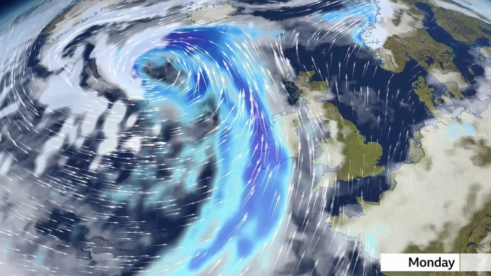
A further Met Office warning has been issued for wind and snow in Northern Ireland on Monday and Tuesday, with snow mainly gathering above 150m (492ft).
Snow, coupled with strong winds, is likely to lead to blizzard conditions over high ground with lightning strikes also possible.
The warning, which comes into force at midnight on Sunday until 12:00 on Tuesday, covers counties mainly towards the north coast.
- Published14 January 2020
- Published12 January 2020
- Published6 September 2019